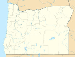
The Cascade Range or Cascades is a major mountain range of western North America, extending from southern British Columbia through Washington and Oregon to Northern California. It includes both non-volcanic mountains, such as the North Cascades, and the notable volcanoes known as the High Cascades. The small part of the range in British Columbia is referred to as the Canadian Cascades or, locally, as the Cascade Mountains. The latter term is also sometimes used by Washington residents to refer to the Washington section of the Cascades in addition to North Cascades, the more usual U.S. term, as in North Cascades National Park. The highest peak in the range is Mount Rainier in Washington at 14,411 feet (4,392 m).

The northern flying squirrel is one of three species of the genus Glaucomys and one of the two flying squirrel species found in North America. They are found in coniferous and mixed coniferous forests across much of Canada, from Alaska to Nova Scotia, and south to the mountains of North Carolina and west to Utah, Washington, and Oregon in the United States. They are light brown with pale underparts and grow to a length of 25 to 37 cm. They are proficient gliders but clumsy walkers on the ground. They feed on a variety of plant material as well as tree sap, fungi, insects, carrion, bird eggs and nestlings. They mostly breed once a year in a cavity lined with lichen or other soft material. Except when they have young, they change nests frequently, and in winter a number of individuals may huddle together in a shared nest. Unlike most members of their family, flying squirrels are strictly nocturnal.

Mount Graham is a mountain in southeastern Arizona in the United States. The mountain reaches 10,724 feet (3,269 m) in height. It is the highest elevation in Graham County, Coronado National Forest and the Pinaleño Mountains As the name "Mount Graham" is often used by locals to refer to the entire mountain range, the peak itself is frequently referred to as "High Peak". It is twentieth of the 57 ultra prominent peaks of the lower 48 states, and the first of the five in Arizona.

Kimmy Robertson is an American actress best known for her role as Lucy Moran in the TV series Twin Peaks.
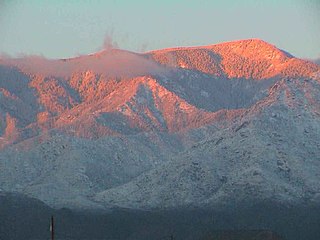
The Pinaleño Mountains are a remote mountain range in southeastern Arizona, near Safford Arizona. The mountains have over 7,000 feet (2,100 m) of vertical relief, more than any other range in the state. The mountains are surrounded by the Sonoran-Chihuahuan Desert. Subalpine forests cover the higher elevations. According to The Nature Conservancy, they traverse five ecological communities and contain "the highest diversity of habitats of any mountain range in North America." The highest point is Mount Graham at 10,720 feet (3,267 m). Locals often refer to the whole mountain range as "Mount Graham", in which case the peak is referred to as "High Peak". The mountains cover 300 square miles (780 km2) and are part of the Coronado National Forest, Safford ranger district.
The Diamond Peak Wilderness is a wilderness area straddling the Cascade crest and includes the Diamond Peak volcano. It is located within two National Forests - the Willamette National Forest on the west and the Deschutes National Forest on the east.

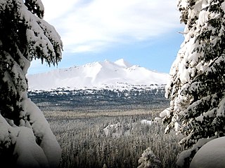
Diamond Peak is a volcano in Klamath and Lane counties in central Oregon in the United States. It is a shield volcano, though it might also be considered a modest stratocone. Diamond Peak forms part of the Cascade Volcanic Arc, a segment of the Cascade Range in western North America extending from southern British Columbia through Oregon to Northern California. Reaching an elevation of 8,748 feet (2,666 m), the mountain is located near Willamette Pass in the Diamond Peak Wilderness within the Deschutes and Willamette National Forests. Diverse species of flora and fauna inhabit the area. Prominent in the skyline from foothills near Eugene, Diamond Peak offers a few climbing routes, and can be scrambled.

The Oregon Coast Range, often called simply the Coast Range and sometimes the Pacific Coast Range, is a mountain range, in the Pacific Coast Ranges physiographic region, in the U.S. state of Oregon along the Pacific Ocean. This north-south running range extends over 200 miles (320 km) from the Columbia River in the north on the border of Oregon and Washington, south to the middle fork of the Coquille River. It is 30 to 60 miles wide and averages around 1,500 feet (460 m) in elevation above sea level. The coast range has three main sections, a Northern, Central, and Southern.

The Columbian ground squirrel, is a species of rodent common in certain regions of Canada and the northwestern United States. It is the second largest member of the genus Urocitellus, which is part of the tribe Marmotini, along with marmots, chipmunks, prairie dogs, and other holarctic ground squirrels. They are stout, with short dense fur, which is characteristically tawny across the bridge of the nose. Social encounters often are initiated with kissing behavior and the most common activity above ground is standing at attention. Residing in mountainous terrain and high plains in northern latitudes, they hibernate most of the year in underground burrows, which may be used for many years. They are emaciated when emerging in the spring. These long periods of torpor earned the squirrels the moniker "Seven Sleepers", since the rests last around seven months. The Columbian ground squirrel came to the attention of the scientific community through writings produced by Lewis and Clark, while 21st century molecular genetics has more finely illuminated its ties with other close relatives.

Bald Peak State Scenic Viewpoint is a state park located atop Bald Peak located in Yamhill County, in the United States. The day use only park offers picnic tables and a hiking trail for views of the Willamette Valley and the Cascade Range. The state of Oregon acquired the 26 acres (11 ha) in 1931 after Yamhill and Washington counties requested a park from the state.

Tumalo State Park is a well-developed state park in Deschutes County, Oregon, United States. Established in 1954, the park is located northwest of the city of Bend and along the Deschutes River at a site home to many bird species. The park is popular for picnics, swimming, fishing, hiking, and camping, and is open year-round.

Eagle Cap Wilderness is a wilderness area located in the Wallowa Mountains of northeastern Oregon, within the Wallowa–Whitman National Forest. The wilderness was established in 1940. In 1964, it was included in the National Wilderness Preservation System. A boundary revision in 1972 added 73,000 acres (30,000 ha) and the Wilderness Act of 1984 added 66,100 acres (26,700 ha) resulting in a current total of 361,446 acres, making Eagle Cap by far Oregon's largest wilderness area.

Roxy Ann Peak is a 3,576-foot-tall (1,090 m) mountain in the Western Cascade Range at the eastern edge of Medford, Oregon. Composed of several geologic layers, the majority of the peak is of volcanic origin and dates to the early Oligocene epoch. It is primarily covered by oak savanna and open grassland on its lower slopes, and mixed coniferous forest on its upper slopes and summit, although not all the way. Despite the peak's relatively small topographic prominence of 753 feet (230 m), it rises 2,200 feet (670 m) above Medford and is visible from most of the Rogue Valley. The mountain is Medford's most important viewshed, open space reserve, and recreational resource.

Lost Lake is a lake in Mount Hood National Forest 16.2 kilometres (10.1 mi) northwest of Mount Hood in Hood River County in the U.S. state of Oregon. It is 34.4 kilometres (21.4 mi) southwest of Hood River, a 26.4-mile (42.5 km) drive.

Brown Mountain is a small cinder cone on top of a shield volcano located in Cascade Volcanic Arc in Klamath and Jackson counties, Oregon. Most of the mountain, including its peak, is in western Klamath County, but its western flanks trail off into eastern Jackson County. It is 7,311 feet (2,228 m) above sea level, but is overshadowed by nearby 9,495-foot (2,894 m) Mount McLoughlin.

Sacajawea Peak is a peak in the Wallowa Mountains, in the U.S. state of Oregon. It is in the Eagle Cap Wilderness and the Wallowa–Whitman National Forest.

Cooper Mountain Nature Park is a 231 acres (93 ha) nature park in the Portland metropolitan area in the U.S. state of Oregon. Opened in 2009, the park is owned and operated by Metro, the regional government in the Oregon portion of the metro area. The park is named after Cooper Mountain, the primary geological feature in the area near Beaverton. Maintained by the regional Tualatin Hills Park and Recreation District, the natural area has 3.5 miles (5.6 km) of hiking trails. It is one of THPRD's two nature parks, along with the Tualatin Hills Nature Park.

The Cline Buttes are mountains with volcanic origins that form three dome-shaped peaks located in Deschutes County in central Oregon. They are some of the eastern foothills of the Cascade Range. Situated on land administered by the Bureau of Land Management, the buttes are flanked on the east and west sides by two separate sections of the Eagle Crest Resort. On the highest summit, there is a Federal Aviation Administration site with an aircraft navigation beacon. The mountains have several hiking trails as well as a number of popular mountain bike routes.