Brandy Station, Virginia

Last updated

Brandy Station, Virginia
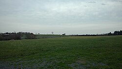
Site of the Battle of Brandy Station.jpg
Portion of the battlefield in April 2017
Brandy Station CDP in Culpeper County.svg
Location of the Brandy Station CDP within the Culpeper County
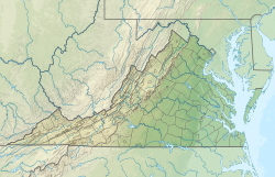
USA Virginia relief location map.svg
Red pog.svg
Brandy Station
Location within the state of Virginia
Usa edcp relief location map.png
Red pog.svg
Brandy Station
Brandy Station (the United States)
Coordinates: 38°30′6″N77°53′37″W / 38.50167°N 77.89361°W / 38.50167; -77.89361
CountryUnited States
State Virginia
County Culpeper
Population
 (2020)
  Total
191
Time zone UTC−5 (Eastern (EST))
  Summer (DST) UTC−4 (EDT)

Brandy Station is an unincorporated community and census-designated place (CDP) in Culpeper County, Virginia, United States. [1] It was first listed as a CDP in the 2020 census with a population of 191. [2] Its original name was Brandy. The name Brandy Station comes from a local tavern sign that advertised brandy. [3]

Contents

Brandy Station was the site of the 1863 Battle of Brandy Station, the largest predominantly cavalry engagement of the American Civil War as well as the largest to take place ever on American soil. [4]

Auburn, Farley, and the Graffiti House are listed on the National Register of Historic Places. [5]

Culpeper Regional Airport is located on Beverly Ford Road in Brandy Station.
Demographics

Brandy Station first appeared as a census designated place in the 2020 U.S. Census. [6]

Generals George Meade, John Sedgwick and Robert O. Tyler along with staff officers at the horse artillery headquarters in Brandy Station, Virginia, February 1864. Meade-Sedgwick-Tyler.jpg
Generals George Meade, John Sedgwick and Robert O. Tyler along with staff officers at the horse artillery headquarters in Brandy Station, Virginia, February 1864.
General Rufus Ingalls and other officers in Brandy Station, Virginia, April 1864. Rufus Ingalls and crew-Brandy Station Virginia.jpg
General Rufus Ingalls and other officers in Brandy Station, Virginia, April 1864.

See also

Notes

  1. U.S. Geological Survey Geographic Names Information System: Brandy Station, Virginia
  2. "Brandy Station CDP, Virginia". United States Census Bureau . Retrieved April 7, 2022.
  3. Dyson, Cathy (July 20, 2003). "History and legend unlock origins of unusual names". The Free Lance-Star. pp. A7. Retrieved May 3, 2015.
  4. Brandy Station Foundation Archived 2007-09-28 at the Wayback Machine . Of the 20,500 men engaged, approximately 3,000 were Union infantrymen. The Battle of Trevilian Station in 1864 was the largest all-cavalry battle of the war. According to the American Civil War Battlefield Preservation Trust Archived 2007-08-20 at the Wayback Machine Brandy Station was the largest battle of its kind on American soil.
  5. "National Register Information System". National Register of Historic Places . National Park Service. July 9, 2010.
  6. "2020 Geography Changes". United States Census Bureau.


Related Research Articles

<span class="mw-page-title-main">Culpeper County, Virginia</span> County in Virginia, United States

Culpeper County is a county located along the borderlands of the northern and central region of the Commonwealth of Virginia. As of the 2020 United States Census, the population was 52,552. Its county seat and only incorporated community is Culpeper.

<span class="mw-page-title-main">Remington, Virginia</span> Town in Virginia, United States

Remington is a small incorporated town in Fauquier County, Virginia, United States. The population was 598 at the 2010 census. It is near the highways, U.S. Route 15, U.S. Route 17, U.S. Route 29, and Virginia State Route 28. Remington is less than a mile northeast of the Culpeper County line.

<span class="mw-page-title-main">Mechanicsville, Virginia</span> Census-designated place in Virginia, United States

Mechanicsville is an unincorporated community and census-designated place (CDP) in Hanover County, Virginia, United States. The population was 39,482 during the 2020 census, up from 36,348 in the 2010 census.

<span class="mw-page-title-main">Bull Run, Prince William County, Virginia</span> Census-designated place in Virginia, United States

Bull Run is a census-designated place (CDP) in Prince William County, Virginia. The population was 14,983 at the 2010 census.

<span class="mw-page-title-main">Falmouth, Virginia</span> Census-designated place in Virginia, US

Falmouth is a census-designated place (CDP) in Stafford County, Virginia, United States. Situated on the north bank of the Rappahannock River at the falls, the community is north of and opposite the city of Fredericksburg. Recognized by the U.S. Census Bureau as a census-designated place (CDP), Falmouth's population was 4,956 as of the 2020 census.

<span class="mw-page-title-main">Battle of Brandy Station</span> 1863 cavalry engagement during the American Civil War

The Battle of Brandy Station, also called the Battle of Fleetwood Hill, was the largest predominantly cavalry engagement of the American Civil War, as well as the largest ever to take place on American soil. It was fought on June 9, 1863, around Brandy Station, Virginia, at the beginning of the Gettysburg Campaign by the Union cavalry under Maj. Gen. Alfred Pleasonton against Maj. Gen. J. E. B. Stuart's Confederate cavalry.

<span class="mw-page-title-main">Graffiti House</span> Historic house in Virginia, United States

The Graffiti House, located at 19484 Brandy Road in the eastern end of the town of Brandy Station, Virginia, is believed by the Brandy Station Foundation to have been built in 1858. It is one of few dwellings in the village built before the American Civil War to survive intact to this day. The house is notable because of the Civil War era graffiti on many of the walls. The graffiti found includes names, drawings, names of units, and inscriptions left by soldiers.

<span class="mw-page-title-main">Disputanta, Virginia</span> Census-designated place in Virginia, United States

Disputanta is an unincorporated community and census-designated place in Prince George County, Virginia, United States in the Richmond-Petersburg region and is a portion of the Richmond Metropolitan Statistical Area (MSA). The postal ZIP Code of Disputanta, Virginia is 23842. It was first listed as a CDP in the 2020 census with a population of 373.

Catlett is a census-designated place (CDP) in Fauquier County, Virginia, United States. The population as of the 2010 census was 297. It is located west of the Prince William County line. Catlett was formerly a rail stop on the Orange and Alexandria Railroad, and the area was the site of many raids on the railroad during the American Civil War.

<span class="mw-page-title-main">Dinwiddie, Virginia</span> Unincorporated community in Virginia, United States

Dinwiddie is an unincorporated community, census-designated place (CDP), and the county seat of Dinwiddie County, Virginia, United States. It was first listed as a CDP in the 2020 census with a population of 619.

<span class="mw-page-title-main">Fairfax Station, Virginia</span> Census-designated place in Virginia, United States

Fairfax Station is a census-designated place (CDP) in Fairfax County, Virginia, United States. The population was 12,420 at the 2020 census. Located in Northern Virginia, its center is located 22 miles (35 km) southwest of Washington, D.C.

Burlington is a census-designated place (CDP) in Mineral County, West Virginia, United States, along U.S. Route 50 crossing Pattersons Creek. As of the 2020 census, its population was 131. It is part of the Cumberland, MD-WV Metropolitan Statistical Area.

<span class="mw-page-title-main">Aldie, Virginia</span> Unincorporated community in Virginia, United States

Aldie is an unincorporated community and census-designated place (CDP) located between Chantilly and Middleburg in Loudoun County, Virginia, United States. The historic village of Aldie is located on the John Mosby Highway in a gap between the Catoctin Mountains and Bull Run Mountains, through which the Little River flows. Aldie traditionally serves as the gateway to the Loudoun Valley and beyond.

<span class="mw-page-title-main">Falling Waters, West Virginia</span> Census-designated place in West Virginia, United States

Falling Waters is a census-designated place (CDP) on the Potomac River in Berkeley County, West Virginia, United States. It is located along Williamsport Pike north of Martinsburg. An 1887 Scientific American article claimed that the first U.S. railroad was built in Falling Waters in 1814.

<span class="mw-page-title-main">Dranesville, Virginia</span> Census-designated place in Virginia, United States

Dranesville is a census-designated place (CDP) in Fairfax County, Virginia, United States. Dranesville is located on the Leesburg Pike at its intersection with Georgetown Pike. The U.S. Census Bureau defines Dranesville as a census-designated place (CDP) with a population of 11,921 as of 2010. At the 2020 Census the population was 11,785.

<span class="mw-page-title-main">Lancaster, Virginia</span> Unincorporated community in Virginia, United States

Lancaster is an unincorporated community and census-designated place (CDP) in Lancaster County, Virginia, United States. It is the county seat, and is also known as Lancaster Courthouse or by an alternative spelling, Lancaster Court House. The community was first drawn as a CDP prior to the 2020 census and had a population of 105 at the said census.

<span class="mw-page-title-main">New Baltimore, Virginia</span> Census-designated place in Virginia, United States

New Baltimore is an unincorporated community and census-designated place (CDP) in eastern Fauquier County, Virginia, United States. The population as of the 2010 census was 8,119. The community has existed since the early 19th century, but it has had its most significant growth since the 1980s. It is the portion of Fauquier County with the easiest access to Washington, D.C., and as a result, many people who live in New Baltimore commute into DC. Other major communities close to New Baltimore are Warrenton, the Gainesville/Haymarket area, and Manassas. The area officially considered to be New Baltimore expanded significantly in 2006 with Fauquier County's designation of service districts, of which New Baltimore is one. The service district designation provides added access to utilities, such as water and sewer, and targets the area for growth.

<span class="mw-page-title-main">Franktown, Virginia</span> Unincorporated community in Virginia, US

Franktown is an unincorporated community and census-designated place in Northampton County, Virginia, United States. It was first listed as a CDP in the 2020 census with a population of 61.

Maybeury is a census-designated place (CDP) in McDowell County, West Virginia, United States, located on U.S. Route 52 between Northfork and Bramwell. As of the 2010 census, its population was 234.

<span class="mw-page-title-main">Hunterstown, Pennsylvania</span> Census-designated place in Pennsylvania, United States

Hunterstown is an unincorporated community and census-designated place in Straban Township, Adams County, Pennsylvania, United States. As of the 2020 census, the population was 506.