Spencer County is a county located in the U.S. state of Kentucky. As of the 2010 census, the population was 17,061. Its county seat is Taylorsville. The county was founded in 1824 and named for Spier Spencer.

The Kentucky River is a tributary of the Ohio River, 260 miles (418 km) long, in the U.S. Commonwealth of Kentucky. The river and its tributaries drain much of the central region of the state, with its upper course passing through the coal-mining regions of the Cumberland Mountains, and its lower course passing through the Bluegrass region in the north central part of the state. Its watershed encompasses about 7,000 square miles (18,000 km2). It supplies drinking water to about one-sixth of the population of the Commonwealth of Kentucky.

The West Branch Delaware River is one of two branches that form the Delaware River. It is approximately 90 mi (144 km) long, and flows through the U.S. states of New York and Pennsylvania. It winds through a mountainous area of New York in the western Catskill Mountains for most of its course, before joining the East Branch along the northeast border of Pennsylvania with New York. Midway or so it is empounded by the Cannonsville Dam to form the Cannonsville Reservoir, both part of the New York City water supply system for delivering drinking water to the City.

The Clark Fork, or the Clark Fork of the Columbia River, is a river in the U.S. states of Montana and Idaho, approximately 310 miles (500 km) long. The largest river by volume in Montana, it drains an extensive region of the Rocky Mountains in western Montana and northern Idaho in the watershed of the Columbia River. The river flows northwest through a long valley at the base of the Cabinet Mountains and empties into Lake Pend Oreille in the Idaho Panhandle. The Pend Oreille River in Idaho, Washington, and British Columbia, Canada which drains the lake to the Columbia in Washington, is sometimes included as part of the Clark Fork, giving it a total length of 479 miles (771 km), with a drainage area of 25,820 square miles (66,900 km2). In its upper 20 miles (32 km) in Montana near Butte, it is known as Silver Bow Creek. Interstate 90 follows much of the upper course of the river from Butte to Saint Regis. The highest point within the river's watershed is Mount Evans at 10,641 feet (3,243 m) in Deer Lodge County, Montana along the Continental Divide.

The Siletz River flows about 67 miles (108 km) to the Pacific Ocean through coastal mountains in the U.S. state of Oregon. Formed by the confluence of its north and south forks near Valsetz in Polk County, it winds through the Central Oregon Coast Range. The river, draining a watershed of 373 square miles (970 km2), empties into Siletz Bay, south of Lincoln City in Lincoln County. Although the river travels 67 miles (108 km) in river miles, its winding course begins only about 20 miles (32 km) east of the ocean, and its mouth and source latitudes are almost identical.

The Pit River is a major river draining from northeastern California into the state's Central Valley. The Pit, the Klamath and the Columbia are the only three rivers in the U.S. that cross the Cascade Range.

The Feather River is the principal tributary of the Sacramento River, in the Sacramento Valley of Northern California. The river's main stem is about 73 miles (117 km) long. Its length to its most distant headwater tributary is just over 210 miles (340 km). The main stem Feather River begins in Lake Oroville, where its four long tributary forks join together—the South Fork, Middle Fork, North Fork, and West Branch Feather Rivers. These and other tributaries drain part of the northern Sierra Nevada, and the extreme southern Cascades, as well as a small portion of the Sacramento Valley. The total drainage basin is about 6,200 square miles (16,000 km2), with approximately 3,604 square miles (9,330 km2) above Lake Oroville.

The Mad River is a stream located in the west central part of the U.S. state of Ohio. It flows 66 miles (106 km) from Logan County to downtown Dayton, where it meets the Great Miami River. The stream flows southwest from its source near Campbell Hill through West Liberty, along U.S. Route 68 west of Urbana, past Springfield, then along Ohio State Route 4 into Dayton. The stream's confluence with the Great Miami River is in Deeds Park.

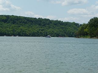
Taylorsville Lake is a 3,050-acre (1,230 ha) artificial lake or reservoir located mainly in Spencer County, Kentucky. Construction by the United States Army Corps of Engineers started in 1974, and flooding began in 1983. The total cost of the lake was $103 million. It is about 18.5 miles (29.8 km) long. Backwater areas of the lake are also located in Nelson County and Anderson County.

The Salt River is a 150-mile-long (240 km) river in the U.S. state of Kentucky that drains 2,920 square miles (7,600 km2). It begins near Parksville, Kentucky, rising from the north slope of Persimmon Knob south of KY 300 between Alum Springs and Wilsonville, and ends at the Ohio River near West Point. Taylorsville Lake is formed from the Salt River, and Guist Creek Lake is also in its drainage basin.
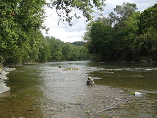
Loramie Creek is a 40.0-mile-long (64.4 km) tributary of the Great Miami River in western Ohio in the United States. Via the Great Miami and Ohio rivers, it is part of the watershed of the Mississippi River, draining an area of 265 square miles (690 km2). According to the Geographic Names Information System, the stream has also been known historically as "Laramie Creek," "Loramie Ditch," "Loramies Creek," and "Lonamie Creek." It is named after Louis Lorimier, a French-Canadian fur trader who had a trading post in the area in the 18th century.

Kentucky Route 44 is a 70.193 mile (112.965 km) long state highway in the U.S. state of Kentucky managed and maintained by the Kentucky Transportation Cabinet.

Fishing Creek is a 29.98-mile (48.25 km) long tributary of the Susquehanna River in Columbia County, Pennsylvania, in the United States. It joins the Susquehanna River near the census-designated place of Rupert and the town of Bloomsburg. The watershed has an area of 385 square miles (1,000 km2).

Little Fishing Creek is a tributary of Fishing Creek in Sullivan County, Lycoming County, and Columbia County, in Pennsylvania, in the United States. It is approximately 23.5 miles (37.8 km) long and flows through eight townships. The watershed of the creek has an area of 68.1 square miles (176 km2). The creek has six named tributaries, of which the largest are Spruce Run and West Branch Run.

The East Branch North Fork Feather River is a left tributary of the North Fork Feather River in the northern Sierra Nevada, Plumas County, California. Primarily within the Plumas National Forest, its course extends from Paxton to Belden.

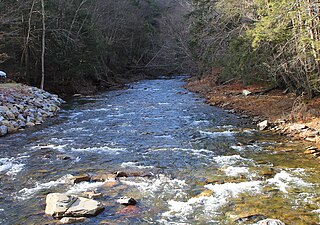
East Branch Fishing Creek is a tributary of Fishing Creek in Columbia County and Sullivan County, Pennsylvania, in the United States. It is 4.4 miles (7.1 km) long. The stream and its tributaries are acidic and contain aluminum. The area in the vicinity was first settled in the late 18th century.

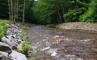
West Branch Fishing Creek is one of the northernmost major tributaries of Fishing Creek in Sullivan County, Pennsylvania and Columbia County, Pennsylvania, in the United States. It is 11.1 miles (17.9 km) long and flows through Davidson Township, Sullivan County and Sugarloaf Township, Columbia County. The creek's watershed has an area of 33.5 square miles, nearly all of which is forested land.
Spencer Run is a tributary of West Creek in Columbia County, Pennsylvania, in the United States. It is approximately 2.1 miles (3.4 km) long and flows through Jackson Township and Benton Township. The watershed of the stream has an area of 2.07 square miles (5.4 km2). Wild trout naturally reproduce in the stream. The surficial geology in the area mainly features Illinoian Till, Illinoian Leg, alluvium, colluvium, and bedrock.
Clear Creek is a stream in Shelby County in the U.S. state of Missouri. It is a tributary of the North River.

Lights Creek is a 19-mile (31 km) long stream in Plumas County, California and is a tributary of Indian Creek, part of the Feather River watershed.


