Bratina

Last updated
Bratina
Village
CountryFlag of Croatia.svg  Croatia
County Zagreb County
Population (2001)
  Total 701
Time zone CET (UTC+1)
  Summer (DST) CEST (UTC+2)

Bratina is a village in Croatia, located in Pisarovina municipality in Zagreb County. In the 2001 Census its recorded population was 701. [1] It is known for traditional costumes including horned headgear and necklaces with glass beads. [2] It was the venue for the 16th IAU World Field Crossbow Championships in 2012. [3]

Croatia Republic in Central Europe

Croatia, officially the Republic of Croatia is a country at the crossroads of Central and Southeast Europe, on the Adriatic Sea. It borders Slovenia to the northwest, Hungary to the northeast, Serbia to the east, Bosnia and Herzegovina, and Montenegro to the southeast, sharing a maritime border with Italy. Its capital, Zagreb, forms one of the country's primary subdivisions, along with twenty counties. Croatia has an area of 56,594 square kilometres and a population of 4.28 million, most of whom are Roman Catholics.

Pisarovina is a municipality in Croatia in the Zagreb County. According to the 2001 census, there are 3,697 inhabitants, absolute majority which are Croats.

Zagreb County County in Croatia

Zagreb County is a county in central Croatia. It surrounds – but does not contain – the nation's capital Zagreb, which is a separate territorial unit. For that reason, it is often nicknamed "Zagreb ring". According to the 2011 census, the county has 317,606 inhabitants.

Related Research Articles

Karlovac County County in Croatia

Karlovac County is a county in central Croatia, with the administrative center in Karlovac.

Ružić, Croatia Municipality in Šibenik-Knin County, Croatia

Ružić is a village and a municipality in Šibenik-Knin County, Croatia. In the 2011 census, it had a total of 1,591 inhabitants. In the 2011 census, 98.99% of the population were Croats.

Hrvace Municipality in Split-Dalmatia, Croatia

Hrvace is a municipality in Croatia in the Split-Dalmatia County. It has a population of 3,617, 98% of which are Croats. The mayor's name is Dinko Bošnjak.

Stupnik is a municipality in Croatia in the Zagreb County. According to the 2011 census, there are 3,251 inhabitants, 95% of whom are Croats.

Ivanska municipality of Croatia

Ivanska is a village and a municipality in Bjelovar-Bilogora County, Croatia. There are 2,911 inhabitants, of which 92% are Croats. The village of Ivanska itself has a population of 722.

Vojnić Municipality in Central and Eastern Croatia, Croatia

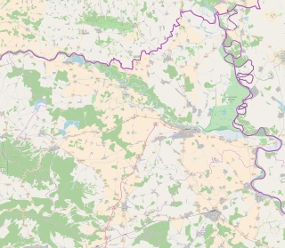
Vojnić is a municipality in Karlovac County, Croatia. There are 4,764 inhabitants, 45% of whom are Serbs and 37% of whom are Croats. The municipality is part of Kordun. Vojnić is underdeveloped municipality which is statistically classified as the First Category Area of Special State Concern by the Government of Croatia.

Sveti Ivan Žabno municipality of Croatia

Sveti Ivan Žabno is a municipality in the Koprivnica-Križevci County in Croatia. According to the 2011 census, there are 5,222 inhabitants in the area.

Ribnik, Croatia Place

Ribnik is a village and a municipality in Karlovac County, Croatia. There are a total of 475 inhabitants in the municipality, 98.74% of whom are Croats.

Petrijevci Municipality in Osijek-Baranja, Croatia

Petrijevci is a municipality in Slavonia, in the Osijek-Baranja County of northeastern Croatia. There are 2439 inhabitants, of which 97.39% are Croats.

Mece Village in Baranya, Croatia

Mece is a settlement in the region of Baranja, Croatia. Administratively, it is located in the Darda municipality within the Osijek-Baranja County. Population is 882 people.

Podolje is a settlement in the region of Baranja, Croatia. Administratively, it is located in the Draž municipality within the Osijek-Baranja County. Population is 140 people as of 2011.

Bokane Village in Continental Croatia, Croatia

Bokane is a village in Croatia, in the municipality of Voćin, Virovitica-Podravina County. It is connected by the D69 highway.

Macute Village in Continental Croatia, Croatia

Macute is a village in Croatia, in the municipality of Voćin, Virovitica-Podravina County. It is connected by the D69 highway.

Kozinščak is a settlement in the Dugo Selo town of Zagreb County, Croatia. As of 2011 it had a population of 1,345 people.

Beder, Croatia is a settlement (naselje) in the Samobor administrative territory of Zagreb County, Croatia. As of 2011 it had a population of 83 people.

Javorek, Croatia is a settlement (naselje) in the Samobor administrative territory of Zagreb County, Croatia. As of 2011 it had a population of 73 people.

Mali Lipovec, Croatia is a settlement (naselje) in the Samobor administrative territory of Zagreb County, Croatia. As of 2011 it had a population of 122 people.

Orešje is a settlement (naselje) in the Sveta Nedelja administrative territory of Zagreb County, Croatia. As of 2011 it had a population of 1,043 people.

References

  1. 2001 Census, Pisarovina municipality
  2. "Tradicijsko ruho Zagrebačke županije (Traditional costumes of Zagreb County)" (in Croatian). Zagreb County Tourist Board. Retrieved 1 September 2016.
  3. "Bratina 2012 video". International Crossbow Shooting Union. Retrieved 1 September 2016.

Coordinates: 45°37′N15°49′E / 45.617°N 15.817°E / 45.617; 15.817

Geographic coordinate system Coordinate system

A geographic coordinate system is a coordinate system that enables every location on Earth to be specified by a set of numbers, letters or symbols. The coordinates are often chosen such that one of the numbers represents a vertical position and two or three of the numbers represent a horizontal position; alternatively, a geographic position may be expressed in a combined three-dimensional Cartesian vector. A common choice of coordinates is latitude, longitude and elevation. To specify a location on a plane requires a map projection.