
The Brecon Beacons, or Bannau Brycheiniog is a mountainous region and national park in Wales. The name 'Brecon Beacons' was originally applied only to the mountain range south of Brecon, now also known as the Central Beacons. The range includes South Wales' highest mountain, Pen y Fan, its twin summit Corn Du, and Craig Gwaun Taf, which are the three highest peaks in the range.

The Taff Trail is a popular walking and cycle path that runs for 55 miles (89 km) between Cardiff Bay and Brecon in Wales. It is so named because it follows the course of the River Taff. Along much of its length, it follows the National Cycle Network Route 8 that continues to Holyhead, and is substantially off-road.

Pen y Fan is the highest peak in South Wales, situated in Brecon Beacons National Park. At 886 metres (2,907 ft) above sea-level, it is also the highest British peak south of Cadair Idris in Snowdonia. It is the highest point of the historic county of Brecknockshire. The twin summits of Pen y Fan and Corn Du at 873 metres (2,864 ft) were formerly referred to as Cadair Arthur or 'Arthur's Seat'.
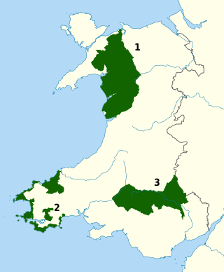
The national parks of Wales are managed areas of outstanding landscape in Wales, United Kingdom where some forms of development are restricted to preserve the landscape and natural environment. Together, they cover 20% of the land surface of Wales and have a resident population of over 80,000 people. Each National Park Authority is a free-standing body within the local government framework.

Blorenge, also called The Blorenge, is a prominent hill overlooking the valley of the River Usk near Abergavenny, Monmouthshire, southeast Wales. It is situated in the southeastern corner of the Brecon Beacons National Park. The summit plateau reaches a height of 1,841 feet (561 m).

Henrhyd Falls in the Brecon Beacons National Park, Wales, is the tallest waterfall in southern Wales with a drop of 90 feet (27 m). It lies on National Trust land, in the traditional county of Brecknockshire. The nearest settlement to it is Coelbren, on the road between Glynneath and Abercraf. Though not in the core of the area, it is considered by many to constitute a part of Wales' celebrated Waterfall Country.

The Black Mountain is a mountain range in South, Mid and West Wales, straddling the county boundary between Carmarthenshire and Powys and forming the westernmost range of the Brecon Beacons National Park. Its highest point is Fan Brycheiniog at 802 metres or 2,631 ft. The Black Mountain also forms a part of the Fforest Fawr Geopark.

The Beacons Way is a waymarked long distance footpath in the Brecon Beacons National Park, Wales. It is a linear route which runs for 99 miles (159 km) east to west through the National Park, and passes many of the most important landmarks and mountain peaks in the mountain range. It also includes a few of the towns in the park as well as popular attractions such as Carreg Cennen Castle near Llandeilo at the western end of the path.
The Nant Llech is a minor river in Powys, Wales and which lies wholly within the Brecon Beacons National Park. The name means 'slab stream', presumably in reference to the sandstones across which it runs. Its headwater streams, the Nant Llech Pellaf and the Nant Llech Isaf join forces at Blaen Llech and then continue westwards as the Nant Llech for 3 km / 2 mi to a confluence with the River Tawe just east of the village of Abercraf.
Heol Senni is a hamlet in the valley of the Afon Senni just north of the Fforest Fawr section of the Brecon Beacons National Park. It lies within the community of Maescar in the county of Powys, Wales. The Welsh name means the 'road by Senni' and reflects its position near the crossing of the river by the minor road running from the A4067 to the A4215 road. This route was, and to some extent still is, an important link between Brecon and the upper Swansea Valley.
Cefn Llechid is a small area of unenclosed land in the Brecon Beacons National Park east of Sennybridge in the county of Powys, Wales. It lies within Fforest Fawr Geopark. Its plateau-like summit surface peaks at 400m where it is marked by a trig point. A couple of small bodies of water lie in a hollow on the plateau. The hill is owned and managed by the Brecon Beacons National Park Authority.

Mynydd Illtud is an extensive area of common land near Libanus, Powys, Wales, located in the Brecon Beacons National Park and some three miles south-west of Brecon. The common is an undulating plateau lying between 330 and 370 metres above sea level. Its highest points are 381 metres (1,250 ft) at Allt Lom and 367 metres (1,204 ft) at Twyn y Gaer trig point overlooking the valley of the River Usk. Twyn y Gaer is the site of an Iron Age hill fort.

Allt yr Esgair is a hill in the Brecon Beacons National Park in Powys, Wales. It is commonly referred to locally as simply 'The Allt'. The Welsh name signifies 'wooded slope of the ridge'. It takes the form of a northwest-southeast aligned ridge which rises to a height of 393m and which overlooks the valley of the River Usk to the west and south. To the northeast are panoramic views across Llangorse Lake to the Black Mountains There is a viewfinder on the summit erected as a monument to Eirene Lloyd White, Baroness White of Rhymney. It is a Marilyn with a prominence of 199 metres.

Y Garn Goch is a hill in the Brecon Beacons National Park in the east of Carmarthenshire, Wales. The name means the 'red cairn'. It lies near the village of Bethlehem, three miles southwest of Llangadog and four miles east of Llandeilo on the southern side of the broad Towy Valley. It is also commonly known as either Garn Goch or Carn Goch. Current owners and land managers are the Brecon Beacons National Park Authority.
Waterfall Country is an English name often given to the Vale of Neath in South Wales. The tourist area around the head of the valley has an unusually large number of publicly accessible waterfalls. The area is not officially defined but generally includes the group of falls on the Nedd Fechan, Pyrddin, Hepste and Mellte rivers, all of which lie between the villages of Pontneddfechan and Ystradfellte in the Brecon Beacons National Park.
Libanus is a village in the Brecon Beacons National Park, Powys, Wales, United Kingdom, and in the community of Glyn Tarell. Presumably, the name of the village derives from Mount Lebanon, also known as the Lebanon Mountains, the ancient name for which was Libanus, a common name for chapels in Wales.

Pen-y-crug is a hill in the Brecon Beacons National Park in the county of Powys, south Wales. It is commonly referred to locally as simply 'The Crug'. The Welsh name signifies 'top of the mound'. It slopes are moderately gently on three sides; only to the west do they steepen somewhat. Its flat trig point adorned summit at 331m overlooks the valley of the River Usk to the south. To the southeast are panoramic views over Brecon whilst eastwards are the Black Mountains and south the Brecon Beacons.

Buckland Hill is a low hill in the Brecon Beacons National Park in the county of Powys in Wales. Sitting transversely across the Usk valley between the river and the village of Bwlch, it provides excellent panoramic views down the valley and across to the Black Mountains. The summit at 316m above sea level is marked by an OS trig point though this is now within a dense conifer plantation and so no longer affords any outward views. Buckland Hall sits at the foot of the hill's afforested northwestern side.

Glyn Tarell is a valley and a community in the county of Powys, Wales, and the historic county of Brecknockshire. It is in the Brecon Beacons National Park and at the northern edge of the Brecon Beacons mountains.