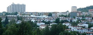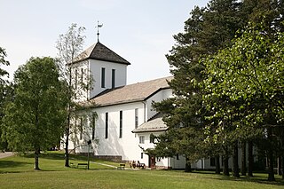
Bredtvet is a neighborhood in the borough of Bjerke in Oslo, Norway. [1]

Bjerke is a borough of the city of Oslo, Norway.

Oslo is the capital and most populous city of Norway. It constitutes both a county and a municipality. Founded in the year 1040 as Ánslo, and established as a kaupstad or trading place in 1048 by Harald Hardrada, the city was elevated to a bishopric in 1070 and a capital under Haakon V of Norway around 1300. Personal unions with Denmark from 1397 to 1523 and again from 1536 to 1814 reduced its influence, and with Sweden from 1814 to 1905 it functioned as a co-official capital. After being destroyed by a fire in 1624, during the reign of King Christian IV, a new city was built closer to Akershus Fortress and named Christiania in the king's honour. It was established as a municipality (formannskapsdistrikt) on 1 January 1838. The city's name was spelled Kristiania between 1877 and 1897 by state and municipal authorities. In 1925 the city was renamed Oslo.

Norway, officially the Kingdom of Norway, is a Nordic country in Northwestern Europe whose territory comprises the western and northernmost portion of the Scandinavian Peninsula; the remote island of Jan Mayen and the archipelago of Svalbard are also part of the Kingdom of Norway. The Antarctic Peter I Island and the sub-Antarctic Bouvet Island are dependent territories and thus not considered part of the kingdom. Norway also lays claim to a section of Antarctica known as Queen Maud Land.
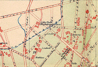
The area is located on a ridge between the neighborhoods of Veitvet to the west and Kalbakken to the east. Its origin was as a farm of the same name. It is not mentioned in writings from the Middle Ages, but was at one time Crown land. [2] Its first private owner is registered in 1662, and from 1817 to 1824 it was owned by Hans Nielsen Hauge. [3]
Crown land, also known as royal domain or demesne, is a territorial area belonging to the monarch, who personifies the Crown. It is the equivalent of an entailed estate and passes with the monarchy, being inseparable from it. Today, in Commonwealth realms such as Canada and Australia, crown land is considered public land and is apart from the monarch's private estate.

Hans Nielsen Hauge was a 19th-century Norwegian Lutheran lay minister, spiritual leader, business entrepreneur, social reformer and author. He led a noted Pietism revival known as the Haugean movement. Hauge is also considered to have been influential in the early industrialization of Norway.
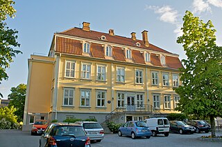
Bredtvet is also a parish in the Church of Norway, created in 1966 although Bredtvet church (Bredtvet kirke) was not erected until 1977. An obelisk with commemorative plaque honoring Hauge was raised in the church garden. [4] [5] Bredtvet is also known as the site of Bredtveit prison. [6] An upper secondary school named Bredtvet was established in 1972, [5] but closed down in 2008.

The Church of Norway is an evangelical Lutheran denomination of Protestant Christianity and by far the largest Christian church in Norway, with membership mandatory for everyone until the 19th century.


