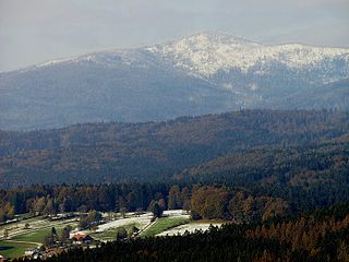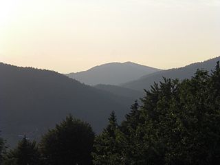
The Bavarian Forest is a wooded, low-mountain region in Bavaria, Germany that is about 100 kilometres long. It runs along the Czech border and is continued on the Czech side by the Bohemian Forest. Most of the Bavarian Forest lies within the province of Lower Bavaria, but the northern part lies within Upper Palatinate. In the south it reaches the border with Upper Austria.
Deggendorf is a Landkreis (district) in Bavaria, Germany. It is bordered by the districts of Regen, Freyung-Grafenau, Passau, Rottal-Inn, Dingolfing-Landau and Straubing-Bogen.

The Zugspitze, at 2,962 m (9,718 ft) above sea level, is the highest peak of the Wetterstein Mountains and the highest mountain in Germany. It lies south of the town of Garmisch-Partenkirchen in Bavaria, and the Austria–Germany border is on its western summit. South of the mountain is the Zugspitzplatt, a high karst plateau with numerous caves. On the flanks of the Zugspitze are two glaciers, the largest in Germany: the Northern Schneeferner with an area of 30.7 hectares and Höllentalferner with an area of 24.7 hectares. Shrinking of the Southern Schneeferner led to the loss of glacier status in 2022.
Straubing-Bogen is a Landkreis (district) in the eastern part of Bavaria, Germany. Neighboring districts are Cham, Regen, Deggendorf, Dingolfing-Landau, Landshut and Regensburg. The independent town of Straubing is surrounded by the district. The seat of the government of the district (Landratsamt) is located in Straubing.

Deggendorf is a town in Bavaria, Germany, capital of the Deggendorf district.

The Großer Arber ; Czech: Velký Javor, "Great Maple") or Great Arber, is the highest peak of the Bavarian/Bohemian Forest mountain range and in Lower Bavaria, with an elevation of 1,455.5 metres (4,775 ft). As a result, it is known in the Lower Bavarian county of Regen and the Upper Palatine county of Cham as the "King of the Bavarian Forest". Its summit region consists of paragneiss.
The Deggendorf—Metten railway was a local Bavarian branch line (Lokalbahn) in southern Germany. It was established by the Aktiengesellschaft der Lokalbahn Deggendorf-Metten, a railway company in eastern Bavarian that built and operated this standard gauge line between the two towns.
The Deggendorf–Kalteneck railway linked the railway line running through the Bavarian Forest from Plattling via Zwiesel to Bayerisch Eisenstein with the Ilz Valley railway (Ilztalbahn) from Passau via Waldkirchen to Freyung. In keeping with the naming of the Bavarian Forest railway or Waldbahn from Plattling to Bayerisch Eisenstein, it was called the Vorwaldbahn.

The Passau–Freyung railway, also known as the Ilz Valley Railway or Ilztalbahn, is a branch line in Bavaria, Germany. It runs from Passau to the town of Freyung in the Bavarian Forest. At Kalteneck it forms a junction with the branch line to Eging-Deggendorf. At Waldkirchen the Waldkirchen–Haidmühle line branches off towards the Czech border, where since 1945 there has been a junction with the Czech railway network.
The Deggendorf–Plattling Railway company was an early German railway company founded in 1865 with an original capital of 300,000 gulden and established to build a railway line between Deggendorf and Plattling in Bavaria, southern Germany. The capital was divided into 3,000 shares of 100 gulden each.

The Dreitannenriegel is a mountain, 1,090.2 m above sea level (NHN), in the Bavarian Forest.

The Einödriegel is a mountain, 1,120.6 m above sea level (NHN), in the Bavarian Forest in Germany. It rises southwest of the Lower Bavarian county town of Regen and northeast of the county town of Deggendorf. It is the highest point in the Danube Hills and the county of Deggendorf and lies in the municipality of Grafling.

The Geißkopf is a mountain, 1,097.4 m above sea level (NHN), in the Bavarian Forest in Germany.
The 1,043-metre-high Geißriegel is a mountain in the Danube Hills, the anterior part of the Bavarian Forest, southwest of the Lower Bavarian county town of Regen and northeast of the county town of Deggendorf. It lies within the municipality of Grafling in the county of Deggendorf.

The Hausstein is a mountain in Bavaria, Germany.

The Hirschenstein is a 1,089-metre-high (3,573 ft) mountain in Bavaria, Germany.

The Großer Rachel or Great Rachel is a mountain, 1,452 m above sea level (NHN); it is the second highest summit in the Bavarian Forest and Bohemian Forest after the Großer Arber and the highest mountain in the Bavarian Forest National Park. Together with the Kleiner Rachel or Little Rachel, 900 metres to the northwest, it forms the mountain of Rachel.
Geißkopf or Geisskopf is the name or part of the name of the following geographic objects:

The Anterior Bavarian Forest, also variously called the Vorderer Forest, Vorderer Wald or Danube Hills, is part of the Bavarian Forest, a low mountain range in Germany.


