Bridal Veil Falls, Bridalveil Falls or Bridalveil Fall is a frequently-used name for waterfalls that observers fancy resemble a bride's veil:

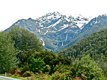
Mount Aspiring National Park is in the Southern Alps of the South Island of New Zealand, north of Fiordland National Park, situated in Otago and Westland regions. The park forms part of the Te Wahipounamu World Heritage Site.

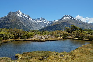
The Routeburn Track is a world-renowned, 32 km tramping (hiking) track found in the South Island of New Zealand. The track can be done in either direction, starting on the Queenstown side of the Southern Alps / Kā Tiritiri o te Moana, at the northern end of Lake Wakatipu or on the Te Anau side, at the Divide, several kilometres from the Homer Tunnel to Milford Sound / Piopiotahi.

Bridal Veil Falls Provincial Park is a BC Park located on the Trans-Canada Highway just east of Rosedale, British Columbia, Canada, part of the City of Chilliwack. The community of Bridal Falls is located adjacent to the falls and park as well as the interchange between the Trans-Canada and BC Highway 9 and has a variety of highway-based tourism services. Access to the falls requires a short hike from the parking lot and well groomed trails, taking most groups 15-25 minutes.

The Bridal Veil Falls is a waterfall located on Bridal Veil Creek along the Columbia River Gorge in Multnomah County, Oregon, United States. The waterfall is accessible from the historic Columbia River Highway and Interstate 84. Spanning two tiers on basalt cliffs, it is the only waterfall which occurs below the historic Columbia Gorge Scenic Highway. The Bridal Veil Falls Bridge, built in 1914, crosses over the falls, and is listed on the National Register of Historic Places.

Bridal Veil Falls is a 45-foot (13.7 m) waterfall located in the Nantahala National Forest, northwest of Highlands, North Carolina. With a short curve of roadway located behind the falls, it had the distinction of being the only waterfall in the state that one could drive a vehicle under, however this has since been closed and is now used for pedestrian access only.

Bridal Veil Fall is a waterfall in Banff National Park, Alberta, Canada. It originates in the Huntington Glacier on the slopes of Cirrus Mountain. Its waters drain into Nigel Creek, then into the North Saskatchewan River at the Big Bend of the Icefields Parkway.

Bridal Veil Falls is a 1,328-foot (405 m) waterfall that flows from Lake Serene directly to the South Fork Skykomish River on the creek of the same name in the U.S. state of Washington. It is a perennial 150-foot (46 m) wide drop with four tiers, two of which are clearly visible. It is at 47.78950°N 121.56924°W.

Bridal Veil Falls is a plunge waterfall located along the Pakoka River in the Waikato area of New Zealand. The waterfall is 55 m (180 ft) high, and has over time caused the formation of a large pool at the base of the waterfall. The falls are in the 217 ha Wairēinga Scenic Reserve with tawa-dominated forest.

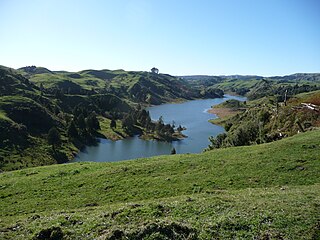
Lake Disappear is an intermittent volcanogenic lake situated in the North Island of New Zealand, just over 20 km from Raglan, 4 km beyond Bridal Veil waterfall. It has also been described as a solution lake. The south end can be seen from Kawhia Rd and, when the north end is full, it can be seen from the point which is at the end of Plateau Rd on the Pipiwharauroa Way. It is the largest known polje in the country, though another large one is in Paparoa National Park.

The Rob Roy Glacier is a small hanging glacier in the Southern Alps of New Zealand's South Island. It is located within the Mount Aspiring National Park, 9 kilometres (6 mi) south of Mount Aspiring / Tititea.

The Govetts Leap Falls, or simply Govetts Leap, is a bridal veil waterfall on the Govetts Leap Brook where it falls 180 metres over Taylor Wall, located at Govetts Leap Lookout approximately 2.4 kilometres (1.5 mi) east of Blackheath in the Blue Mountains region of New South Wales, Australia. It is the 17th tallest waterfall in Australia.

The Bridal Veil Falls is a cascade waterfall on the Leura Falls Creek where it spills into the Jamison Valley, located south-east of Leura in the Blue Mountains region of New South Wales, Australia.

Roaring Billy Falls is a waterfall in Mount Aspiring National Park, Westland District, New Zealand. It is located in the Haast River valley, around 30 km (19 mi) inland from Haast, near Eighteen Mile Bluff on State Highway 6. The falls are a 30-metre-high (98 ft) cascade on The Roaring Billy stream. The bottom of the cascade is at an elevation of around 80 metres (262 ft) where it flows into the Haast River.

Thunder Creek Falls is a waterfall in Mount Aspiring National Park, Westland District, New Zealand. It is located in the Haast River valley, around 52 kilometres (32 mi) inland from Haast, near the Gates of Haast bridge on State Highway 6. The falls are about 28 metres (92 ft) high and the base is at an elevation of around 120 metres (390 ft) where it flows into the Haast River.


