
Sint Laurens is a village in the Dutch province of Zeeland. It is located in the municipality of Middelburg, about 3 km north of the city.
Oosterbroek is a mansion and a former hamlet in the Dutch province of Drenthe. The mansion is located about 2 km east of Eelde, in the municipality of Tynaarlo.
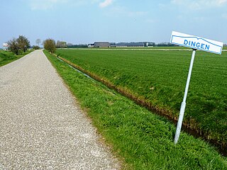
De Dingen is a former hamlet in the Dutch province of Groningen. It was located about 1 km south of Baflo.

Strevelshoek is a hamlet in the Dutch province of South Holland. It is located about 1 km northwest of the village of Rijsoord, on the south bank of the Waaltje. The hamlet is not mentioned on recent topographical maps.

Aalsum is a small hamlet in the Dutch province of Groningen. It is located in the municipality of Westerkwartier, about 1.5 km west of Oldehove.

Bleijenbeek is a small hamlet in the Dutch province of Limburg. It is located in the municipality of Bergen, about 2 km east of Afferden.
Anholt is a hamlet in northeast Netherlands. It is located in the municipality De Wolden, Drenthe, about 2 km west of Pesse.

Appel is a hamlet in the Dutch province of Gelderland. It is located in the municipality Nijkerk, about 6 km southeast of the city, on the border with the municipality of Barneveld.
Appen is a hamlet in the Dutch province of Gelderland. It is located in the municipality of Voorst, about 0.5 km southwest of Gietelo, to which it belongs.
Baal is a hamlet in the Dutch province of Gelderland. It is located in the municipality of Lingewaard, about 1 km northeast of Bemmel, and located 1 kilometer north of Haalderen and is therefore part of Haalderen.
Bahr is a hamlet in the Dutch province of Gelderland. It is located in the municipality Zevenaar, about 3 km southeast of Rheden.
Baalhoek is a hamlet in the Dutch province of Zeeland. It is located in the municipality of Hulst, about 5 km east of Kloosterzande on the dyke of the Westerschelde.
Toom is a hamlet in the Dutch province of North Brabant. It is located in the municipality of Cranendonck, about 1 km west of Budel, and a few hundred metres from the Belgian border.

Bern is a hamlet in the Dutch province of Gelderland. It is located in the municipality of Zaltbommel, about 10 kilometres south of the town Zaltbommel.
Bosch is a hamlet in the Dutch province of North Brabant. It is located in the municipality of Cranendonck, about 1.5 km east of Budel.
Heikant is a hamlet in the Dutch province of North Brabant. It is located in the municipality of Cranendonck, about 1.5 km southeast of Budel.
Heikant is a hamlet in the Dutch province of North Brabant. It is located in the municipality of Alphen-Chaam, about 2 km northeast of Chaam.
Heikant is a former hamlet in the Dutch province of North Brabant. It was located in the municipality of Gilze en Rijen, about 1 km west of the centre of Rijen.
Heikant is a hamlet in the municipality of Reusel-De Mierden, in the Dutch province of North Brabant. It is located about 1 km north of Hulsel.
Pothuizen is a former village in the Dutch province of Utrecht. It was located on the Lek river north of Culemborg, and stretched along the Lek dike on both sides of the Schalkwijkse Wetering.

