
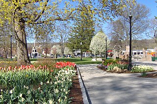
Terryville is a census-designated place (CDP) in Litchfield County, Connecticut, United States, and is the largest village within the town of Plymouth. In the 2010 census, Terryville had a population of 5,387, out of 12,243 in the entire town of Plymouth. The village is named for Eli Terry Jr., the son of the well-known clockmaker Eli Terry Sr. Terryville is also home to the Lock Museum of America. There is a water wheel located in downtown Terryville that is dedicated to the son of Eli Terry Sr.
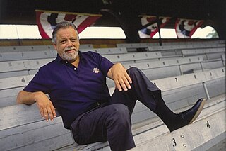
Angelo Bartlett "Bart" Giamatti was an American professor of English Renaissance literature, the president of Yale University, and the seventh Commissioner of Major League Baseball.

Bristol is a suburban city located in Hartford County, Connecticut, United States, 20 miles (32 km) southwest-west of Hartford. The city is also 120 miles southwest from Boston, and approximately 100 miles northeast of New York City. The city is part of the Naugatuck Valley Planning Region. As of the 2020 census, the population of the city was 61,844.
Torrington is the most populated municipality and largest city in Litchfield County, Connecticut, United States, and the Northwest Hills Planning Region. It is also the core city of Greater Torrington, one of the largest micropolitan areas in the United States. The city population was 35,515 according to the 2020 census. The city is located roughly 23 miles (37 km) west of Hartford, 34 miles (55 km) southwest of Springfield, Massachusetts, 67 miles (108 km) southeast of Albany, New York, 84 miles (135 km) northeast of New York City, and 127 miles (204 km) west of Boston, Massachusetts.
Eastern Connecticut State University is a public university in Willimantic, Connecticut. Founded in 1889, it is the second-oldest campus in the Connecticut State University System and third-oldest public university in the state. Eastern is located on Windham Street in Willimantic, Connecticut, on 182 acres (0.74 km2) 30 minutes from Hartford, lying midway between New York City and Boston. Although the majority of courses are held on the main campus, select classes take place at Manchester Community College, Capital Community College, and a satellite center in Groton.

The Binghamton Rumble Ponies are an American Minor League Baseball team based in Binghamton, New York. The team, which plays in the Eastern League, is the Double-A affiliate of the New York Mets major-league club. The Rumble Ponies play in Mirabito Stadium, located in Binghamton.
Notre Dame High School (NDWH) is a private, Roman Catholic, co-educational college preparatory school located in West Haven, Connecticut, a coastal suburb of New Haven, Connecticut.
The Frederick Gunn School is a private, coeducational, boarding and day prep school for students in grades 9–12 and postgraduate, located in rural Connecticut, United States. The 220-acre (0.89 km2) campus borders the village green of Washington, a small, historic town in Litchfield Hills. Formerly known as The Gunnery and Mr. Gunn's School, it was named for its founder, has no military affiliations and is a non-sectarian school.

Muzzy Field is a stadium in Bristol, Connecticut adjacent to Rockwell Park. In 1912, it was given to the Public Welfare Association in the city of Bristol by Commissioner Adrian Muzzy in memory of his two sons, for the express purpose of amateur athletics, officially opening on 8 July 1914, for both baseball and football. In 1939, after a fire, the 4,900-capacity brick-faced grandstand was built. It features a ring of tall pine trees that line the outside of the outfield wall and the grandstand.

Ridgefield High School (RHS) is a public high school in Ridgefield, Connecticut, United States. It is part of the Ridgefield School District. It was ranked 119th in Newsweek's 2015 list of the top 1,600 high schools in America and 226th in U.S. News & World Report's 2012 list of the top 4,813 high schools.

Bristol Central High School is a public high school in Bristol, Connecticut, United States. Its mascot is the Ram, and its colors are maroon and white. The school is known for its performing arts group, Central Stage, as well as for its athletics. The Rams have excelled in basketball, baseball, wrestling, and track in recent years. In 2017, principal Peter Wininger was awarded Varsity Brands 'Principal of Principles,' deeming him the best principal in the United States. The schools Italian Language teacher Gina Gallo-Reinhardt nominated Wininger for the award, and he and his family were sent to Florida for the ceremony where he was crowned the winner.

Salisbury High School is a public high school located in Salisbury Township, Pennsylvania, in the Lehigh Valley region of eastern Pennsylvania. It is the only high school within the Salisbury Township School District.
The Bristol Red Sox baseball club was an American minor league baseball franchise. Based in Bristol, Connecticut, it was the Double-A Eastern League farm system affiliate of the Boston Red Sox for ten seasons (1973–82) and played at Muzzy Field.

Amity High School is a regional public high school located in Woodbridge, Connecticut, United States. It provides high school education for the children in the towns of Woodbridge, Orange, and Bethany. The name Amity is derived from both the colonial history of Woodbridge as well as the "friendship" demonstrated among the three founding towns in arranging for a communal educational program.

Fiondella Field is a baseball venue located on the campus of the University of Hartford in West Hartford, Connecticut, United States. It is home to the Hartford Hawks baseball team, a member of the NCAA Division III Commonwealth Coast Conference. The stadium hosted its first game on March 29, 2006. It holds a capacity of 1,000 spectators and includes dugouts, batting cages, and a modern scoreboard over the left field fence.
William Francis Denehy is an American former professional baseball pitcher and coach. Denehy threw and batted right-handed, stood 6 ft 3 in (1.91 m) tall, and weighed 200 lb (91 kg). He was born in Middletown, Connecticut and attended Middletown Woodrow Wilson High School.

The Mystic Schooners are a collegiate summer baseball team that operates in the Mystic, Connecticut region. The franchise is one of the two oldest franchises in the New England Collegiate Baseball League.
There have been numerous professional baseball teams in Connecticut since the late 1800s. Most have been minor league teams, however, some early major league teams played in Connecticut. The last major league team was the Hartford Dark Blues, which played its final season in Hartford as a charter member of the newly-established modern National League in 1876.

The Hartford Yard Goats are a Minor League Baseball team based in Hartford, Connecticut. The Yard Goats, which play in the Eastern League, are the Double-A affiliate of the Colorado Rockies. The team was founded in 2016 when the New Britain Rock Cats relocated to Hartford. The Yard Goats' home stadium is Dunkin' Park.

