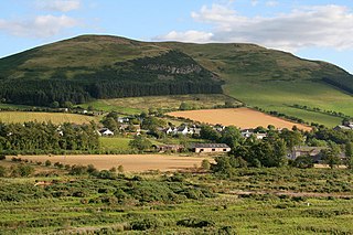
It is known for having Scotland's first youth hostel, which was converted from a row of four cottages by the late William Stewart Morton, and opened by the Scottish Youth Hostels Association as Broadmeadows Youth Hostel on 2 May 1931[1]. It is located in secluded woodland in the Yarrow Valley.
Broadmeadows Youth Hostel and villagers featured in the short film As Long as You're Young (1962)[2] (12'50" - 13'40"), produced by Glasgow Films Ltd, and catalogued by the National Library of Scotland.
The Yarrow Water is a river in the Borders in the south east of Scotland. It is a tributary of the Ettrick Water and renowned for its high quality trout and salmon fishing. The name "Yarrow" may derive from the Celtic word garw meaning "rough" or possibly share a derivation with the English name "Jarrow".
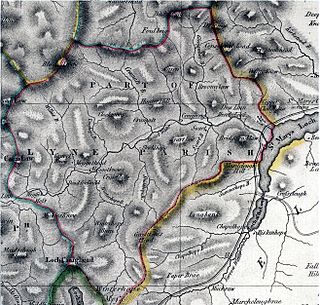
Selkirkshire or the County of Selkirk is a historic county and registration county of Scotland. It borders Peeblesshire to the west, Midlothian to the north, Roxburghshire to the east, and Dumfriesshire to the south. It derives its name from its county town, the royal burgh of Selkirk. The county was historically also known as Ettrick Forest.
Kirk Yetholm is a village in the Scottish Borders region of Scotland, 8 miles southeast of Kelso and less than 1 mile west of the border. The first mention is of its church in the 13th century. Its sister town is Town Yetholm which lies 1⁄2 mile across the Bowmont Water. The population of the two villages was recorded as 591 in the 2001 census.
Hostelling Scotland is part of Hostelling International and provides youth hostel accommodation in Scotland. As of January 2022 the organisation represents 58 hostels: 31 run by Hostelling Scotland and 27 affiliates.
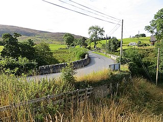
Ettrick is a small village and civil parish in the Scottish Borders area of Scotland. It is located on the B709, around 17 miles (28 km) south-west of the town of Selkirk.
Bonar Bridge is a village on the north bank of the Kyle of Sutherland to the west and the Dornoch Firth to the east in the Parish of Creich in the Highland council area of Scotland.
Philiphaugh is a village by the Yarrow Water, on the outskirts of Selkirk, in the Scottish Borders.
Selkirk Football Club was a Scottish football club based in the town of Selkirk. Founded in 1880, they were the oldest established football club in the Scottish Borders. The club was selected as a founder member of the Lowland Football League, which was formed in 2013 by the Scottish Football Association (SFA) as part of a proposed pyramid system. Their home ground was Yarrow Park. Following financial problems, they resigned from the Lowland League during the 2018–19 season and later went out of business due to insurmountable debts and failure to keep their SFA membership.
Nisbet is a small hamlet on the B6400, in Roxburghshire, along the River Teviot, in the Scottish Borders area of Scotland. It is located 5.5 kilometres (3.4 mi) north of Jedburgh and 5 kilometres (3.1 mi) south of Roxburgh.
Ettrickbridge is a village situated in the Scottish Borders region of Scotland, 7 miles (11 km) from the nearby town of Selkirk.
Belses is a village on the Ale Water, in the Scottish Borders area of Scotland the former Selkirkshire. It is situated close to Old Belses, and lies south of St Boswells, west of Jedburgh, north of Hawick, and east of Selkirk.
Kirkhope Tower is a Scottish Pele, located in the Ettrick Valley, in the historic county of Selkirkshire, now a division of the Scottish Borders. The tower lies a mile to the north west of Ettrickbridge, and seven miles (11 km) from the Burgh of Selkirk.
Dryhope Tower is a ruined Scottish peel tower in the valley of the Yarrow Water, in the historic county of Selkirkshire, now part of the Scottish Borders. It lies approximately equidistant between the burghs of Moffat and Selkirk, and defended the north eastern end of St Mary's Loch. The site itself was protected on two sides, to the east by the Dryhope Burn and to the west by the Kirkstead Burn.
Aikwood Tower is a 16th-century tower house in the Scottish Borders area of Scotland, 4 miles southwest of the town of Selkirk, on the Ettrick Water.
Caddonfoot is a village on the River Tweed, in the Scottish Borders area of Scotland, on the A707, near Galashiels.
Bowhill is a village off the A708, in the Scottish Borders area of Scotland, near Selkirk, by the Yarrow Water
Yarrowford is a village on the A708, in the Scottish Borders area of Scotland, 4 miles north-west of Selkirk, in the Ettrick Forest.
Yarrow is a place and parish in the Scottish Borders area of Scotland and in the former county of Selkirkshire.The name "Yarrow" may derive from the Celtic word garw meaning "rough" or possibly share a derivation with the English name "Jarrow".
Megget is a former chapelry or parish containing the valley of Megget Water, now forming the westernmost part of the parish of Yarrow, Selkirkshire in the Scottish Borders area of Scotland. The centre of the valley is 19 miles west of Selkirk.
Tinnis Castle or Tynnis Castle was formerly a Scottish tower house or castle at Old Tinnis in the parish of Yarrow, Scottish Borders, or former county of Selkirkshire.
This page is based on this Wikipedia article Text is available under the CC BY-SA 4.0 license; additional terms may apply. Images, videos and audio are available under their respective licenses.