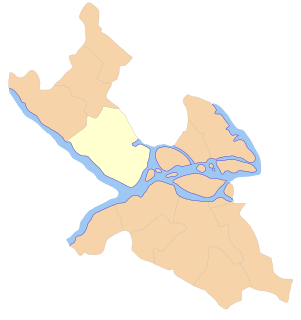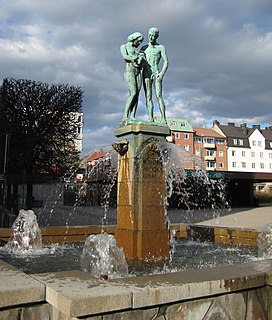
Sundbyberg Municipality is a municipality in Stockholm County in east central Sweden, just north of the capital Stockholm. Sundbyberg is wholly within the Stockholm urban area and has a 100% urban population.
Västerort is the western part of Stockholm Municipality in Stockholm County, Sweden. It also forms part of Stockholm urban area and of Stockholm Metropolitan Area. It constitutes the western suburban area within Stockholm's municipal borders.

Vällingby is a suburban district in Västerort in the western part of Stockholm Municipality, Sweden.
KFQD is a class A, AM and FM radio station in Anchorage, Alaska, operating on 750 kHz and 103.7 MHz. It is owned by Alpha Media LLC and broadcasts in a news/talk format. Owned by Alpha Media LLC, its studios are located in Anchorage, and its transmitter is in Knik, Alaska.

Blackeberg is a suburb of Stockholm built in the 1950s, and is part of the Bromma borough. Blackeberg was originally a croft first mentioned in 1599. The croft was demolished in 1861 by Knut Ljunglöf, who built a house, a stable, a mill and a saw instead. The saw and mill are now both cultural relics and are still standing in Kvarnviken for tourists to see. The city of Stockholm bought Blackeberg in the late 1940s. Three-story apartment blocks and a centre with a cinema and a library were built in the 1950s. Many people moved from the central parts of Stockholm to Blackeberg and neighbouring suburbs. Blackeberg has a metro station. It was designed by Peter Celsing and opened in 1952.

Bingo Yawata Station is a JR West Geibi Line station located in Suga, Tōjō-chō, Shōbara, Hiroshima Prefecture, Japan. Tickets are available at the nearby Suga Area Post Office.
Holtsås is a village in Sauherad municipality, Norway. It is located between Hjuksebø and Nordagutu.

Nybrogatan is a street in the borough of Östermalm in central Stockholm, Sweden. Approximately one kilometre in length, it stretches north from Nybroplan to Valhallavägen.

Gary Metro Center is a multimodal commuter hub operated by the Gary Public Transportation Corporation. It was built in 1984 as an elevated replacement of the previously ground-level Broadway Street Station.
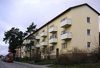
Traneberg is a residential district in western Stockholm (Västerort) and part of the Bromma borough. For the 1912 Summer Olympics, Tranebergs Idrottsplats hosted some of the football competitions.

Abrahamsberg is a residential district in the Västerort section of Stockholm municipality, Sweden, and part of the Bromma borough. It is bordered by Riksby, Stora Mossen, Ålsten, Olovslund and Åkeslund and is served by the Abrahamsberg metro station. The district was developed with small blocks of flats in yellow brick, and is therefore sometimes called den gula staden. As of December 2013 it had 3,154 residents.

Södra Ängby is a residential area blending functionalism with garden city ideals, located in western Stockholm, Sweden, forming part of the Bromma borough.
Ulvsunda is a district in Bromma in western Stockholm, just east of Stockholm Bromma Airport, built around Ulvsunda Castle, a 17th-century castle.

Bromma kyrka is a round church in the borough Bromma in Stockholm, Sweden. The oldest parts of the church were built in the later 12th century as a fortress church, and the church is among Stockholm's oldest buildings.

Crestview is a Capital MetroRail commuter rail station and Capital MetroRapid bus rapid transit station in Austin, Texas. It is at the edge of the Crestview neighborhood of North Austin, at the corner of Airport Boulevard and North Lamar Boulevard. The North Lamar Transit Center is one mile north of the station, and the Highland Mall Transit Center is half a mile to the southeast. There is no on-site parking at the Crestview station. Riders must park at the North Lamar Transit center and take buses 1 or 801 south to the train.

Šainovac is a village in the municipality of Leskovac, Serbia. According to the 2002 census, the village has a population of 216 people.
Tristolzer Berg is a mountain of Baden-Württemberg, Germany.

Haiyue station is a metro station on Line 2 of the Shenzhen Metro. It opened on 28 December 2010.
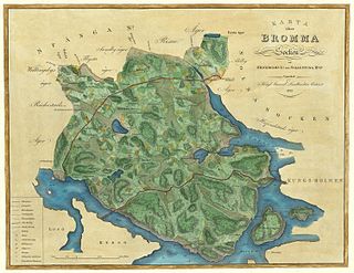
Bromma socken is a former socken of Sollentuna Hundred in Uppland, Sweden. It became part of Stockholm City in 1916, and has been part of the municipalities of Stockholm and Sundbyberg since 1971.

Stěbořice is a village in the Moravian-Silesian Region of the Czech Republic. As of 2006, the population was 1,345.


![]()
