Related Research Articles

Maryborough is a city and a suburb in the Fraser Coast Region, Queensland, Australia. At the 2021 Census, the suburb of Maryborough had a population of 15,287.

Dame Annabelle Jane Mary Rankin DBE was an Australian politician and diplomat. She was the first woman from Queensland elected to parliament, the first woman federal departmental minister, and the first Australian woman to be appointed head of a foreign mission.

The Shire of Woocoo was a local government area located in the Wide Bay–Burnett region of Queensland, Australia, containing the rural residential area to the west of the town of Maryborough, and surrounding countryside. The shire covered an area of 2,007.9 square kilometres (775.3 sq mi), and existed as a local government entity from 1914 until 2008, when it was amalgamated with the City of Maryborough, City of Hervey Bay and the 1st and 2nd divisions of the Shire of Tiaro to form the Fraser Coast Region.

Colin Dunlop Wilson Rankin, was a Scottish-born Australian soldier, politician, cane farmer and company director.

Howard is a rural town and locality in the Fraser Coast Region, Queensland, Australia. It is a southern boundary of the Dundaburra peoples of the Northern Kabi Kabi Isis districts and surrounds. In the 2016 census, Howard had a population of 1,359 people. It is located 284 kilometres (176 mi) north of Brisbane and 37 kilometres (23 mi) west of Hervey Bay.

The Fraser Coast Region is a local government area in the Wide Bay–Burnett region of Queensland, Australia, about 250 kilometres (160 mi) north of Brisbane, the state capital. It is centred on the twin cities of Hervey Bay and Maryborough and also contains K'gari. It was created in 2008 from a merger of the Cities of Maryborough and Hervey Bay and the Shires of Woocoo and most of Tiaro. In June 2018 it had a population of 105,463.

Pialba is a coastal town and suburb of Hervey Bay in the Fraser Coast Region, Queensland, Australia. It is the central business district of Hervey Bay. In the 2016 census, Pialba had a population of 3,678 people.

Theebine is a rural town and locality split between the Gympie Region and the Fraser Coast Region, both in Queensland, Australia.

Urangan is a coastal suburb of Hervey Bay in the Fraser Coast Region, Queensland, Australia. In the 2016 census Urangan had a population of 9,764 people.

Duckinwilla is a rural locality in the Fraser Coast Region, Queensland, Australia. In the 2016 census Duckinwilla had a population of 12 people.
Kawungan is a suburb of Hervey Bay in the Fraser Coast Region, Queensland, Australia. In the 2016 census Kawungan had a population of 4,816 people.

Tinana is a rural town and locality in the Fraser Coast Region, Queensland, Australia. In the 2016 census the locality of Tinana had a population of 5,476 people.

The Shire of Howard is a former local government area in the Wide Bay–Burnett area of Queensland, Australia, centred on the town of Howard.

The Maryborough Military & Colonial Museum is a non-profit museum located at 106 Wharf Street, Maryborough, Queensland, Australia. It was established and is operated by John and Else Meyers for the benefit of the Fraser Coast community.

Torbanlea is a rural town and locality in the Fraser Coast Region, Queensland, Australia. In the 2016 census the locality of Torbanlea had a population of 791 people.
Burrum Heads is a coastal town and locality in the Fraser Coast Region, Queensland, Australia. In the 2016 census, Burrum Heads had a population of 2,067 people.

Bauple is a rural town and locality in the Fraser Coast Region, Queensland, Australia. In the 2016 census the locality of Bauple had a population of 644 people.
North Aramara is a rural locality in the Fraser Coast Region, Queensland, Australia. In the 2016 census, North Aramara had a population of 35 people.

Munna Creek is a locality split between the Fraser Coast Region and the Gympie Region, in Queensland, Australia. In the 2016 census, Munna Creek had a population of 23 people.
References
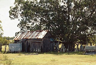
- 1 2 "Brooklyn House". Local Heritage Register. Fraser Coast Regional Council. Archived from the original (PDF) on 8 August 2020. Retrieved 11 December 2015.
- ↑ "Howard". Queensland Places. Centre for the Government of Queensland, University of Queensland. Retrieved 14 September 2012.
25°18′50″S152°33′55″E / 25.3140°S 152.5652°E
| | This article about a building or structure in Queensland is a stub. You can help Wikipedia by expanding it. |