Related Research Articles
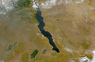
A rift valley is a linear shaped lowland between several highlands or mountain ranges produced by the action of a geologic rift. Rifts are formed as a result of the pulling apart of the lithosphere due to extensional tectonics. The linear depression may subsequently be further deepened by the forces of erosion. More generally the valley is likely to be filled with sedimentary deposits derived from the rift flanks and the surrounding areas. In many cases rift lakes are formed. One of the best known examples of this process is the East African Rift. On Earth, rifts can occur at all elevations, from the sea floor to plateaus and mountain ranges in continental crust or in oceanic crust. They are often associated with a number of adjoining subsidiary or co-extensive valleys, which are typically considered part of the principal rift valley geologically.

Ganges Chasma is a deep canyon at the eastern end of the vast Valles Marineris system on Mars, an offshoot of Capri Chasma, and is in the Coprates quadrangle. It is named after the River Ganges in South Asia. Ganges Chasma is thought to have formed through a series of catastrophic discharges of water and CO2 from chaos terrains such as that preserved in Ganges Chaos at its southern margin. Most of the evidence for these discharges and the ensuing collapses is believed to have been washed away. Prior to developing an outlet that joined it to Capri Chasma and the connected outflow channels to its east, Ganges Chasma may at some point in the Noachian period have contained a lake which drained northward through partially subsurface pathways into Shalbatana Vallis.

Eos Chasma is a chasma in the southern part of the Valles Marineris canyon system of the Coprates quadrangle and the Margaritifer Sinus quadrangles of the planet Mars.
In planetary nomenclature, a chasma is a deep, elongated, steep-sided depression. As of 2020, the IAU has named 122 such features in the Solar System, on Venus (63), Mars (25), Saturn's satellites Mimas (6), Tethys (2), Dione (8) and Rhea (5), Uranus's satellites Ariel (7), Titania (2) and Oberon (1) and Pluto's satellite Charon (3). An example is Eos Chasma on Mars.

Candor Chasma is one of the largest canyons in the Valles Marineris canyon system on Mars. The feature is geographically divided into two halves: East and West Candor Chasmas, respectively. It is unclear how the canyon originally formed; one theory is that it was expanded and deepened by tectonic processes similar to a graben, while another suggests that it was formed by subsurface water erosion similar to a karst. MRO discovered sulfates, hydrated sulfates, and iron oxides in Candor Chasma.

Juventae Chasma is an enormous box canyon on Mars which opens to the north and forms the outflow channel Maja Valles. Juventae Chasma is located north of Valles Marineris in the Coprates quadrangle and cuts more than 5 km into the plains of Lunae Planum.

Melas Chasma is a canyon on Mars, the widest segment of the Valles Marineris canyon system, located east of Ius Chasma at 9.8°S, 283.6°E in Coprates quadrangle. It cuts through layered deposits that are thought to be sediments from an old lake that resulted from runoff of the valley networks to the west. Other theories include windblown sediment deposits and volcanic ash. Support for abundant, past water in Melas Chasma is the discovery by MRO of hydrated sulfates. In addition, sulfate and iron oxides were found by the same satellite. Although not chosen as one of the finalists, it was one of eight potential landing sites for the Mars 2020 rover, a mission with a focus on astrobiology.
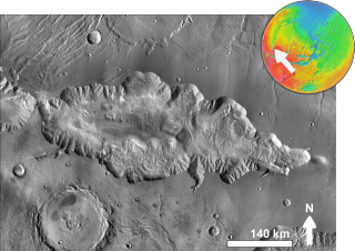
Hebes Chasma is an isolated chasma just north of the Valles Marineris canyon system of Mars. It is centered at 1 degree southern latitude and 76 degrees western longitude, just between the Martian equator and the Valles Marineris system, just east of the Tharsis region.

Echus Chasma is a chasma in the Lunae Planum high plateau north of the Valles Marineris canyon system of Mars. It is in the Coprates quadrangle. Clay has been found within it, meaning that water once sat there for a time. It may have been one of the many lakes that have been advanced for the Martian past.

The Coprates quadrangle is one of a series of 30 quadrangle maps of Mars used by the United States Geological Survey (USGS) Astrogeology Research Program. The Coprates quadrangle is also referred to as MC-18. The Coprates quadrangle contains parts of many of the old classical regions of Mars: Sinai Planum, Solis Planum, Thaumasia Planum, Lunae Planum, Noachis Terra, and Xanthe Terra.

Eos Chaos is a rough, collapsed area in the Coprates quadrangle on Mars at 16.8° south latitude and 46.9° west longitude. It is about 490 km long and was named after the Greek name of Aurora, an albedo feature.

Capri Mensa is a mesa in the Coprates quadrangle of Mars at 14° south latitude and 47.4° west longitude. It is about 275 km long and was named after a classical albedo feature name.
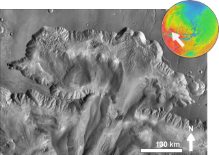
Ophir Chasma is a canyon in the Coprates quadrangle of Mars at 4° south latitude and 72.5° west longitude. It is about 317 km long and was named after Ophir, a land mentioned in the Bible. In the Bible it was the land which King Solomon sent an expedition that returned with gold. It is a classical albedo feature name.
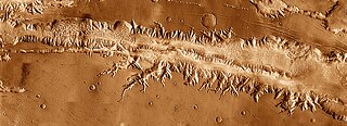
Ius Chasma is a large canyon in the Coprates quadrangle of Mars at 7° south latitude and 85.8° west longitude. It is about 938 km long and was named after a classical albedo feature name.
Tithonium Chasma is a large canyon in the Coprates quadrangle of Mars at 4.6° south latitude and 84.7° west longitude. It is about 810 km long and was named after a classical albedo feature.
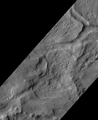
Chasma Boreale is a large canyon in Mars's north polar ice cap in the Mare Boreum quadrangle of Mars at 83° north latitude and 47.1° west longitude. It is about 560 km (350 mi) long and was named after a classical albedo feature name. The canyon's sides reveal layered features within the ice cap that result from seasonal melting and deposition of ice, together with dust deposits from Martian dust storms. Information about the past climate of Mars may eventually be revealed in these layers, just as tree ring patterns and ice core data do on Earth. Both polar caps also display grooved features, probably caused by wind flow patterns. The grooves are also influenced by the amount of dust. The more dust, the darker the surface. The darker the surface, the more melting as dark surfaces absorb more energy.
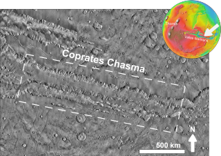
Coprates Chasma is a huge canyon in the Coprates quadrangle of Mars, located at 13.4° south latitude and 61.4° west longitude, part of the Valles Marineris canyon system. It is 966 km (600 mi) long and was named after a classical albedo feature name. It was named from the classical Greek name for the Dez River in Persia.

Arsia Chasmata is a steep-sided depression located northeast of Arsia Mons in the Phoenicis Lacus quadrangle on Mars, located at 7.6° S and 119.3° W. It is 97 km long and was named after an albedo name.

The Kachina Chasmata are the longest canyon or system of canyons on the surface of the Uranian moon Ariel. The name comes from a spirit in Hopi mythology. The 622 km long and 50 km wide chasmata arise from a system of normal faults running from the north-west to south-east. The faults bound down-dropped crustal blocks forming structures called graben. The canyons cut the cratered terrain, which means that they were formed at a relatively late stage of the moon's evolution, when the interior of Ariel expanded and its ice crust cracked as a result. The floor of the canyons is not visible on the images obtained by the Voyager 2 spacecraft in January 1986; thus, whether it is covered by smooth plains like the floors of other Arielian graben is currently unknown.
The Kewpie Chasma is a chasma on the surface of Ariel, the fourth largest moon of Uranus.
