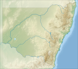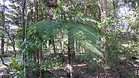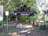
The Nightcap National Park is a national park situated within the Nightcap Range in the Northern Rivers region of New South Wales, Australia. The 8,080-hectare (20,000-acre) park was created in April 1983 and is situated 35 kilometres (22 mi) north of Lismore. The park was established following campaigns and blockades against logging at Terania Creek, Grier's Scrub and Mount Nardi between 1979 and 1982. Sections of the Whian Whian state forest were added to it following blockading and campaigning in 1998. The national park is classed by the IUCN World Commission on Protected Areas as Category II and is part of the Shield Volcano Group of the World Heritage Site Gondwana Rainforests of Australia inscribed in 1986 and added to the Australian National Heritage List in 2007.
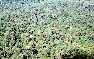
The Toonumbar National Park is a protected national park located in the Northern Rivers region of New South Wales, Australia. The 14,910-hectare (36,800-acre) park is situated approximately 620 kilometres (390 mi) north of Sydney, near the town of Woodenbong.

Northern Rivers is the most north-easterly region of the Australian state of New South Wales, located between 590 and 820 kilometres north of the state capital, Sydney, and encompasses the catchments and fertile valleys of the Clarence, Richmond, and Tweed rivers. It extends from Tweed Heads in the north to the southern extent of the Clarence river catchment which lies between Grafton and Coffs Harbour, and includes the main towns of Tweed Heads, Byron Bay, Ballina, Kyogle, Lismore, Casino and Grafton. At its most northern point, the region is 102 kilometres (63 mi) south-southeast of the Queensland capital, Brisbane.

Mullumbimby is an Australian town in the Byron Shire in the Northern Rivers region of New South Wales. It promotes itself as "The Biggest Little Town in Australia". The town lies at the foot of Mount Chincogan in the Brunswick Valley about 9 kilometres by road from the coast. At the 2016 census, Mullumbimby and the surrounding area had a population of 3,596 people. It was first inhabited by Australian Aboriginals.
The Big Scrub was the largest area of lowland subtropical rainforest in eastern Australia. It was intensively cleared for agricultural use in the 19th century (1801–1900) by settlers. Less than 1% now remains.

Archontophoenix cunninghamiana – commonly known as Bangalow palm, king palm, Illawara palm or piccabeen palm – is a tree in the palm family Arecaceae which is endemic to the east coast of New South Wales and Queensland, Australia.
The Rainforest Way is a circular series of tourist drives that extends through South East Queensland, Australia across the border into the Northern Rivers region of New South Wales.

Wilsons River, a perennial river and part of the Richmond River catchment, is situated in the Northern Rivers district of New South Wales, Australia.

Mount Banda Banda, a mountain of the Mid North Coast region of New South Wales, Australia, is situated 320 kilometres (200 mi) from Sydney within the Willi Willi National Park. Banda Banda can be seen on the north-western horizon from Port Macquarie, as well as on the south-western horizon 39 km from the town of Kempsey. At 1,258 metres (4,127 ft) AHD it is the highest mountain in the region.

Numinbah Nature Reserve is a protected nature reserve that is located in the Northern Rivers region of New South Wales, in eastern Australia. The reserve was gazetted in December 1981 with a further addition made in 1989 to make the reserve to its current area of 858 hectares. The reserve is situated north-east of the rural locality of Numinbah, and south of the Queensland town of Springbrook and defines part of the state border between New South Wales and Queensland.
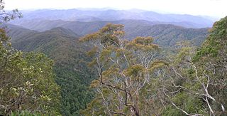
The Eastern Australian temperate forests is a broad ecoregion of open forest on uplands starting from the east coast of New South Wales in the South Coast to southern Queensland, Australia. Although dry sclerophyll and wet sclerophyll eucalyptus forests predominate within this ecoregion, a number of distinguishable rainforest communities are present as well.

The Victoria Park Nature Reserve is a protected nature reserve that is located in the Northern Rivers region in the state of New South Wales, in eastern Australia. The sub-tropical jungle remnant is located an undulating high rainfall plain near Alstonville. The red-brown soil is derived from a basaltic flow from the nearby Mount Warning. Of the total land in the reserve, 8 hectares is original rainforest; and the other areas are being re-vegetated.

The Minyon Falls is a plunge waterfall on Repentance Creek in the Northern Rivers region of New South Wales, Australia. The waterfall descends more than 100 metres (330 ft) over the huge rhyolite cliffs which were once part of the Tweed Volcano. The water flow eroded the rocks to create the waterfall.

The Sea Acres National Park is a national park that is located in the Mid North Coast region of New South Wales, in eastern Australia. The 76-hectare (190-acre) park is situated near the town of Port Macquarie. The park is a popular tourist area with a 1.3-kilometre (0.81 mi) long boardwalk through a remnant of seaside rainforest. There is also an education centre and cafe. The park was initially declared as a nature reserve in 1987; and gazetted as a national park in October 2010.
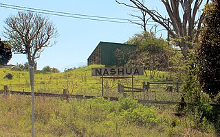
Nashua is a former railway station and locality in the north-east of New South Wales, between Lismore and Byron Bay.
The Kangaroo River Nature Reserve, part of the Kangaroo Valley Group of Nature Reserves, is a protected nature reserve that is located on the floor of the Kangaroo Valley in the Southern Highlands and South Coast regions of New South Wales in eastern Australia. The reserve is situated approximately 150 kilometres (93 mi) south of Sydney, 50 kilometres (31 mi) southwest of Wollongong and 16 kilometres (9.9 mi) northwest of Nowra. The reserve has a protective covenant placed upon it with purpose to ensure the protection of the natural heritage of this area. National parks in the area include the Morton National Park and the Budderoo National Park. Other nature reserves in the area include the Barren Grounds Nature Reserve, and the Cambewarra Range, Barrengarry and Rodway nature reserves – the latter three part of the Kangaroo Valley Group of Nature Reserves.
Cape Byron Marine Park is one of four marine parks in New South Wales, Australia, and is the most recently sanctioned. The Cape Byron Marine Park is located in Northern NSW and extends 37 kilometres (23 mi) from the Brunswick River to Lennox Head. The marine park extends out to 3 nautical miles which dictates the border between state and federal jurisdiction. The marine park covers an area of 220 square kilometres (85 sq mi) and includes a variety of marine terrain including beaches, rocky shores, open ocean and the tidal waters of the Brunswick River and its tributaries, the Belongil Creek and Tallow Creek. The Cape Byron Marine Park was declared in 2002 and the zoning plan was implemented in April 2006. Of the 15 distinct marine ecosystems identified within the Tweed-Moreton bioregion, the Cape Byron Marine Park supports 10 of these.
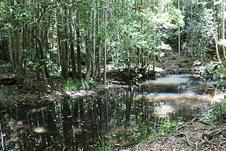
Sherwood Nature Reserve is a protected nature reserve located near Woolgoolga in the north coast region of New South Wales, Australia.

The High Conservation Value Old Growth forest is a heritage-listed forest located across twelve local government areas in the Northern Rivers, Mid North Coast, and New England regions of New South Wales, Australia. The conservation area is also known as Old Growth Forest; HCVOG Forest; and Upper North East NSW. Broadly speaking, the conservation area forms part of the much larger Gondwana Rainforests, a UNESCO World Heritage Site totalling more than 366,000 hectares. The conservation area is owned by the NSW Department of Primary Industries and the NSW Office of Environment and Heritage, both agencies of the Government of New South Wales. The conservation area was added to the New South Wales State Heritage Register on 22 December 2000.

South Eastern Queensland is an interim Australian bioregion located in south-eastern Queensland and north-eastern New South Wales. It has an area of 7,804,921 hectares. It is one of the most biodiverse bioregions in Australia. The bioregion is home to eucalypt forests and woodlands, with rainforests on mountain slopes and in stream valleys and wallum heaths near the coast. South Eastern Queensland bioregion is the northernmost part of the Eastern Australian temperate forests ecoregion.

