
Saraburi City is the provincial capital of Saraburi Province in central Thailand. In 2005, it had a population of 61,900, and covers the complete tambon Pak Phriao of the Mueang Saraburi district.

Penrose Island Marine Provincial Park is a provincial park in the Central Coast region of British Columbia, Canada, located on the north side of the entrance to Rivers Inlet, 86 km north of Port Hardy at the south end of Fitz Hugh Sound. Comprising 1,079 hectares of marine area and 934 hectares of land area, the park is accessible by boat only and entrance to its anchorages are on its eastern side, the western being exposed to the open ocean. Exploration by dinghy and kayak are popular with visitors, as are nature viewing, scuba diving and exploring the islands many beaches and adjoining islets. The nearest supply centre for fuel and food is at the community of Rivers Inlet.

Walsum power plant is a coal-fired power station owned by Evonik Industries. It is in the Walsum quarter of Duisburg, on the area of the former Walsum coal mine.

Lasinja is a village and a municipality in Karlovac County, Croatia. The prehistoric Lasinja culture is named after Lasinja.

Jalappa is a village in Tilden Township, Berks County, Pennsylvania. It is located on Old Route 22 less than a mile south of Interstate 78. Access to 78 is from Hamburg and Shartlesville. The Mill Creek flows eastward through the village to the Schuylkill River. The village uses the Hamburg ZIP code of 19526.
Lubowicze is a village in the administrative district of Gmina Grodzisk, within Siemiatycze County, Podlaskie Voivodeship, in north-eastern Poland.

Wargowo is a village in the administrative district of Gmina Czarna Dąbrówka, within Bytów County, Pomeranian Voivodeship, in northern Poland. It lies approximately 9 kilometres (6 mi) north of Czarna Dąbrówka, 33 km (21 mi) north of Bytów, and 72 km (45 mi) west of the regional capital Gdańsk.
Kolonia Przerąb is a village in the administrative district of Gmina Masłowice, within Radomsko County, Łódź Voivodeship, in central Poland. It lies approximately 5 kilometres (3 mi) north-west of Masłowice, 22 km (14 mi) east of Radomsko, and 75 km (47 mi) south of the regional capital Łódź.
Świerki is a village in the administrative district of Gmina Burzenin, within Sieradz County, Łódź Voivodeship, in central Poland. It lies approximately 8 kilometres (5 mi) west of Burzenin, 14 km (9 mi) south of Sieradz, and 61 km (38 mi) south-west of the regional capital Łódź.
Huta is a village in the administrative district of Gmina Baranów, within Puławy County, Lublin Voivodeship, in eastern Poland.

Blatnička is a village in Hodonín District in the South Moravian Region of the Czech Republic. As of 2008 it had a population of 437. The village was first mentioned in 1371.
Jaźwiny is a village in the administrative district of Gmina Krotoszyn, within Krotoszyn County, Greater Poland Voivodeship, in west-central Poland.
Mielno is a settlement in the administrative district of Gmina Zabór, within Zielona Góra County, Lubusz Voivodeship, in western Poland. It lies approximately 3 kilometres (2 mi) north-east of Zabór and 16 km (10 mi) east of Zielona Góra.
Lisia Góra is a village in the administrative district of Gmina Jasień, within Żary County, Lubusz Voivodeship, in western Poland. It lies approximately 3 kilometres (2 mi) south-west of Jasień, 15 km (9 mi) north-west of Żary, and 42 km (26 mi) south-west of Zielona Góra.
Myślęcin is a village in the administrative district of Gmina Szczecinek, within Szczecinek County, West Pomeranian Voivodeship, in north-western Poland. It lies approximately 16 kilometres (10 mi) north-west of Szczecinek and 137 km (85 mi) east of the regional capital Szczecin.

Seling is a town in Aizawl district, Mizoram, India.
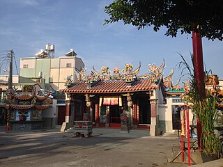
Jiuru Township is a rural township in Pingtung County, Taiwan.
Zaarvlaas is a populated place in the municipality of Gemert-Bakel, North Brabant province of the Netherlands.
Sedraia is a town and commune in Médéa Province, Algeria. According to the 1998 census it has a population of 7070.
Homerusbuurt is a neighborhood of Rotterdam, Netherlands.


