The III District is one of the central districts of Turku, Finland. It is located on the east side of the river Aura, between Kaskenkatu and Martinkatu. The district is largely composed of the Samppalinna sports park, and includes sporting venues such as the Paavo Nurmi Stadion as well as cultural sites such as the city theatre and the Wäinö Aaltonen Museum of Art.

Zuber is an unincorporated community in Marion County, Florida, United States. It is located near the intersection of State Road 326 and County Road 25A. Its commerce is supported by its proximity to Interstate 75.
The Tŝideldel First Nation is the band government of the Tsi Del Del subgroup of the Tsilhqot'in people, located in the Chilcotin District in the western Central Interior region of the Canadian province of British Columbia. It is a member of the Tsilhqot'in National Government.

Siloam Township is one of fifteen townships in Surry County, North Carolina. The township had a population of 1,071 according to the 2000 census, making it the smallest township in Surry County by population.

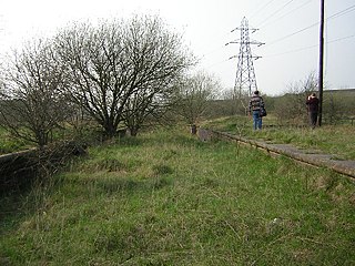
Staveley Works railway station was on the outskirts of the town of Staveley, Derbyshire.

Mikłasze is a village in the administrative district of Gmina Orla, within Bielsk County, Podlaskie Voivodeship, in north-eastern Poland. It lies approximately 2 kilometres (1 mi) north-west of Orla, 10 km (6 mi) south-east of Bielsk Podlaski, and 45 km (28 mi) south of the regional capital Białystok.

Fanisławice is a village in the administrative district of Gmina Łopuszno, within Kielce County, Świętokrzyskie Voivodeship, in south-central Poland. It lies approximately 8 kilometres (5 mi) south-east of Łopuszno and 22 km (14 mi) west of the regional capital Kielce.

Podosiczyna is a settlement in the administrative district of Gmina Ulanów, within Nisko County, Subcarpathian Voivodeship, in south-eastern Poland. It lies approximately 5 kilometres (3 mi) north-east of Ulanów, 13 km (8 mi) east of Nisko, and 60 km (37 mi) north of the regional capital Rzeszów.

Olchowa is a village in the administrative district of Gmina Zagórz, within Sanok County, Subcarpathian Voivodeship, in south-eastern Poland. It lies approximately 9 kilometres (6 mi) south of Zagórz, 13 km (8 mi) south of Sanok, and 69 km (43 mi) south of the regional capital Rzeszów.

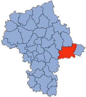
Lipniki is a village in the administrative district of Gmina Czerwonka, within Maków County, Masovian Voivodeship, in east-central Poland. It lies approximately 4 kilometres (2 mi) east of Czerwonka, 12 km (7 mi) east of Maków Mazowiecki, and 78 km (48 mi) north of Warsaw.

Krasnodęby-Kasmy is a village in the administrative district of Gmina Sokołów Podlaski, within Sokołów County, Masovian Voivodeship, in east-central Poland. It lies approximately 6 kilometres (4 mi) south-east of Sokołów Podlaski and 92 km (57 mi) east of Warsaw.
Ogródek is a village in the administrative district of Gmina Grębków, within Węgrów County, Masovian Voivodeship, in east-central Poland.

Leśniakowizna is a village in the administrative district of Gmina Wołomin, within Wołomin County, Masovian Voivodeship, in east-central Poland.
Marianowo is a village in the administrative district of Gmina Ślesin, within Konin County, Greater Poland Voivodeship, in west-central Poland.
Wąsosze is a village in the administrative district of Gmina Ślesin, within Konin County, Greater Poland Voivodeship, in west-central Poland.
Gowidlino-Wybudowanie is a settlement in the administrative district of Gmina Sierakowice, within Kartuzy County, Pomeranian Voivodeship, in northern Poland.
Jarkowo is a village in the administrative district of Gmina Bartoszyce, within Bartoszyce County, Warmian-Masurian Voivodeship, in northern Poland, close to the border with the Kaliningrad Oblast of Russia.

Luśno is a settlement in the administrative district of Gmina Barlinek, within Myślibórz County, West Pomeranian Voivodeship, in north-western Poland. It lies approximately 6 kilometres (4 mi) south-east of Barlinek, 28 km (17 mi) east of Myślibórz, and 67 km (42 mi) south-east of the regional capital Szczecin.

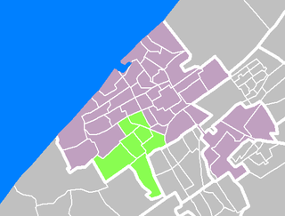
Escamp is a district of The Hague, Netherlands, built largely after the Second World War, on the 15th century Eskamppolders. With the addition of the Vinex neighbourhood Wateringse Veld, Escamp is the most populous district of the city; as of January 2013, it had 118,483 inhabitants. The district features one railway station: Den Haag Moerwijk.
Metsapere is a village in Saaremaa Parish, Saare County in western Estonia.


