Stade des Frères Brakni is a soccer stadium in Blida, Algeria, it has a maximum capacity of 10,000 people. It was replaced by the bigger Stade Mustapha Tchaker currently used mostly for football matches,and for the national team since 2006.

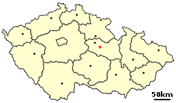
Leštinka is a small village in the Pardubice Region of the Czech Republic. It has around 140 inhabitants.

Mustapha Tchaker Stadium is a multi-purpose stadium in Blida, Algeria. It is currently used mostly for football matches. The stadium has a capacity of 37,000 people. The stadium is the home of the Algeria national football team.
Kikyō Station is a railway station on the JR Hokkaido Hakodate Main Line. It is located in Hakodate, Hokkaidō, Japan.

Stary Dwór is a village in the administrative district of Gmina Kąty Wrocławskie, within Wrocław County, Lower Silesian Voivodeship, in south-western Poland. Prior to 1945 it was in Germany.
Poryte Małe is a village in the administrative district of Gmina Stawiski, within Kolno County, Podlaskie Voivodeship, in north-eastern Poland.

Falniów-Wysiołek is a village in the administrative district of Gmina Miechów, within Miechów County, Lesser Poland Voivodeship, in southern Poland. It lies approximately 6 kilometres (4 mi) west of Miechów and 33 km (21 mi) north of the regional capital Kraków.

Wilków is a village in the administrative district of Gmina Bodzentyn, within Kielce County, Świętokrzyskie Voivodeship, in south-central Poland. It lies approximately 9 kilometres (6 mi) west of Bodzentyn and 17 km (11 mi) east of the regional capital Kielce.

Żurawlówka is a village in the administrative district of Gmina Huszlew, within Łosice County, Masovian Voivodeship, in east-central Poland. It lies approximately 4 kilometres (2 mi) south of Huszlew, 16 km (10 mi) south-east of Łosice, and 127 km (79 mi) east of Warsaw.

Żychckie Osady is a village in the administrative district of Gmina Konarzyny, within Chojnice County, Pomeranian Voivodeship, in northern Poland. It lies approximately 3 kilometres (2 mi) north of Konarzyny, 20 km (12 mi) north-west of Chojnice, and 101 km (63 mi) south-west of the regional capital Gdańsk.
Joachimowo is a settlement in the administrative district of Gmina Mrągowo, within Mrągowo County, Warmian-Masurian Voivodeship, in northern Poland.
Bagniewko is a village in the administrative district of Gmina Biały Bór, within Szczecinek County, West Pomeranian Voivodeship, in north-western Poland.

Białka is a village in the administrative district of Gmina Biały Bór, within Szczecinek County, West Pomeranian Voivodeship, in north-western Poland. It lies approximately 5 kilometres (3 mi) south of Biały Bór, 19 km (12 mi) north-east of Szczecinek, and 158 km (98 mi) east of the regional capital Szczecin.

Viki is a village in Saaremaa Parish, Saare County, on the western part of Saaremaa Island, Estonia.
Woodlawn, New York is a hamlet in the town of Hamburg in Erie County, New York, United States.

Zablaće is a village in the municipality of Čačak, Serbia. According to the 2011 census, the village has a population of 1,170 people.

Velika Gostilja is a village in the municipality of Višegrad, Bosnia and Herzegovina.
The Village of La Jolla, often simply referred to as the Village, is the center—downtown area of La Jolla, a community within San Diego, on the South Coast of California.
The Arena Polarica, also called Kuben, is an indoor ice hockey arena in Haparanda, Sweden. Opened in 1990, it has a capacity of 1500 spectators, and serves as the home arena for Asplöven HC of the HockeyAllsvenskan.

Kırıkkale MKE Weapon Industry Museum is a museum in Kırıkkale, Turkey. It is at 39°50′48″N33°30′55″E.Kırıkkale is an industrial city. Mechanical and Chemical Industry Corporation of Turkey has a weapons factory in Kırıkkale. The museum was established by MKE on 15 July 1990. On 2 November 1993 it was transferred to its current location.


