This article needs additional citations for verification .(May 2021) |
Buck Peak is a summit in the Diablo Range in San Benito County, California. It rises to an elevation of 3,527 feet (1,075 meters). [1]
This article needs additional citations for verification .(May 2021) |
Buck Peak is a summit in the Diablo Range in San Benito County, California. It rises to an elevation of 3,527 feet (1,075 meters). [1]

Hillsboro is a town in Pocahontas County, West Virginia, United States. The population was 232 at the 2020 census.

The Feather River is the principal tributary of the Sacramento River, in the Sacramento Valley of Northern California. The river's main stem is about 73 miles (117 km) long. Its length to its most distant headwater tributary is just over 210 miles (340 km). The main stem Feather River begins in Lake Oroville, where its four long tributary forks join—the South Fork, Middle Fork, North Fork, and West Branch Feather Rivers. These and other tributaries drain part of the northern Sierra Nevada, and the extreme southern Cascades, as well as a small portion of the Sacramento Valley. The total drainage basin is about 6,200 square miles (16,000 km2), with approximately 3,604 square miles (9,330 km2) above Lake Oroville.
Sawtooth Range, Sawtooth Ridge, and Sawtooth Mountains may refer to:

The Wenatchee Mountains are a range of mountains in central Washington State, United States of America. A major subrange of the Cascade Range, extending east 50 miles (80 km) from the Cascade crest, the Wenatchee Mountains separate the drainage basins of the Yakima River from the Wenatchee River. The crest of the range forms part of the boundary between Chelan and Kittitas Counties.

The Chiwaukum Mountains are a north–south mountain range in central Washington, United States. They stretch from Snowgrass Mountain at 47°41′N120°56′W, to 47°45′N120°54′W.

The Stuart Range is a mountain range in central Washington, United States. The range lies within the eastern extent of the Cascade Range immediately southwest of Leavenworth and runs east–west. The western peaks make up a single sharp ridge. The eastern half of the range splits into two parallel ridges, the northern of which is known as the Enchantment Peaks. Between these ridges lies the Enchantment Basin, which holds the dozens of tarns known as the Enchantment Lakes. Collectively, the basin and the encircling eastern peaks of the Stuart Range make up The Enchantments, a well-known backpacking destination. The south face of the Stuart Range falls off steeply to Ingalls Creek, beyond which rise the roughly parallel Wenatchee Mountains.

The Twin Peaks are two prominent hills with an elevation of about 925 feet (282 m) located near the geographic center of San Francisco, California. The Twin Peaks are the second and third highest natural points in San Francisco; only 928 foot (283 m) Mount Davidson is higher within city limits.
Emar Lakes Provincial Park is a provincial park in British Columbia, Canada. The park is located in the upper Emar Creek watershed, northwest of the community of Little Fort. The Hudson's Bay Company Brigade Trail was identified in the park near Jim Lake and Richard Lake.

Manastash Ridge is a long anticline mountain ridge located in central Washington state in the United States. Manastash Ridge runs mostly west-to-east in Kittitas and Yakima counties, for approximately 50 miles. The ridge is part of the Yakima Fold Belt of east-tending long ridges formed by the folding of Miocene Columbia River basalt flows.

Buck Meadows is a census-designated place in Mariposa County, California, United States. It is located 2 miles (3 km) east-northeast of Smith Peak, at an elevation of 3,015 feet (919 m). The population was 21 at the 2020 census.

The Cathedral Group is the group of the tallest mountains of the Teton Range, all of which are located in Grand Teton National Park in the U.S. state of Wyoming. The Cathedral Group are classic alpine peaks, with pyramidal shapes caused by glacial motion. The highest peak in the group is Grand Teton, which rises more than 7,000 feet (2,100 m) above Jackson Hole valley, and is the second tallest mountain in Wyoming, after Gannett Peak. The Cathedral Group is separated from other tall peaks of the range by the Cascade Canyon to the north and Avalanche Canyon to the south.

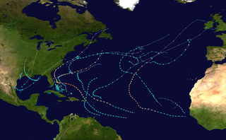
The 1996 Atlantic hurricane season had 13 named storms, of which 9 became hurricanes and 6 became major hurricanes. These major hurricanes were Bertha, Edouard, Fran, Hortense, Isidore, and Lili. This timeline documents all the storm formations, strengthening, weakening, landfalls, extratropical transitions, as well as dissipation. The timeline also includes information that was not operationally released, meaning that information from post-storm reviews by the National Hurricane Center, such as information on a storm that was not operationally warned on, has been included. The season officially began on June 1, 1996, and ended on November 30 that same year.

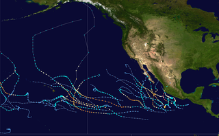
The 2015 Pacific hurricane season was the second-most active Pacific hurricane season on record, and featured the strongest tropical cyclone ever observed in the Western Hemisphere: Hurricane Patricia. The season officially started on May 15 in the Eastern Pacific—east of 140°W—and on June 1 in the Central Pacific—between the International Date Line and 140°W—and ended on November 30. These dates typically cover the period of each year when most tropical cyclones form in the Northeastern Pacific tropical cyclone basin. The season's first storm, Hurricane Andres, developed on May 28; the season's final storm, Tropical Depression Nine-C, dissipated on December 31, well after the official end of the season.
Buck Donic is an unincorporated community in Dunklin County, in the U.S. state of Missouri.
Buck Prairie Township is an inactive township in Lawrence County, in the U.S. state of Missouri.

The 2018 Pacific hurricane season was an event in the annual cycle of tropical cyclone formation, in which tropical cyclones form in the eastern Pacific Ocean. The season officially started on May 15 in the eastern Pacific—east of 140°W—and began on June 1 in the central Pacific—the region between the International Date Line and 140°W, and ended on November 30. These dates typically cover the period of each year when most tropical cyclones form in the eastern Pacific basin. The season began with the formation of Tropical Depression One-E, which developed on May 10, and ended with the dissipation of the season's final storm, Tropical Storm Xavier, which dissipated as a tropical cyclone on November 5.

The 2019 Atlantic hurricane season was an event in the annual tropical cyclone season in the north Atlantic Ocean. It was the fourth consecutive above-normal Atlantic hurricane season. The season officially began on June 1, 2019, and ended on November 30, 2019. These dates, adopted by convention, historically describe the period in each year when most tropical systems form. However, storm formation is possible at any time of the year, as demonstrated in 2019 by the formation of the season's first named storm, Subtropical Storm Andrea, on May 20. The final storm of the season, Tropical Storm Sebastien, transitioned to an extratropical cyclone on November 25.
Griswold Creek is a stream in San Benito County, California. Its head is at the confluence of Pimental Creek and Vallecitos Creek. From there it flows north-northeastward through the canyon between the Griswold Hills in the east, and Buck Peak in the Diablo Range on the west, to its mouth, located at an elevation of 1,145 feet (349 m) at its confluence with Panoche Creek 1.5 miles (2.4 km) southeast of Panoche in the Panoche Valley.

The 2020 Pacific hurricane season was an event in the annual cycle of tropical cyclone formation, in which tropical cyclones form in the Eastern Pacific Ocean. The season officially started on May 15 in the Eastern Pacific—east of 140°W—and began on June 1 in the Central Pacific—the region between the International Date Line and 140°W–and ended on November 30. These dates typically cover the period of each year when most tropical cyclones form in the Eastern Pacific basin according to the National Hurricane Center. However, tropical cyclones sometimes form outside the bounds of an official season, as was evidenced by the formation of Tropical Depression One-E on April 25. The season effectively ended with the dissipation of its final storm, Tropical Storm Polo, on November 19.

The 2020 Atlantic hurricane season was the most active Atlantic hurricane season on record in terms of number of named storms. Additionally, it was as an above-average season for tropical cyclones for the fifth consecutive year. The season officially began on June 1, 2020, and ended on November 30, 2020. These dates, adopted by convention, historically delimit the period each year when most Atlantic tropical systems form. However, storm formation is possible at any time of the year, as was the case this season, when its first two named storms, Tropical Storm Arthur and Tropical Storm Bertha, formed on May 16 and May 27, respectively. The final storm, Hurricane Iota, dissipated on November 18.
36°32′42″N120°52′23″W / 36.54496°N 120.87296°W