Buckingham Palace Road

Last updated

Buckingham Palace Road
A3214
Buckingham Palace Road, 15 July 2019.jpg
Buckingham Palace Road, opposite Victoria Station, 2019
Former name(s)Chelsea Road (18th century)
Location London, England
Postal code SW1
Nearest train station National Rail logo.svg Underground no-text.svg Victoria
Northeast end Birdcage Walk
Southwest endEbury Bridge Road

Buckingham Palace Road is a street that runs through Victoria, London, from the south side of Buckingham Palace towards Chelsea, forming the A3214 road. It is dominated by Victoria Station.

Contents

History

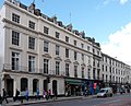
In the 18th century, the road was known as Chelsea Road and was often frequented by highwaymen. A reward of £10 was offered in 1752 for the capture of one of the worst offenders. Towards the southern end, Victoria Station was opened in 1866 and the adjacent Victoria Coach Station was built in 1932 in the Art Deco style. [1] From 1890 to 1956 the street had a parish church in the form of St Philip's Church, Buckingham Palace Road.

In 1938, the Empire Terminal of Imperial Airways opened opposite the coach station, designed by Albert Lakeman, also in the Art Deco style. It allowed passengers to check-in before boarding special trains from Victoria Station to Croydon Airport or Southampton Docks for the flying boat service. The terminal continued in service until the end of the 1970s, by which time there were dedicated rail or bus connections to Gatwick and Heathrow Airports. It is now the headquarters of the National Audit Office. [2]

Landmarks

Entrance to the Royal Mews The Royal Mews (geograph 2321013).jpg
Entrance to the Royal Mews

The entrances to the Royal Mews and Queen's Gallery are in Buckingham Palace Road.

Scouts and Girl Guides

Girlguiding, 17-19 Buckingham Palace Road 17-19 Buckingham Palace Road - geograph.org.uk - 1576315.jpg
Girlguiding, 17–19 Buckingham Palace Road

In June 1917, the Imperial Headquarters of the Boy Scouts' Association (since 1967, The Scout Association) moved to 25 Buckingham Palace Road from its previous office at 116 Victoria Street. [3] It was in that building that the Boy Scouts' International Bureau (now the World Scout Bureau) was inaugurated in 1920. [4] The UK Scout Headquarters remained at that address until December 1974, when it moved to Baden-Powell House. [5]

The Girl Guides Association (now Girlguiding) rented offices within Scout Headquarters until 1929, when there was no longer storage space for the Association's records. Following a national fundraising campaign called "Save Our Stuff", the Guides were able to move into their own purpose-built headquarters at 17–19 Buckingham Palace Road, which they still occupy today. [6]

Related Research Articles

<span class="mw-page-title-main">Royal Borough of Kensington and Chelsea</span> Place in United Kingdom

The Royal Borough of Kensington and Chelsea is an Inner London borough with royal status. It is the smallest borough in London and the second smallest district in England; it is one of the most densely populated administrative regions in the United Kingdom. It includes affluent areas such as Notting Hill, Kensington, South Kensington, Chelsea, and Knightsbridge.

<span class="mw-page-title-main">London Borough of Hillingdon</span> London borough in United Kingdom

The London Borough of Hillingdon is the largest and westernmost borough in West London, England. It was formed in 1965 from the districts of Hayes and Harlington, Ruislip-Northwood, Uxbridge, and Yiewsley and West Drayton in the ceremonial county of Greater London. Today, Hillingdon is home to Heathrow Airport and Brunel University, and is the second largest of the 32 London boroughs by area.

<span class="mw-page-title-main">London Borough of Hammersmith and Fulham</span> London borough in United Kingdom

The London Borough of Hammersmith and Fulham is a London borough in West London and which also forms part of Inner London. The borough was formed in 1965 from the merger of the former Metropolitan Boroughs of Hammersmith and Fulham. The borough borders Brent to the north, the Royal Borough of Kensington and Chelsea to the east, Wandsworth to the south, Richmond upon Thames to the south west, and Hounslow and Ealing to the west.

<span class="mw-page-title-main">Pimlico</span> Human settlement in England

Pimlico is an area of Central London in the City of Westminster, built as a southern extension to neighbouring Belgravia. It is known for its garden squares and distinctive Regency architecture. Pimlico is demarcated to the north by Victoria Station, by the River Thames to the south, Vauxhall Bridge Road to the east and the former Grosvenor Canal to the west. At its heart is a grid of residential streets laid down by the planner Thomas Cubitt, beginning in 1825 and now protected as the Pimlico Conservation Area. The most prestigious are those on garden squares, with buildings decreasing in grandeur away from St George's Square, Warwick Square, Eccleston Square and the main thoroughfares of Belgrave Road and St. George's Drive. Additions have included the pre–World War II Dolphin Square and the Churchill Gardens and Lillington and Longmoore Gardens estates, now conservation areas in their own right. The area has over 350 Grade II listed buildings and several Grade II* listed churches. At the western edge of Pimlico, on the borders of Chelsea, Pimlico Road has become known in recent years for its interiors and design stores.

<span class="mw-page-title-main">London Victoria station</span> London Underground and railway station

Victoria station, also known as London Victoria, is a central London railway terminus and connected London Underground station in Victoria, in the City of Westminster, managed by Network Rail. Named after the nearby Victoria Street, the main line station is a terminus of the Brighton Main Line to Gatwick Airport and Brighton and the Chatham Main Line to Ramsgate and Dover via Chatham. From the main lines, trains can connect to the Catford Loop Line, the Dartford Loop Line, and the Oxted line to East Grinstead and Uckfield. Southern operates most commuter and regional services to south London, Sussex and parts of east Surrey, while Southeastern operates trains to south-east London and Kent, alongside limited services operated by Thameslink. Gatwick Express trains run direct to Gatwick. The Underground station is on the Circle and District lines between Sloane Square and St James's Park, and the Victoria line between Pimlico and Green Park. The area around the station is an important interchange for other forms of transport: a local bus station is in the forecourt and Victoria Coach Station is nearby.

<span class="mw-page-title-main">Marble Arch</span> Monument in London, England

The Marble Arch is a 19th-century white marble-faced triumphal arch in London, England. The structure was designed by John Nash in 1827 as the state entrance to the cour d'honneur of Buckingham Palace; it stood near the site of what is today the three-bayed, central projection of the palace containing the well-known balcony. In 1851, on the initiative of architect and urban planner Decimus Burton, a one-time pupil of John Nash, the arch was relocated to its current site, near the northeast corner of Hyde Park, so that expansion of Buckingham Palace could proceed.

<span class="mw-page-title-main">Victoria Embankment</span> Road and river-walk along the north bank of the River Thames in London

Victoria Embankment is part of the Thames Embankment, a road and river-walk along the north bank of the River Thames in London, England. Built in the 1860s, it runs from the Palace of Westminster to Blackfriars Bridge in the City of London, and acts as a major thoroughfare for road traffic between the City of Westminster and the City of London.

<span class="mw-page-title-main">Cromwell Road</span> Road in the Royal Borough of Kensington and Chelsea, London, England

Cromwell Road is a major London road in the Royal Borough of Kensington and Chelsea, designated as part of the A4. It was created in the 19th century and is said to be named after Richard Cromwell, son of Oliver Cromwell, who once owned a house there.

<span class="mw-page-title-main">Victoria Coach Station</span> Coach station in London

Victoria Coach Station in the City of Westminster is the largest coach station in London, and a terminus for medium and long distance coach services in the United Kingdom. It is operated by Victoria Coach Station Limited, a subsidiary of Transport for London. As of 2017, there were 14 million passenger and 472,000 coach movements annually.

<i>The Wolf Cubs Handbook</i>

The Wolf Cub's Handbook is an instructional handbook on Wolf Cubs training, published in various editions since December 1916. Early editions were written and illustrated by Robert Baden-Powell with later editions being extensively rewritten by others. The book has a theme based on Rudyard Kipling's The Jungle Book jungle setting and characters.

<span class="mw-page-title-main">Victoria, London</span> Human settlement in England

Victoria is an area of Central London in the City of Westminster. It is named after Victoria Station, which is a major transport hub. The station was named after the nearby Victoria Street.

<span class="mw-page-title-main">Architecture of London</span> Overview of the architecture in London

London's architectural heritage involves many architectural styles from different historical periods. London's architectural eclecticism stems from its long history, continual redevelopment, destruction by the Great Fire of London and The Blitz, and state recognition of private property rights which have limited large-scale state planning. This sets London apart from other European capitals such as Paris and Rome which are more architecturally homogeneous. London's architecture ranges from the Romanesque central keep of The Tower of London, the great Gothic church of Westminster Abbey, the Palladian royal residence Queen's House, Christopher Wren's Baroque masterpiece St Paul's Cathedral, the High Victorian Gothic of The Palace of Westminster, the industrial Art Deco of Battersea Power Station, the post-war Modernism of The Barbican Estate and the Postmodern skyscraper 30 St Mary Axe 'The Gherkin'.

<span class="mw-page-title-main">Pimlico railway station</span> Former railway station in London

Pimlico terminus was a railway station built beside the new Chelsea Bridge, across the road from the new Battersea Gardens. It was at the end of a 3 mi 20 ch (5.2 km) extension of the West End of London and Crystal Palace Railway from Wandsworth Common. Confusingly, the station was not actually in Pimlico, which is on the other (northern) bank of the river; to reach it, Pimlico residents had to cross Chelsea Bridge which opened a week after the station.

<span class="mw-page-title-main">Buckingham Gate</span> Street in Westminster London, England

Buckingham Gate is a street in Westminster, London, England, near Buckingham Palace.

<span class="mw-page-title-main">A202 road</span> Primary A road in London, England

The A202 is a primary A road in London. It runs from New Cross Gate to London Victoria station. A section of the route forms a part of the London Inner Ring Road between Vauxhall and Victoria, known as Vauxhall Bridge Road.

<span class="mw-page-title-main">Adelphi, London</span>

Adelphi is a district of the City of Westminster in London. The small district includes the streets of Adelphi Terrace, Robert Street and John Adam Street. Of rare use colloquially, Adelphi is grouped with Aldwych as the greater Strand district which for many decades formed a parliamentary constituency and civil registration district.

This article covers the history of the English city of London through the early 20th century, from 1900 to the outbreak of World War II in 1939. London entered the 20th century at the height of its influence as the capital of the largest empire in history, but the new century was to bring many challenges. London was the largest city in the world from about 1825 until it was overtaken by New York City in 1925.

The Franklin London - Starhotels Collezione is a luxury 5-star hotel in London, England. It is located at 22-28 Egerton Gardens, Knightsbridge on the borders of Chelsea.

<span class="mw-page-title-main">West London Air Terminal</span> Airport terminal in London, UK

The West London Air Terminal was a check-in facility for British European Airways flights from Heathrow Airport. It was located on Cromwell Road in Kensington, London, and was in operation from 6 October 1957 to 1 January 1974. After passengers checked in their baggage and received their boarding passes, they would travel to Heathrow Airport by coach. One of the drawbacks of using the terminal for checking in was that road traffic could delay the coaches and ultimately delay the departure of the flight.

<span class="mw-page-title-main">St Philip's Church, Buckingham Palace Road</span> Church building

St Philip's Church was a church building at 188 Buckingham Palace Road in Victoria, London.

References

  1. Weinreb, Ben; Hibbert, Christopher (2008). The London Encyclopaedia. Macmillan. p. 110. ISBN   978-1-4050-4925-2.
  2. Wright, Daniel (8 January 2014). "An Airline Terminal in the City Centre (Empire Air Terminal, London, UK)". The Beauty of Transport. Retrieved 6 July 2014.
  3. Moynihan, Paul (ed.) (2006). An Official History of Scouting. Hamlyn, p. 171. ISBN   978-0-600-61398-5
  4. Kroonenberg, Piet J. (March 2004). "Chapter 2: International Scouting: Refugees, Displaced Persons and Exile Scouting". The Undaunted (Integral Internet Edition, November 2011 ed.). ISBN   9780974647906. Archived from the original on 20 December 2016. Retrieved 21 March 2016. (p. 20)
  5. Moynihan 2006, p. 182.
  6. Smith, Leslie. "Leslie's Guiding History Site - Timeline". lesliesguidinghistory.webs.com. Archived from the original on 28 December 2013. Retrieved 21 March 2016.

51°29′42″N0°08′45″W / 51.4950°N 0.1459°W / 51.4950; -0.1459