Budajenő

Last updated
Budajenő
Jeine
Hungary location map.svg
Red pog.svg
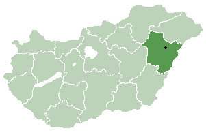
Budajenő
Jeine
Location of Budajenő
Jeine in Hungary
Coordinates: 47°33′22.57″N18°48′9.61″E / 47.5562694°N 18.8026694°E / 47.5562694; 18.8026694
Country Hungary
Region Central Hungary
County Pest
Subregion Budaörsi
RankVillage
Area
[1]
  Total 12.42 km2 (4.80 sq mi)
Time zone UTC+1 (CET)
  Summer (DST) UTC+2 (CEST)
Postal code
2093
Area code +36 26
Website www.budajeno.hu

Budajenő (German : Jeine) is a village in Pest county, Budapest metropolitan area, Hungary. It has a population of 1,617 (2007).

German language West Germanic language

German is a West Germanic language that is mainly spoken in Central Europe. It is the most widely spoken and official or co-official language in Germany, Austria, Switzerland, South Tyrol (Italy), the German-speaking Community of Belgium, and Liechtenstein. It is also one of the three official languages of Luxembourg and a co-official language in the Opole Voivodeship in Poland. The languages which are most similar to German are the other members of the West Germanic language branch: Afrikaans, Dutch, English, the Frisian languages, Low German/Low Saxon, Luxembourgish, and Yiddish. There are also strong similarities in vocabulary with Danish, Norwegian and Swedish, although those belong to the North Germanic group. German is the second most widely spoken Germanic language, after English.

Budapest metropolitan area Place in Central Hungary, Hungary

The Budapest metropolitan area is a statistical area that describes the reach of commuter movement to and from Budapest and its surrounding suburbs. Created by Hungary's national statistical office HCSO to describe suburban development around centres of urban growth, the surrounding a more densely built and densely populated urban area. As of 2014 the Budapest metropolitan area, with its 7,626 km², extends significantly beyond Budapest's administrative region, a region also commonly referred to as Central Hungary. It had a population of 3,303,786 inhabitants at the January 2013 census, making it the tenth largest urban region in Europe. 33% of Hungary's population resides in the region.

Hungary Country in Central Europe

Hungary is a country in Central Europe. Spanning 93,030 square kilometres (35,920 sq mi) in the Carpathian Basin, it borders Slovakia to the north, Ukraine to the northeast, Austria to the northwest, Romania to the east, Serbia to the south, Croatia to the southwest, and Slovenia to the west. With about 10 million inhabitants, Hungary is a medium-sized member state of the European Union. The official language is Hungarian, which is the most widely spoken Uralic language in the world. Hungary's capital and its largest city and metropolis is Budapest. Other major urban areas include Debrecen, Szeged, Miskolc, Pécs and Győr.

The settlement has a strong appeal with its pristine buildings and also architecturally significant buildings. The most important buildings are the former monastery from the 19th Century in neoclassical style, school today, Calvary Chapel and the cemetery from the 12th Century, winegrowers' houses from the 17th Century in the folk style.

See also

Related Research Articles

Nagykereki Place in Northern Great Plain, Hungary

Nagykereki is a village in Hajdú-Bihar county, in the Northern Great Plain region of eastern Hungary.

Magyarhomorog Place in Hajdú-Bihar, Hungary

Magyarhomorog is a village in Hajdú-Bihar county, in the Northern Great Plain region of eastern Hungary.

Nyírábrány Large village in Hajdú-Bihar, Hungary

Nyírábrány is a large village in Hajdú-Bihar county, in the Northern Great Plain region of eastern Hungary.

Nyírbátor Town in Szabolcs-Szatmár-Bereg, Hungary

Nyírbátor is a town in Szabolcs-Szatmár-Bereg county, in the Northern Great Plain region of eastern Hungary. With its historic atmosphere, this city is known for its 15th- and 16th-century ecclesiastic and secular architectural heritage and for the Báthory family, former landowners.

Tyukod Place in Szabolcs-Szatmár-Bereg, Hungary

Tyukod is a village in Szabolcs-Szatmár-Bereg county, in the Northern Great Plain region of eastern Hungary.

Tisztaberek Place in Szabolcs-Szatmár-Bereg, Hungary

Újdombrád is a village in Szabolcs-Szatmár-Bereg county, in the Northern Great Plain region of eastern Hungary.

Kisnána Place in Northern Hungary, Hungary

Kisnána is a village in Heves county, Hungary, located 25 kilometres (16 mi) from Gyöngyös to the northeast. There is a castle in the village that was built in the 11th or 12th century.

Csömör Place in Central Hungary, Hungary

Csömör is a village in Hungary, in Pest county, Budapest metropolitan area in the Gödöllő subregion (kistérség). It is west of Kistarcsa, north of the 16th district of Budapest, on the western part of the Gödöllő hills, in the turning of the Csömör stream. It has a population of 8,433 (2007).

Kőszegdoroszló Place in Western Transdanubia, Hungary

Kőszegdoroszló is a village in Vas county, Hungary. The village has a thriving tourist trade.

Nagykölked Place in Western Transdanubia, Hungary

Nagykölked is a village in Vas county, Hungary.

Bénye Place in Central Hungary, Hungary

Bénye is a village in Pest county, Hungary.

Dánszentmiklós Place in Central Hungary, Hungary

Dánszentmiklós is a village in Pest County, Hungary.

Dány Place in Central Hungary, Hungary

Dány is a village in Pest county, Hungary.

Kosd Place in Central Hungary, Hungary

Kosd is a village in Pest county, Hungary.

Nyársapát Place in Central Hungary, Hungary

Nyársapát is a village in Pest county, Hungary.

Penc Place in Central Hungary, Hungary

Penc is a village in Pest county, Hungary.

Rábaszentmiklós Place in Western Transdanubia, Hungary

Rábaszentmiklós is a village in Hungary, in the Győr-Moson-Sopron county.

Sopronhorpács Place in Western Transdanubia, Hungary

’’’Sopronhorpács’’’ is a village in Győr-Moson-Sopron County in Hungary.

Bánokszentgyörgy is a village in Zala County, Hungary.

Parádsasvár Municipality in Northern Hungary, Hungary

Parádsasvár is a small village in northern Hungary. It is located in Heves County, in the Mátra mountains, between the towns Gyöngyös and Eger.

References

Coordinates: 47°33′N18°48′E / 47.550°N 18.800°E / 47.550; 18.800

Geographic coordinate system Coordinate system

A geographic coordinate system is a coordinate system that enables every location on Earth to be specified by a set of numbers, letters or symbols. The coordinates are often chosen such that one of the numbers represents a vertical position and two or three of the numbers represent a horizontal position; alternatively, a geographic position may be expressed in a combined three-dimensional Cartesian vector. A common choice of coordinates is latitude, longitude and elevation. To specify a location on a plane requires a map projection.