The politics of Hungary takes place in a framework of a parliamentary representative democratic republic. The prime minister is the head of government of a pluriform multi-party system, while the president is the head of state and holds a largely ceremonial position. As of 2024, The country is considered "no longer a full democracy" by the EU, and is generally said to have democratically backslid since 2010 when the Fidesz–KDNP Party Alliance led by Viktor Orbán won a two-third parliamentary supermajority and adopted a new constitution of Hungary that have both remained in place since.
Heves was an administrative county in the Kingdom of Hungary. Its territory, which is now in northern Hungary, was slightly larger than that of present Heves county. The capital of the county was Eger.

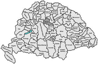
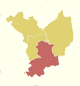
Jász-Nagykun-Szolnok was an administrative county (comitatus) in the Kingdom of Hungary. Its territory, which is now in central Hungary, was slightly smaller than that of present Jász-Nagykun-Szolnok county. The capital of the county was Szolnok.
Jász–Nagykun–Szolnok is an administrative county in Hungary. It lies in central Hungary and shares borders with the Hungarian counties Pest, Heves, Borsod–Abaúj–Zemplén, Hajdú–Bihar, Békés, Csongrád, and Bács–Kiskun. The rivers Tisza and Körös flow through the county. The capital of Jász–Nagykun–Szolnok county is Szolnok. Its area is 5582 km2. The county is named after the Ossetians (Jasz) and Cumans (Kun) who settled there, along with Szolnok. The county was part of the Danube–Criș–Mureș–Tisa Euroregion between 1997 and 2004.

The Carpathian Euroregion is an international association formed on February 14, 1993, by the representatives of the regional administrations of Poland, Ukraine, Slovakia and Hungary in the city of Debrecen. In 2000, the request from several regional administrations of Romania to join the Euroregion was accepted.

Great Plain and North is a statistical region of Hungary. It comprises the NUTS 2 regions of Northern Hungary, Northern Great Plain, and Southern Great Plain.

The modern bilateral relationship between Hungary and Ukraine formally began in the early 1990s, after the end of communism in Hungary in 1989 and Ukrainian independence from the Soviet Union in 1991. Since then, the relationship has been marred by controversy over the rights of the Hungarian minority in the western Ukrainian region of Zakarpattia, where 150,000 ethnic Hungarians reside. Hungary and Ukraine have embassies in Kyiv and Budapest, respectively, as well as consulates in regions with large minority populations.

This article discusses the administrative divisions of the Kingdom of Hungary between 1941 and 1945. As a result of the First (1938) and Second Vienna Award (1940), territories that had been ceded by the Kingdom of Hungary at the 1920 Treaty of Trianon were partly regained from Czechoslovakia and Romania respectively. This required modification of the administrative divisions.
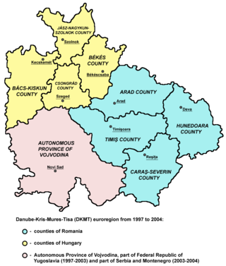
The Danube–Criș–Mureș–Tisa Euroregion is a euroregion located in Hungary, Romania and Serbia. It is named after four rivers: Danube, Criș, Mureș and Tisa.
Megyei Bajnokság I is the fourth tier of Hungarian football league system. It includes the championships of the 20 counties of Hungary. The champions might be promoted to the Nemzeti Bajnokság III.
Local elections were held in Hungary on 13 October 2019. Mayors and assembly members were elected for a term of 5 years.

The 3rd constituency of Jász-Nagykun-Szolnok County is one of the single member constituencies of the National Assembly, the national legislature of Hungary. The constituency standard abbreviation: Jász-Nagykun-Szolnok 03. OEVK.
The 4th constituency of Jász-Nagykun-Szolnok County is one of the single member constituencies of the National Assembly, the national legislature of Hungary. The constituency standard abbreviation: Jász-Nagykun-Szolnok 04. OEVK.