 NUTS 1 in Europe
 NUTS 2 in Europe
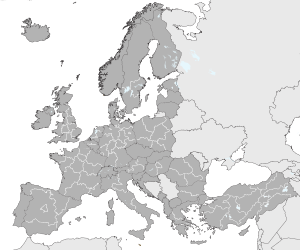
 NUTS 3 in Europe

Nomenclature of Territorial Units for Statistics or NUTS (French : Nomenclature des unités territoriales statistiques) is a geocode standard for referencing the administrative divisions of countries for statistical purposes. [1] [2] [3] [4] [5] [6] [7] The standard, adopted in 2003, [8] is developed and regulated by the European Union, and thus only covers the EU member states in detail. The Nomenclature of Territorial Units for Statistics is instrumental in the European Union's Structural Funds and Cohesion Fund delivery mechanisms and for locating the area where goods and services subject to European public procurement legislation are to be delivered.
Contents
- National structures
- Member states
- Candidate countries
- EFTA countries
- Former EU member state
- Maps
- Establishment
- Examples
- See also
- Notes
- References
- External links
For each EU member country, a hierarchy of three NUTS levels is established by Eurostat in agreement with each member state; the subdivisions in some levels do not necessarily correspond to administrative divisions within the country. A NUTS code begins with a two-letter code referencing the country, as abbreviated in the European Union's Interinstitutional Style Guide. [9] The subdivision of the country is then referred to with one number. A second or third subdivision level is referred to with another number each. Each numbering starts with 1, as 0 is used for the upper level. Where the subdivision has more than nine entities, capital letters are used to continue the numbering. Below the three NUTS levels are local administrative units (LAUs). A similar statistical system is defined for the candidate countries and members of the European Free Trade Association, but they are not part of NUTS governed by the regulations.
The current NUTS classification, dated 21 November 2016 and effective from 1 January 2018 (now updated to current members as of 2020 [update] ), lists 92 regions at NUTS 1, 244 regions at NUTS 2, 1215 regions at NUTS 3 level, and 99,387 local administrative units (LAUs). [10] [11]


