Budaka, Uganda

Last updated

Budaka
Uganda location map.svg
Red pog.svg
Budaka
Location in Uganda
Coordinates: 01°01′00″N33°56′42″E / 1.01667°N 33.94500°E / 1.01667; 33.94500
Country Flag of Uganda.svg Uganda
Region Eastern Region of Uganda
District Budaka District
Elevation
3,810 ft (1,160 m)
Population
 (2020 Estimate)
  Total29,100 [1]

Budaka is a town in the Eastern Region of Uganda. It is the chief town of Budaka District, and the district headquarters are located there. [2]

Contents

Location

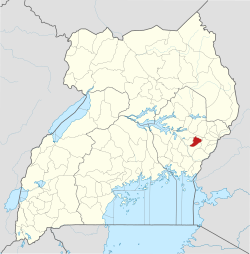
Budaka is approximately 29 kilometres (18 mi), by road, west of Mbale, the largest city in Uganda's Eastern Region, along the Iganga–Tirinyi–Kamonkoli–Mbale Road. [3] This is approximately 225 kilometres (140 mi), by road, north-east of Kampala, the capital and largest city of Uganda. [4] The coordinates of the town are:01 01 00N, 33 56 42E (Latitude:1.0150; Longitude:33.9450). [5] Budaka Town is situated at an average elevation of 1,160 metres (3,806 ft) above mean sea level. [2]

Population

The 2002 national population census estimated the town's population at 17,000. The Uganda Bureau of Statistics (UBOS) estimated the 2010 population at 21,100. In 2011, UBOS estimated the population at 21,700. [6] [7]

In 2015, UBOS estimated the mid-year population of the town at 24,500. In 2020, according to UBOS, the mid-year population of Budaka was estimated to have increased to 29,100. Of those, 15,100 (51.9 percent) were females and 14,000 (48.1 percent) were males. The population of the town is calculated to have grown at an average annual growth rate of 3.5 percent, between 2015 and 2020, according to UBOS. [1]

Overview

Naboa Sub-County was given that name by British Colonial masters because the area was full of Grammodes geometrica moths (Nziira) of the family Erebidae.[ citation needed ]

The Basimba people of the Leopard Clan with the names Katunku, Ngulya, Kaabya, Mwati, Kabolesa, Namuyonjo, Ntembe of Lupada, resident in Naboa Sub-County, Budaka County, Budaka District live among the Bagwere but trace their origin from Tanzania and Zambia. [8]

Points of interest

The following points of interest are located within the town of Budaka or close to the edges of town: [5]

1. The headquarters of Budaka District Administration

2. Bugwere Primary School, with enrollment of about 300 students

3. Budaka central market

4. The offices of Budaka Town Council

5. A mobile branch of PostBank Uganda

6. The Iganga–Tirinyi–Kamonkoli–Mbale Road, passes through town in a general west to east direction. [5]

See also

Related Research Articles

<span class="mw-page-title-main">Mbale</span> Place in Eastern Uganda, Uganda

Mbale is a city in the Eastern Region of Uganda. It is the main municipal, administrative, and commercial center of Mbale District and the surrounding sub-region.

<span class="mw-page-title-main">Moroto Town</span> Place in Northern Region, Uganda

Moroto is a town in Moroto District in the Northern Region of Uganda. It is the location of the district headquarters.

Pallisa is a town in Pallisa District of the Eastern Region of Uganda.

Bugiri is a town in the Eastern Region of Uganda. It is the chief town of Bugiri District, and the district headquarters are located there. The town was elevated to Municipal Council status in 2019.

<span class="mw-page-title-main">Iganga</span> Ugandan town

Iganga is a town in the Eastern Region of Uganda. It is the main municipal, administrative, and commercial center of Iganga District.

Katakwi is a town in the Eastern Region of Uganda. It is the main municipal, administrative, and commercial center of Katakwi District and the site of the district headquarters.

Mayuge is a town in the Eastern Region of Uganda. It is the location of the headquarters of Mayuge District.

Butaleja is a town in Eastern Region of Uganda. It is the main municipal, administrative and commercial center of Butaleja District and the district headquarters are located there. The district is named after the town.

Malaba, Uganda is a town in Tororo District in the Eastern Region of Uganda, on its eastern border with Kenya. It sits adjacent from Malaba, Kenya, across the Malaba River that marks the border between Uganda and Kenya.

Manafwa is a town in the Eastern Region of Uganda. It is the largest town in Manafwa District and the site of the district headquarters.

Busolwe is a town in the Eastern Region of Uganda. It is one of the two municipalities in Butaleja District, the other being Butaleja.

Bukedea is a town in the Eastern Region of Uganda. It is the chief municipal, administrative, and commercial center of Bukedea District, and the district headquarters are located there.

Namutumba is a town in the Namutumba District of the Eastern Region of Uganda. It is the main municipal, administrative, and commercial centre of the district.

Busembatya, sometimes spelled Busembatia, is a town in the Eastern Region of Uganda.

Nagongera is a town in Tororo District, in the Eastern Region of Uganda.

Bududa is a town in the Eastern Region of Uganda. It is the main municipal, administrative, and commercial center of Bududa District.

Ngora is a town in the Eastern Region of Uganda. It is the main political, administrative, and commercial centre of Ngora District.

Tirinyi is a town in the Kibuku District in the Eastern Region of Uganda.

Kamonkoli is a town in Budaka District, in the Eastern Region of Uganda.

The Iganga–Tirinyi–Kamonkoli–Mbale Road, also known as the Nakalama–Tirinyi–Kamonkoli–Mbale Road, is a road in the Eastern Region of Uganda, connecting the towns of Iganga in Iganga District, Namutumba in Namutumba District, Tirinyi in Kibuku District, Kamonkoli in Budaka District, and Mbale in Mbale District.

References

  1. 1 2 UBOS (14 June 2020). "Estimated Population of Budaka Town, Eastern Region, Uganda". Citypopulation.de Quoting Uganda Bureau of Statistics (UBOS). Retrieved 31 December 2020.
  2. 1 2 Cities of Peace, Inc. (2020). "Budka, Uganda: International Cities of Peace". International Cities of Peace. Retrieved 31 December 2020.
  3. Google (31 December 2020). "Travel Distance Between Budaka And Mbale In Uganda" (Map). Google Maps . Google. Retrieved 31 December 2020.
  4. Google (31 December 2020). "Road Distance Between Budaka, Uganda And Kampala, Uganda" (Map). Google Maps . Google. Retrieved 31 December 2020.
  5. 1 2 3 Google (31 December 2020). "Location of Budaka Town" (Map). Google Maps . Google. Retrieved 31 December 2020.
  6. UBOS (27 August 2014). "The Population of The Regions of the Republic of Uganda And All Cities And Towns of More Than 15,000 Inhabitants". Citypopulation.de Quoting Uganda Bureau of Statistics (UBOS). Retrieved 21 February 2015.
  7. UBOS. "Estimated Population of Budaka In 2002, 2010 & 2011" (PDF). Uganda Bureau of Statistics (UBOS). Archived from the original (PDF) on 7 July 2014. Retrieved 17 April 2014.
  8. Ethnographic Survey of Africa: East Central Africa, Parts 1-4, International African Institute, 1950, p. 80