
Mbarara District is a district in South Western Uganda. In 2019, the Ugandan Cabinet approved part of Mbarara District, the then-Mbarara municipality, to be upgraded to city status effective July 2020.

Mbarara City is a city in the Western Region of Uganda and the second largest city in Uganda after Kampala. The city is divided into 6 boroughs of Kakoba Division, Kamukuzi Division, Nyamitanga Division, Biharwe Division, Kakiika Division, Nyakayojo Division. It is the main commercial centre of most of south western districts of Uganda and the site of the district headquarters. In May 2019, the Uganda's cabinet granted Mbarara a city status, which started on 1 July 2020.

Francis K. Butagira is a Ugandan lawyer, judge, politician and retired diplomat, who serves as the chairman of the Uganda Registration Services Bureau (URSB), an agency of the Ugandan government responsible for maintaining registration data. He was appointed to that position in October 2015. He concurrently serves as the Managing Partner of Butagira and Company Advocates, a Kampala-based legal practice.

Kayunga is a town in the Central Region of Uganda. It is the main municipal, administrative, and commercial center of Kayunga District.
Nebbi is a town in the Nebbi District of the Northern Region of Uganda. It is the site of the district headquarters.

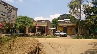
Ntare School is a residential all-boys' secondary school located in Mbarara, Mbarara District, south western Uganda. It was founded in 1956 by a Scottish educator named William Crichton.
Isingiro is a town in the Western Region of Uganda. It is the main municipal, administrative, and commercial center of Isingiro District and the site of the district's headquarters.

Lyantonde is a town in the southern part of the Central Region of Uganda. It is the main municipal, administrative, and commercial center of Lyantonde District.

Sheema, also Sheema Municipality, is an urban centre in the Western Region of Uganda. It is the largest municipality in Sheema District.
Kikagati is a town in the Western Region of Uganda. It sits across the Kagera River from the town of Murongo, in the Kagera Region of Tanzania.
The Mbarara–Kikagati Road is in southwestern Uganda, connecting the city of Mbarara in Mbarara District and the town of Kikagati in Isingiro District, at the border between Uganda and Tanzania. The road continues into Tanzania as Highway B182.
Bukomansimbi is a town in the Central Region of Uganda. It is the chief municipal, administrative, and commercial center of Bukomansimbi District and the site of the district headquarters.
Rubirizi, sometimes spelled Rubiriizi, is a town in Rubirizi District, Ankole sub-region, Western Uganda. The town is the main municipal, administrative and commercial center of Rubirizi District. The district is named after the town.
Katunguru, is a settlement in Rubirizi District, Ankole sub-region, in the Western Region of Uganda. The name also applies to Katunguru Sub-county and Katunguru Parish, where the settlement is located.
Bukomero is a town in Ssingo County, Kiboga District, in the Central Region of Uganda.
Namayumba is a settlement in the Wakiso District in the Buganda Region of Uganda. The name also refers to "Namayumba sub-county", the location of Namayumba settlement.
Rubanda is a town in the extreme southwest of the Western Region of Uganda. It serves as the commercial, political and administrative center of Rubanda District.
Rwampara District is a district in South Western Uganda. The district was carved out of Mbarara District and given the district status in July 2019.
Rugaaga is a town in Isingiro District in the Western Region of Uganda.
Bugamba Central Forest reserve is a natural forest located in the Rwampara district, in southwestern Uganda. It has been referred to as an intensive soil conservation zone. The Reserve is one of the few softwood plantations where spacing is practiced. It is managed and is maintained on behalf of the Government of Uganda by the National Forestry Authority (NFA) under the National Forestry Authority and Tree Planting Act 8/2003.
