
Mbarara District is a district in South Western Uganda. In 2019, the Ugandan Cabinet approved part of Mbarara District, the then-Mbarara municipality, to be upgraded to city status effective July 2020.

Rakai District is a district in the Central Region of Uganda. The town of Rakai is the site of the district's headquarters.
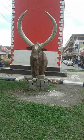
Mbarara City is a city in the Western Region of Uganda and the second largest city in Uganda after Kampala.The city is divided into 6 boroughs of Kakoba Division, Kamukuzi Division, Nyamitanga Division, Biharwe Division, Kakiika Division, Nyakayojo Division. It is the main commercial centre of most of south western districts of Uganda and the site of the district headquarters. In May 2019, the Uganda's cabinet granted Mbarara a city status, which started on 1 July 2020.
Kyaka is a town in Tanzania. It is an urban centre in Missenyi District, Kagera Region. The population of Kyaka was estimated at 6,000 people in 2015.
Bugamba is an urban centre in the Western Region of Uganda. It is one of the trading centres in Mbarara District.
Isingiro is a town in the Western Region of Uganda. It is the main municipal, administrative, and commercial center of Isingiro District and the site of the district's headquarters.
Lyantonde is a town in the southern part of the Central Region of Uganda. It is the main municipal, administrative, and commercial center of Lyantonde District.
Sheema, also Sheema Municipality, is an urban centre in the Western Region of Uganda. It is the largest municipality in Sheema District.
The Mbarara–Kikagati Road is in southwestern Uganda, connecting the city of Mbarara in Mbarara District and the town of Kikagati in Isingiro District, at the border between Uganda and Tanzania. The road continues into Tanzania as Highway B182.

Rubirizi District is a district in Western Uganda. Like most Ugandan districts, the district is named after its 'chief town', Rubirizi, where the district headquarters are located.

Buhweju District is a district in Western Uganda. It is one of the districts that constitute the Ankole sub-region. Its 'chief town', is Nsiika.
Kikagati Hydroelectric Power Station, also referred to as Kikagati Power Station, is a 15.57 MW (20,880 hp) hydroelectric power station, in Uganda.
Mirama Hills is a town in the Western Region of Uganda.
Nshyugyezi Hydroelectric Power Station, also Nsongezi Hydroelectric Power Station, is a planned 39 megawatts (52,000 hp) hydroelectric power station in Uganda. The power project is under development, as of September 2017.
Masaka–Mutukula Road is a road in the Central Region of Uganda, connecting the town of Masaka, in Masaka District, to the border town of Mutukula in Rakai District.
The Mirama–Kikagati–Nsongezi High Voltage Power Line is a planned high voltage electricity power line, connecting the high voltage substation at Mirama Hills, in the Western Region of Uganda, to another high voltage substation at Kikagati Hydroelectric Power Station and continues to end at Nshungyezi Hydropower Station.
Kobero–Bugene–Mutukula–Kikagati Road, also Burundi–Tanzania–Uganda Road, is a road in the Kagera Region of Tanzania. The road connects the border towns of Mutukula and Kikagati in Uganda, to the border town of Kobero, in Burundi. The road allows direct access between Uganda and Burundi, promoting exchange of goods and passengers, avoiding routes through Rwanda, where free movement of Ugandan goods and passengers are restricted, since February 2019.
Rugaaga is a town in Isingiro District in the Western Region of Uganda.
Isingiro Water Supply and Sanitation Project (IWSSP), also Isingiro Water Supply and Sewerage System is a water intake, purification, distribution and waste water collection and disposal system in Isingiro District, in the Western Region of Uganda. The project is intended to meet the water supply and sanitation needs of 340,000 people of the 550,000 inhabitants of the district. The beneficiaries include the 100,000 occupants of Nakivale Refugee Settlement and the 32,000 occupants of Oruchinga Refugee Settlement. The work is to be carried out by the Uganda Ministry of Water and Environment through the parastatal utility company, National Water and Sewerage Corporation (NWSC). Funding, have been provided by the French Development Agency and the European Union.
Masaka–Mbarara Water Supply and Sanitation Project (MMWSSP), is a water intake, purification, distribution and waste water collection and disposal system in the cities of Masaka and Mbarara in the Central Region and the Western Region of Uganda. The project is intended to meet the water supply and sanitation needs of approximately 1,055,000 by 2030. The work is to be carried out by the Uganda Ministry of Water and Environment through the parastatal utility company, National Water and Sewerage Corporation (NWSC). Funding, have been provided by the French Development Agency and the European Union.

