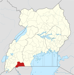
Isingiro

Last updated

Isingiro
Uganda location map.svg
Red pog.svg
Isingiro
Location in Uganda
Coordinates: 00°47′42″S30°48′55″E / 0.79500°S 30.81528°E / -0.79500; 30.81528 Coordinates: 00°47′42″S30°48′55″E / 0.79500°S 30.81528°E / -0.79500; 30.81528
Country Flag of Uganda.svg Uganda
Region Western Region
Sub-region Ankole sub-region
District Isingiro District
Elevation
4,206 ft (1,282 m)
Population
 (2020 Estimate)
  Total34,300

Isingiro is a town in the Western Region of Uganda. It is the main municipal, administrative, and commercial center of Isingiro District and the site of the district's headquarters. [1]

Contents

Location

Isingiro is approximately 42 kilometres (26 mi), by road, southeast of Mbarara, the largest city in the Ankole sub-region. The town of Isingiro is surrounded by the villages of Nyakigera, Gayaza, Rwembwa, Mabona, Kibwera, and Rumira. [2] Isingiro is located approximately 310 kilometres (193 mi), by road, southwest of Kampala, the capital and largest city of Uganda. [3] The coordinates of Isingiro Town Council are 0°47'42.0"S, 30°48'55.0"E (Latitude:-0.795000, Longitude:30.815278). [4]

Population

The 2002 national population census estimated the town's population at 17,000. In 2010, the Uganda Bureau of Statistics (UBOS) estimated the population at 21,400. In 2011, UBOS estimated the mid-year population at 22,000. [5]

In August 2014, the national population census put the population at 27,991. In 2015, UBOS estimated the population of the town at 28,800. In 2020, the population agency estimated the mid-year population at 34,300 inhabitants. Of those, 17,500 (51 percent) were females and 16,800 (49 percent) were males. UBOS calculated that the population of Isingiro Town Council expanded at an average annual rate of 3.6 percent, between 2015 and 2020. [6] [7]

Historical population
YearPop.±%
200219,773    
201021,400+8.2%
201122,000+2.8%
201427,991+27.2%
201528,200+0.7%
202034,300+21.6%
source: [5] [6] [7]

Points of interest

The following additional points of interest lie within the town limits or close to the edges of town: [4] (a) the headquarters of Isingiro District administration (b) the offices of Isingiro Town Council (c) Isingiro central market, the source of daily fresh produce and (d) the 74 kilometres (46 mi) Mbarara–Kikagati Road passes through the western neighborhoods of the town in a general north to south direction. [8] [9]

See also

Related Research Articles

Mbarara Place in Western Region, Uganda

Mbarara City is a city in the Western Region of Uganda and the second largest city in Uganda after Kampala. The city is divided into 6 boroughs/divisions of Kakoba Division, Kamukuzi Division, Nyamitanga Division, Biharwe Division, Kakiika Division, Nyakayojo Division. It is the main commercial centre of most of south western districts of Uganda and the site of the district headquarters. In May 2019, the Uganda's cabinet granted Mbarara a city status, which started on 1 July 2020.

Adjumani Ugandan town

Adjumani is a town in the Northern Region of Uganda. It is the main municipal, administrative, and commercial centre of Adjumani District. The district is named after the town.

Bushenyi Place in Western Uganda, Uganda

Bushenyi is a town in Western Uganda. It is the 'chief town' of Bushenyi District and the district headquarters are located there. The district is named after the town, in keeping with the practice in most of the districts in the country.

Rukungiri Place in Uganda

Rukungiri is a town in Rukungiri District of the Western Region of Uganda. It is the site of the district headquarters.

Kiboga Town in Uganda

Kiboga is a town in the Buganda Region of Uganda. It is the main municipal, administrative, and commercial center of Kiboga District, and the district headquarters are located there.

Butaleja Human settlement in Eastern Region, Uganda

Butaleja is a town in Eastern Rgion of Uganda. It is the main municipal, administrative and commercial center of Butaleja District and the district headquarters are located there. The district is named after the town.

Ibanda Place in Ibanda District

Ibanda is a town in the Western Region of Uganda. It is the main political, administrative, and commercial centre of Ibanda District and the site of the district headquarters. It started wayback in 1990s and was elevated from a trading centre to a town board, town council and in 2016 it was granted a Municipality status. The Municipal Council has three Divisions of Kagongo, Bisheshe and Bufunda with 21 wards of Kyaruhanga, Bufunda, Nyamirima, Nsasi, Kayenje, Kashangura, Rwenshuri, Kigarama, Rugazi, Rwobuzizi, Kakatsi, Bugarama, Karangara, Kabaare, Kanyansheko, Nyakatookye, Kyeikucu, Kikoni, Kagongo, Ruyonza and Katongore ward. Ibanda Municipal Council has over 230 villages. Ibanda Municipal council commenced its operations on 1 July 2016 after being elevated from a Town Council and other sub counties that were annexed to..

Kiruhura, Uganda Place in Uganda

Kiruhura is a town in the Western Region of Uganda. It is the largest town in Kiruhura District and the site of the district headquarters.

Lyantonde Place in Central Region of Uganda

Lyantonde is a town in the southern part of the Central Region of Uganda. It is the main municipal, administrative, and commercial center of Lyantonde District.

Mpondwe Place in Uganda

Mpondwe is a town in the Western Region of Uganda.

Amolatar Ugandan town

Amolatar is a town in Northern Uganda. It is the main municipal, administrative and commercial centre of Amolatar District. The district is named after the town.

Busolwe Place in Eastern Uganda, Uganda

Busolwe is a town in the Eastern Region of Uganda. It is one of the two municipalities in Butaleja District, the other being Butaleja.

Bukedea Place in Uganda

Bukedea is a town in the Eastern Region of Uganda. It is the chief municipal, administrative, and commercial center of Bukedea District, and the district headquarters are located there.

Kaabong Ugandan town

Kaabong is a town in the Northern Region of Uganda. It is the chief municipal, administrative and commercial center of Kaabong District, and the district headquarters are located there.

Bududa Place in Uganda

Bududa is a town in the Eastern Region of Uganda. It is the main municipal, administrative, and commercial center of Bududa District.

Kikagati Ugandan town

Kikagati is a town in the Western Region of Uganda. It sits across the Kagera River from the town of Murongo, in the Kagera Region of Tanzania.

Buhweju District District in Uganda

Buhweju District is a district in Western Uganda. It is one of the districts that constitute the Ankole sub-region. Its 'chief town', is Nsiika.

Sanga, Uganda Place in Western Region, Uganda

Sanga, is an urban center in the Kiruhura District, Ankole sub-region, in the Western Region of Uganda.

Masulita Place in Central Region, Uganda

Masulita is a town in Wakiso District in the Central Region of Uganda. As of April 2021 Masulita is one of four town councils in the district.

Rugaaga Ugandan town

Rugaaga is a town in Isingiro District in the Western Region of Uganda.

References

  1. Mindat (22 July 2021). "Isingiro Town Council, Isingiro County, Isingiro District, Western Region, Uganda". Mindat.org. Retrieved 22 July 2021.
  2. Google (22 July 2021). "Road Distance Between Mbarara, Uganda And Isingiro, Uganda With Interactive Map" (Map). Google Maps . Google. Retrieved 22 July 2021.
  3. Google (22 July 2021). "Road Distance Between Kampala, Uganda And Isingiro, Uganda" (Map). Google Maps . Google. Retrieved 22 July 2021.
  4. 1 2 Google (22 July 2021). "Location of Isingiro Town Council, Isingiro District, Western Region, Uganda" (Map). Google Maps . Google. Retrieved 22 July 2021.
  5. 1 2 Uganda Bureau of Statistics (2012). "Estimated Population of Isingiro In 2002, 2010 And 2011" (PDF). Uganda Bureau of Statistics . Kampala, Uganda. Archived from the original (Archived from the original on 7 July 2014) on 7 July 2014. Retrieved 22 July 2021.
  6. 1 2 Uganda Bureau of Statistics (14 June 2020). "The population of all Ugandan cities and towns with more than 15,000 inhabitants according to census results and latest official projections" (Citypopulation.de Quoting Uganda Bureau of Statistics). Citypopulation.de. Retrieved 22 July 2021.
  7. 1 2 Uganda Burau of Statistics (14 June 2021). "The population development of Isingiro as well as related information and services". Citypopulation.de Quoting Uganda Bureau of Statistics . Retrieved 22 July 2021.
  8. Google (22 July 2021). "Map of Isingiro Showing Mbarara–Kikagati Road Going Though The Town" (Map). Google Maps . Google. Retrieved 22 July 2021.
  9. ChimpReports (2 October 2014). "Mbarara–Kikagati–Murongo Bridge Road Completed". ChimpReports. Kampala. Retrieved 22 July 2021.