Rugaaga | |
|---|---|
| Coordinates: 00°49′40″S31°01′23″E / 0.82778°S 31.02306°E | |
| Country | |
| District | Isingiro District |
| Region | Western Uganda |
| Elevation | 4,708 ft (1,435 m) |
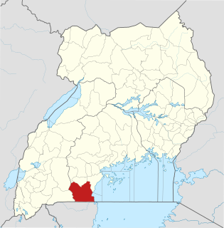
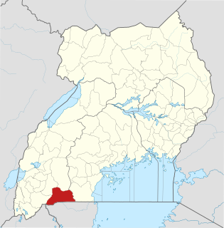
Rugaaga is a town in Isingiro District in the Western Region of Uganda. [1]
Rugaaga | |
|---|---|
| Coordinates: 00°49′40″S31°01′23″E / 0.82778°S 31.02306°E | |
| Country | |
| District | Isingiro District |
| Region | Western Uganda |
| Elevation | 4,708 ft (1,435 m) |
Rugaaga is a town in Isingiro District in the Western Region of Uganda. [1]
The town is located approximately 31 kilometres (19 mi) southeast of Isingiro Town Council, the district capital. [2]
Rugaaga is approximately 65 kilometres (40 mi), by road, southeast of the city of Mbarara, the largest urban area in the Western Region of Uganda. [3] This is about 260 kilometres (162 mi), by road, southwest of Kampala, Uganda's capital and largest city. [4]
The geographical coordinates of Rugaaga Town are 0°49'40.0"S, 31°01'23.0"E (Latitude:-0.827778; Longitude 31.023056). [5]
Rugaaga Town Council simultaneously serves as the headquarters of Rugaaga Sub-county, in Bukanga County in Isingiro District. In 2015, the Uganda Bureau of Statistics (UBOS), estimated the population of Rugaaga sub-county at 33,900. In 2020, UBOS estimated the mid-year population of the sub-county a 40,500 inhabitants, of whom 20,700 (51.1 percent) were female and 17,800 (48.9 percent) were male. UBOS calculated that the population in the sub-county grew at an average annual rate of 3.6 percent, between 2015 and 2020. [6]
The following additional points of interest lie within the town or near its edges: (a) the offices of Rugaaga Town Council (b) Rugaaga Health Center IV, administered by Isingiro District Administration on behalf of the Uganda Ministry of Health. [5]
The Isingiro–Ntantamuki–Rakai Road passes through the middle of Rugaaga in a general north to south direction. [7]
Gordon Babala Kasibante Wavamunno, a businessman, entrepreneur and philanthropist was born in Rugaaga in December 1943. [8]
Mull Sebujja Katende, a Ugandan diplomat who serves as the Ambassador of Uganda to the United States, was born here in February 1957. [9] [10]

Rakai District is a district in the Central Region of Uganda. The town of Rakai is the site of the district's headquarters.

Kabale District is a district in the Western Region of Uganda. Kabale hosts the district headquarters. It was originally part of Kigezi District, before the districts of Rukungiri, Kanungu, Kisoro, Rubanda and Rukiga and were excised to form separate districts. Kabale is sometimes nicknamed "Kastone" as in the local language Rukiga, a "kabale" is a small stone.

Kabale is a town in the Western Region of Uganda. It is the chief town of Kabale District, and the district headquarters are located there.

Rakai is a town in the Central Region of Uganda. It is the site of the headquarters of Rakai District. Other towns in the district include Kalisizo, Kyotera Kakuuto and Mutukula.

Isingiro District is a district in the Western Region of Uganda. The town of Isingiro is the district's main municipal, administrative, and commercial center.

Kiruhura District is a district in the Western Region of Uganda. The town of Kiruhura is the site of the district headquarters.

Kasangati is a town in Nangabo sub-county, Wakiso District in the Central Region of Uganda. It also serves as the headquarters for Kyadondo County. The town is multi-lingual and is a "melting pot" of diverse cultures.

Ibanda is a town in the Western Region of Uganda. It is the main political, administrative, and commercial centre of Ibanda District and the site of the district headquarters. It started wayback in 1990s and was elevated from a trading centre to a town board, town council and in 2016 it was granted a Municipality status. The Municipal Council has three Divisions of Kagongo, Bisheshe and Bufunda with 21 wards of Kyaruhanga, Bufunda, Nyamirima, Nsasi, Kayenje, Kashangura, Rwenshuri, Kigarama, Rugazi, Rwobuzizi, Kakatsi, Bugarama, Karangara, Kabaare, Kanyansheko, Nyakatookye, Kyeikucu, Kikoni, Kagongo, Ruyonza and Katongore ward. Ibanda Municipal Council has over 230 villages. Ibanda Municipal council commenced its operations on 1 July 2016 after being elevated from a Town Council and other sub counties that were annexed to..

Isingiro is a town in the Western Region of Uganda. It is the main municipal, administrative, and commercial center of Isingiro District and the site of the district's headquarters.

Kiruhura is a town in the Western Region of Uganda. It is the largest town in Kiruhura District and the site of the district headquarters.

Lyantonde is a town in the southern part of the Central Region of Uganda. It is the main municipal, administrative, and commercial center of Lyantonde District.

Amolatar is a town in Northern Uganda. It is the main municipal, administrative and commercial centre of Amolatar District. The district is named after the town.

Kalisizo is a town in the southern part of the Central Region of Uganda. Although it is the leading commercial center in Kyotera District, the administrative headquarters of the district are in Kasaali.

Ishaka is a town in the Western Region of Uganda. It is one of the municipalities in Bushenyi District.

Kikagati is a town in the Western Region of Uganda. It sits across the Kagera River from the town of Murongo, in the Kagera Region of Tanzania.

Alebtong, is a town in the Northern Region of Uganda. It is the chief municipal, administrative, and commercial centre of Alebtong District. The district is named after the town.

Buhweju District is a district in Western Uganda. It is one of the districts that constitute the Ankole sub-region. Its 'chief town', is Nsiika.

Nyakahita is a sparsely populated settlement in the Western Region of Uganda.

Namayumba is a settlement in the Wakiso District in the Buganda Region of Uganda. The name also refers to "Namayumba sub-county", the location of Namayumba settlement.
The Isingiro–Ntantamuki–Rakai Road is a road in the Central and Western Regions of Uganda, connecting the towns of Isingiro, in Isingiro District, Western Region and Rakai in Rakai District, Central Region.