This article includes information on the demographic history of Kosovo.

Gjilan is the third most populous city in Kosovo and it serves as both a municipality and the administrative center of the Gjilan District. According to the 2024 census, the municipality of Gjilan has a population of 82,901 with the majority residing in the city.

Peja or Peć, is the fourth most populous city in Kosovo and serves as the seat of the Peja Municipality and the District of Peja. It is located in the Rugova region on the eastern section of the Accursed Mountains along the Peja's Lumbardh in the western part of Kosovo.
The Llap Region is a region located in the north-eastern part of Kosovo. Llap in the broadest sense includes the watershed of the Llapi River. The Llapi water collection begins in the mountains of Kopaonik in the north and west and its source is considered to be the village of Pollatë, and ends by joining the Sitnica river in Lumadh, municipality of Vushtrri, in the north-west of Pristina. The topographic watershed of the Llapi River covers an area of 945.4 km2 (365.0 sq mi).

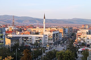
Vushtrri is a city and municipality located in the Mitrovica District in Kosovo. According to the 2011 census, the town of Vushtrri has 26,964 inhabitants, while the municipality has 69,870 inhabitants. Vushtrri is surrounded by the city of Mitrovica to the north, Podujevë in the east, Obiliq in the south, Drenas in the south-west, and Skenderaj in the west. The municipality of Vushtrri has 67 villages.

Žitorađa is a town and municipality located in the Toplica District of southern Serbia. The municipality includes 30 settlements. According to the 2022 census, the population of the municipality is 13,782 inhabitants.

FC Vushtrria is a football club based in Vushtrri, Kosovo. The club was founded in 1922, and currently play their home games at the 7,000 seat capacity Ferki Aliu Stadium in the city of Vushtrri. Notable players to have played for the club include former Albania internationals Armend Dallku, Ahmed Januzi and Kosovo international Milot Rashica.
Albanians in Serbia are a recognized national minority in Serbia. According to the 2022 census, the population of ethnic Albanians in Serbia is 61,687, constituting 0.93% of the total population. The vast majority of them live in the southern part of the country that borders Kosovo and North Macedonia, called the Preševo Valley. Their cultural center is located in Preševo.

The Circassians in Kosovo were a group of the Circassian people who lived in Kosovo beginning in the mid-19th century, when they were exiled during the Circassian genocide to the Ottoman Empire after the Russo-Circassian War. During this time, the Circassians in Kosovo were from three of the twelve Adyghe tribes: the Abzakh, Shapsug and Ubykh. In 1998 they numbered 200.
The Sanjak of Viçitrina, also known as the Pristina Pashaluk, was a sanjak of the Ottoman Empire in Rumelia, in present-day Kosovo. It was named after its administrative center Vushtrri.

Viciana or Station Viciano was a Roman road station of unclear location, somewhere in Kosovo field.
The strategic position of the region of Mitrovica in the middle of two great rivers Ibar and Sitnica and its mineral wealth in Albanik, made this location populated since the prehistoric period. This region was populated by Illyrians, who were members of the Dardan tribe. The first data for the archaeological sites in the region of Mitrovica, begin with the research of Sir Arthur Evans, who was the first to pinpoint the Roman town of the Municipium Dardanourm. In the archaeological sites of the region of Mitrovica were found traces and objects from different periods such as; Neolithic, Roman, late antiquity and medieval period. Objects and figurines include: fortress vestiges, necropolis, Terpsichore figure, statues, sarcophagus, altar, jewelry, etc.

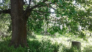
The Bukoshi Oak is a natural heritage monument of botanical character, located in the village of Bukosh in Vushtrri Municipality, Kosovo.

Duboc Fortress is a fortress in Duboc village in the Vushtrri municipality in Kosovo. It is situated above Ceçan, part of the Ciçavica mountain chain, approximately 11 km southwest of the city of Vushtrri.
Bardhasan is a village in the Dushkaja subregion of the Gjakova municipality of Kosovo. It is inhabited exclusively by Albanians.
Ujmir is a village in Klina municipality, Kosovo. It is located south of the Klina River.

The Architectural complex in Maletaj is a cultural heritage monument located in Maletaj (Gumnisht), Vushtrri, Kosovo. This monument is of the "Architectural" category, approved with number.
Voksh is a village and tribal region situated in western Kosovo[a], which is inhabited by 570 people, all of whom are Albanians. The village of Voksh is also home to the Vokshi tribe which is part of the larger polyphyletic Thaçi tribe.

Galica is a village administratively located in the Municipality of Vushtrri, Kosovo, but geographically situated in the Drenica region. The village covers an area of 443 hectares and is known for its numerous microtoponyms such as Katuni i Moçëm, Livadhi i Kolë Bibës, Kroni i Bajramit, among others, which testify to the village's history and culture.


