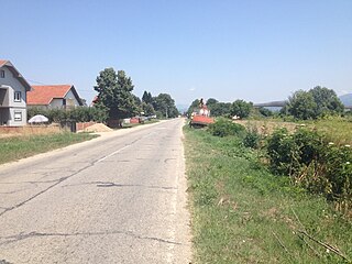
Buljane

Last updated
Buljane
Village
CountryFlag of Serbia.svg  Serbia
District Pomoravlje District
Municipality Paraćin
Population (2002)
  Total 1,545
Time zone CET (UTC+1)
  Summer (DST) CEST (UTC+2)

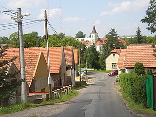
Buljane is a village in the municipality of Paraćin, Serbia. According to the 2002 census, the village has a population of 1545 people. [1]

Village Small clustered human settlement smaller than a town

A village is a clustered human settlement or community, larger than a hamlet but smaller than a town, with a population ranging from a few hundred to a few thousand. Though villages are often located in rural areas, the term urban village is also applied to certain urban neighborhoods. Villages are normally permanent, with fixed dwellings; however, transient villages can occur. Further, the dwellings of a village are fairly close to one another, not scattered broadly over the landscape, as a dispersed settlement.

Paraćin Town and municipality in Šumadija and Western Serbia, Serbia

Paraćin is a town and municipality located in the Pomoravlje District of central Serbia. It is located in the valley of the Velika Morava river, north of Kruševac and southeast of Kragujevac. In 2011 the town had a population of 24,573. It also had a civil airport.

Serbia Republic in Southeastern Europe

Serbia, officially the Republic of Serbia, is a country situated at the crossroads of Central and Southeast Europe in the southern Pannonian Plain and the central Balkans. The sovereign state borders Hungary to the north, Romania to the northeast, Bulgaria to the southeast, North Macedonia to the south, Croatia and Bosnia and Herzegovina to the west, and Montenegro to the southwest. The country claims a border with Albania through the disputed territory of Kosovo. Serbia's population is about seven million. Its capital, Belgrade, ranks among the oldest and largest citiеs in southeastern Europe.

Related Research Articles

Rizvia Society

Rizvia Society is one of the neighbourhoods of Liaquatabad Town in Karachi, Sindh, Pakistan. This neighbourhood is predominantly populated by Shiite Muslims.

Aliabad Place in Kunduz Province, Afghanistan

The town of 'Aliabad is the center of Ali abad District in Kunduz Province, Northern Afghanistan. It is situated in the central part of the district on 36.5222°N 68.8992°E at 425 m altitude on the main road between Kunduz and Baghlan.

Rosołów is a village in the administrative district of Gmina Pniewy, within Grójec County, Masovian Voivodeship, in east-central Poland.

Quách Phẩm Bắc Commune and village in Cà Mau, Vietnam

Quách Phẩm Bắc is a commune (xã) and village in Đầm Dơi District, Cà Mau Province, in Vietnam.

Kšely Municipality and village in Central Bohemian Region, Czech Republic

Kšely is a village and municipality in Kolín District in the Central Bohemian Region of the Czech Republic.

Gornje Suhotno Village in Nišava, Serbia

Gornje Suhotno is a village in the municipality of Aleksinac, Serbia. According to the 2002 census, the village has a population of 343 people.

Čifluk Razgojnski Village in Jablanica District, Serbia

Čifluk Razgojnski is a village in the municipality of Leskovac, Serbia. According to the 2002 census, the village has a population of 335 people.

Donja Lokošnica Village in Jablanica District, Serbia

Donja Lokošnica is a village in the municipality of Leskovac, Serbia. According to the 2002 census, the village has a population of 1060 people.

Draškovac Village in Jablanica District, Serbia

Draškovac is a village in the municipality of Leskovac, Serbia. According to the 2002 census, the village has a population of 791 people.

Dušanovo Village in Jablanica District, Serbia

Dušanovo is a village in the municipality of Leskovac, Serbia. According to the 2002 census, the village has a population of 236 people.

Grajevce Village in Jablanica District, Serbia

Grajevce is a village in the municipality of Leskovac, Serbia. According to the 2002 census, the village has a population of 404 people.

Grdanica Village in Jablanica District, Serbia

Grdanica is a village in the municipality of Leskovac, Serbia. According to the 2002 census, the village has a population of 605 people.

Međa (Leskovac) Village in Jablanica District, Serbia

Međa is a village in the municipality of Leskovac, Serbia. According to the 2002 census, the village has a population of 872 people.

Milanovo (Leskovac) Village in Jablanica District, Serbia

Milanovo is a village in the municipality of Leskovac, Serbia. According to the 2002 census, the village has a population of 546 people.

Podrimce Village in Jablanica District, Serbia

Podrimce is a village in the municipality of Leskovac, Serbia. According to the 2002 census, the village has a population of 283 people.

Priboj, Leskovac Village in Jablanica District, Serbia

Priboj is a village in the municipality of Leskovac, Serbia. According to the 2002 census, the village has a population of 642.

Zalužnje Village in Jablanica District, Serbia

Zalužnje is a village in the municipality of Leskovac, Serbia. According to the 2002 census, the village has a population of 482 people.

Živkovo Village in Jablanica District, Serbia

Živkovo is a village in the municipality of Leskovac, Serbia. According to the 2002 census, the village has a population of 669 people.

Zlokućane Village in Jablanica District, Serbia

Zlokućane is a village in the municipality of Leskovac, Serbia. According to the 2002 census, the village has a population of 217 people.

Semer is a village in the District of Kızılcahamam, Ankara Province, Turkey.

References

  1. Popis stanovništva, domaćinstava i Stanova 2002. Knjiga 1: Nacionalna ili etnička pripadnost po naseljima. Republika Srbija, Republički zavod za statistiku Beograd 2003. ISBN   86-84433-00-9

Coordinates: 43°53′57″N21°32′05″E / 43.8992°N 21.5347°E / 43.8992; 21.5347

Geographic coordinate system Coordinate system

A geographic coordinate system is a coordinate system that enables every location on Earth to be specified by a set of numbers, letters or symbols. The coordinates are often chosen such that one of the numbers represents a vertical position and two or three of the numbers represent a horizontal position; alternatively, a geographic position may be expressed in a combined three-dimensional Cartesian vector. A common choice of coordinates is latitude, longitude and elevation. To specify a location on a plane requires a map projection.