Related Research Articles

The Palm Springs Aerial Tramway in Palm Springs, California, is the largest rotating aerial tramway in the world. It was opened in September 1963 as a way of getting from the floor of the Coachella Valley to near the top of San Jacinto Peak and was constructed in rugged Chino Canyon. Before its construction, the only way to the top of the mountain was to hike hours from Idyllwild. The rotating cars were added in 2000.
The Agua Caliente Band of Cahuilla Indians of the Agua Caliente Indian Reservation is a federally recognized tribe of the Cahuilla, located in Riverside County, California, United States. The Cahuilla inhabited the Coachella Valley desert and surrounding mountains between 5000 BCE and 500 CE. With the establishment of the reservations, the Cahuilla were officially divided into 10 sovereign nations, including the Agua Caliente Band.
Tilhance Creek is a 10.4-mile-long (16.7 km) tributary stream of Back Creek in Berkeley County of West Virginia's Eastern Panhandle.
The San Gorgonio River is a 26.8-mile-long (43.1 km) river primarily flowing in western Riverside County, with a small upstream section in southwestern San Bernardino County, in southern California.
KDES-FM is a radio station in the Palm Springs area and the Coachella Valley of Southern California.
Lone Star is an unincorporated community in Calhoun County, South Carolina, United States. The community has the ZIP Code of 29030 and lies at approximately 33.63 latitude and -80.59 longitude, with an elevation of 171 feet. It is part of the Columbia, South Carolina Metropolitan Statistical Area.

The Mojave Road, also known as Old Government Road, is a historic route and present day dirt road across what is now the Mojave National Preserve in the Mojave Desert in the United States. This rough road stretched 147 miles (237 km) from Beale's Crossing, to Fork of the Road location along the north bank of the Mojave River where the old Mojave Road split off from the route of the Old Spanish Trail/Mormon Road.

Whitewater is a census-designated place in Riverside County, California. It is directly off Interstate 10 halfway between North Palm Springs and Cabazon on the way from Palm Springs to Los Angeles. It is known as the site of the San Gorgonio Pass Wind Farm. The ZIP Code is 92282, and the community is inside area code 760. The population was 859 at the 2010 census. The elevation is 1,575 feet (480 m).
San Jacinto National Forest was established as the San Jacinto Forest Reserve by the General Land Office in California on February 22, 1897 with 740,000 acres (3,000 km2). After the transfer of federal forests to the U.S. Forest Service in 1905, it became a National Forest on March 4, 1907. On July 1, 1908 the entire forest was combined with Trabuco Canyon National Forest to establish Cleveland National Forest, and the name was discontinued.
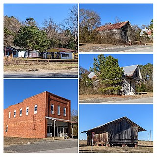
Pinyon Pines is an unincorporated community in Riverside County, California.

Chino Canyon is a 5.5-mile-long (8.9 km) desert canyon in Riverside County, California, United States. It is one of the steepest canyons in North America, dropping from over 8,500 feet (2,600 m) at the south rim to less than 2,700 feet (820 m) on the valley floor in less than a mile. The Palm Springs Aerial Tramway was built in the canyon in 1963 to quickly transport people from the valley floor to the top of the mountain. After it was redesigned in 2000, it became the largest rotating aerial tramway in the world.
The Indio Hills are a low mountain range in the Colorado Desert. located in Riverside County, California's Coachella Valley. The hills were named for their proximity to the city of Indio, and are sometimes referred to as the Indio Mud Hills or Indio Sand Hills.

The Morongo Band of Mission Indians is a federally recognized tribe in California, United States. The main tribal groups are Cahuilla and Serrano. Tribal members also include Cupeño, Luiseño, and Chemehuevi Indians. Although many tribes in California are known as Mission Indians, some, such as those at Morongo, were never a part of the Spanish Missions in California.
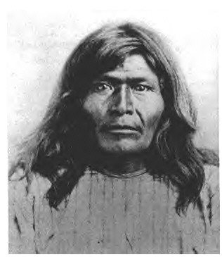
Victorio's War, or the Victorio Campaign, was an armed conflict between the Apache followers of Chief Victorio, the United States, and Mexico beginning in September 1879. Faced with arrest and forcible relocation from his homeland in New Mexico to San Carlos Indian Reservation in southeastern Arizona, Victorio led a guerrilla war across southern New Mexico, west Texas and northern Mexico. Victorio fought many battles and skirmishes with the United States Army and raided several settlements until the Mexican Army killed him and most of his warriors in October 1880 in the Battle of Tres Castillos. After Victorio's death, his lieutenant Nana led a raid in 1881.
Temescal Mountains, also known as the Sierra Temescal, are one of the northernmost mountain ranges of the Peninsular Ranges in western Riverside County, in Southern California in the United States. They extend for approximately 25 mi (40 km) southeast of the Santa Ana River east of the Elsinore Fault Zone to the Temecula Basin and form the western edge of the Perris Block.
Oriflamme Canyon is a steep mountain canyon, in San Diego County, California that descends from its head in the Laguna Mountains, at 32°56′41″N116°29′45″W, in an arc northwestward then northeastward to join Rodriguez Canyon at the northwest end of Mason Valley, where Vallecito Wash has its source.
San Felipe Creek is a stream in Imperial and San Diego Counties of California. It arises in the Volcan Mountains of San Diego County 33°11′57″N116°37′35″W, and runs eastward, gathering the waters of most of the eastern slope of the mountains and desert of the county in the San Sebastian Marsh before it empties into the Salton Sea. It is probably the last remaining perennial natural desert stream in the Colorado Desert region. In 1974, the San Felipe Creek Area was designated as a National Natural Landmark by the National Park Service.
Palm Canyon Wash is an arroyo and tributary ephemeral stream or wash of the Whitewater River, in Riverside County, California.
Bull Canyon is a canyon at the top of Palm Canyon Wash, which is a tributary to the Whitewater River, in Riverside County, California. Bull Canyon and the creek of Palm Canyon Wash heads at 33°36′47″N116°33′23″W, at an elevation of 6,165 feet in the southern western slope of a ridge in the San Jacinto Mountains. The waters of the creek of Palm Canyon Wash are augmented by Bull Canyon Spring at 33°35′22″N116°33′24″W, at an elevation of 5,331 feet / 1,625 meters. The mouth of Bull Canyon is at an elevation of 4,508 feet / 1,374 meters at the head of Palm Canyon. The mouth of an unnamed creek flows north down from Vandeventer Flat into the head of Palm Canyon at its confluence with Palm Canyon Wash at 33°34′08″N116°31′43″W at an elevation of 4,460 feet.

References
33°35′22″N116°33′24″W / 33.58944°N 116.55667°W
| | This Riverside County, California-related article is a stub. You can help Wikipedia by expanding it. |