
Homer is an unincorporated community and census-designated place (CDP) in Homer Township, Winona County, Minnesota, United States, on the south bank of the Mississippi River. As of the 2010 census, its population was 181.

The Yuba River is a tributary of the Feather River in the Sierra Nevada and eastern Sacramento Valley, in the U.S. state of California. The main stem of the river is about 40 miles (64 km) long, and its headwaters are split into three major forks. The Yuba River proper is formed at the confluence of the North Yuba and Middle Yuba Rivers, with the South Yuba joining a short distance downstream. Measured to the head of the North Yuba River, the Yuba River is just over 100 miles (160 km) long.
Canyon is an unincorporated community in Northland Township, Saint Louis County, Minnesota, United States.
Bassett is an unincorporated community in Bassett Township, Saint Louis County, Minnesota, United States located within the Superior National Forest.
Gowan is an unincorporated community in Floodwood Township, Saint Louis County, Minnesota, United States.
Plum Creek is a 35.4-mile-long (57.0 km) stream near the city of Walnut Grove, Minnesota. It passes to the northwest of the town, flowing northeasterly to the Cottonwood River, with its waters then flowing to the Minnesota River and eventually the Mississippi River. Plum Creek lends its name to a regional library network.
Ash Creek is an unincorporated community in Clinton Township, Rock County, Minnesota, United States. The community took its name from nearby Ash Creek.
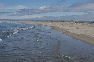
Bullards Beach State Park is a state park in the U.S. state of Oregon, administered by the Oregon Parks and Recreation Department.
Pine Creek is a 23.7-mile-long (38.1 km) tributary of the Mississippi River in Winona and Houston counties, Minnesota, United States. Pine Creek joins the Mississippi southeast of La Crescent, Minnesota, directly across from La Crosse, Wisconsin.
Sand Creek is a 36.6-mile-long (58.9 km) tributary of the Minnesota River in Le Sueur and Scott counties, Minnesota, United States. It rises at the outlet of Lake Sanborn, 2 miles (3 km) northeast of the city of Montgomery, and flows north past New Prague, entering the Minnesota River just north of Jordan.

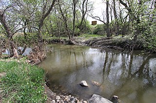
Winnebago Creek is a 23.6-mile-long (38.0 km) tributary of the Mississippi River in southeastern Minnesota.
Pine Creek is an unincorporated community in Houston and Winona counties in the U.S. state of Minnesota.

Lime Creek is an unincorporated community in Belfast Township, Murray County, Minnesota, United States. It is located two miles northeast of Fulda.
Wacouta is an unincorporated community in Wacouta Township, Goodhue County, Minnesota, United States.
Money Creek is a stream in Houston and Winona counties, in the U.S. state of Minnesota. It is a tributary of the Root River. Money Creek was so named when a passerby's money blew into the creek and was lost.
Woodbury Creek is a stream in Freeborn and Mower Counties in the U.S. state of Minnesota.
Mission Creek is a stream in Pine County, in the U.S. state of Minnesota. It is a tributary of the Snake River.
Beaver Falls is an unincorporated community in Renville County, in the U.S. state of Minnesota.

Bullard Mountain is a 4,225-foot (1,288 m) mountain summit located in the Boundary Ranges, in the U.S. state of Alaska. The peak is situated immediately east of the terminus of Mendenhall Glacier, within Tongass National Forest, 9 mi (14 km) north-northwest of Juneau, and 6 mi (10 km) northeast of Juneau International Airport. McGinnis Mountain lies 3.7 mi (6 km) on the opposite side of the glacier, and Heintzleman Ridge lies 2.75 mi (4 km) to the south. Bullard Mountain is often seen and photographed with Mount Wrather, a 5,968-foot (1,819 m) summit 3.9 mi (6 km) to the north because they are together in the background behind Mendenhall Lake, a popular tourist and recreation area. Although modest in elevation, relief is significant since the mountain rises from this nearly sea-level lake in less than two miles. Precipitation runoff from the mountain drains into the lake via Nugget Creek and Nugget Falls. Bullard Mountain is named for Benjamin Bullard (1848-1933), a mining engineer who, in 1907, began mining on Nugget Creek where he later built a hydroelectric power plant.
