
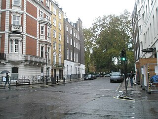
Bulstrode Street is a street in Marylebone in the City of Westminster that runs from Welbeck Street in the east to Thayer Street in the west. It is crossed only by Marylebone Lane.
Bulstrode Street is a street in Marylebone in the City of Westminster that runs from Welbeck Street in the east to Thayer Street in the west. It is crossed only by Marylebone Lane.
Bulstrode Street was laid out when the Marylebone area was urbanised on a grid pattern in the early 1700s. [1] It is named after Bulstrode Park in Buckinghamshire which was in the ownership of the first Duke of Portland and was the family seat until 1810. The second Duke married Margaret Cavendish, the only child and heiress of Edward Harley of Harley Street fame, and thus acquired the land on which Bulstrode Street stands. [2]

The most prominent buildings in Bulstrode Street are the modern Marylebone Hotel on the north side, which has its entrance in Welbeck Street, and The American College on the south side. The three terraced town houses at numbers 3 to 7 on the south side, built around 1780–1800, are grade II listed buildings with Historic England. [3] Adjoining houses number 19 [4] and 21 [5] at the western end on the south side are also grade II listed.
The Golden Eagle, a late Victorian public house, [6] is on the corner with Marylebone Lane on the south side. Opposite are the haberdashers V.V. Rouleaux at number 102. [7]

Bulstrode is an English country house and its large park, located to the southwest of Gerrards Cross, Buckinghamshire. The estate spreads across Chalfont St Peter, Gerrards Cross and Fulmer, and predates the Norman conquest. Its name may originate from the Anglo-Saxon words burh (marsh) and stród (fort). The park and garden are designated a Grade II* listed building.

Cavendish Square is a public garden square in Marylebone in the West End of London. It has a double-helix underground commercial car park. Its northern road forms ends of four streets: of Wigmore Street that runs to Portman Square in the much larger Portman Estate to the west; of Harley Street which runs an alike distance; of Chandos Street which runs for one block and; of Cavendish Place which runs the same. The south side itself is modern: the rear façade and accesses to a flagship department store and office block. On the ground floors facing are Comptoir Libanais, Royal Bank of Scotland and Pret a Manger premises.
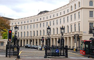
Park Crescent is at the north end of Portland Place and south of Marylebone Road in London. The crescent consists of elegant stuccoed terraced houses by the architect John Nash, which form a semicircle. The crescent is part of Nash's and wider town-planning visions of Roman-inspired imperial West End approaches to Regent's Park. It was originally conceived as a circus (circle) to be named Regent's Circus but instead Park Square was built to the north. The only buildings on the Regent's Park side of the square are small garden buildings, enabling higher floors of the Park Crescent buildings to have a longer, green northern view.

Marylebone is an area in London, England and is located in the City of Westminster. It is in Central London and part of the West End. Oxford Street forms its southern boundary.

Hill Street is a street in Mayfair, London, which runs south-west, then west, from Berkeley Square to Deanery Street, a short approach way from Park Lane. It was developed from farmland in the 18th century. Travelling one block to the east and south sees a fall of about three metres, whereas in the other direction the land rises gradually across six main blocks to beyond the north of Marble Arch. Hill Street's homes gained fashionable status from the outset: grand townhouses seeing use, at first, as seasonal lettings (rentals) and/or longer-term London homes of nobility — later, of other wealthy capitalists as much. Twenty-two, approximately half of its town houses, are listed. Along its course, only Audley Square House departs from townhouse-sized frontage, yet this shares in the street's predominant form of domestic architecture, Georgian neo-classical. Hill Street's public house is the oldest surviving one in Mayfair.

The Barley Mow is a grade II listed pub located at 8 Dorset Street, Marylebone, London, W1.

Thayer Street is a street in the Marylebone district of the City of Westminster, London, that contains four listed buildings.
Hinde Street is a street in the Marylebone district of the City of Westminster, London, that contains the Hinde Street Methodist Church and was home to the novelist Rose Macaulay until her death.

Riding House Street is a street in central London in the City of Westminster.

Weymouth Street lies in the Marylebone district of the City of Westminster and connects Marylebone High Street with Great Portland Street. The area was developed in the late 18th century by Henrietta Cavendish Holles and her husband Edward Harley, 2nd Earl of Oxford. This part of Marylebone was noted to part of Manor of Tyburn and dates back to the year 1086.

Nottingham Street is a street in the City of Westminster, London, that runs from Marylebone High Street in the east to Luxborough Street in the west. It is crossed by Nottingham Place. Bingham Place and Oldbury Place join it on the north side.

New Cavendish Street is a street in the City of Westminster, London, that runs from Marylebone High Street in the west to Cleveland Street in the east. The street was built in 1775 and named after the Cavendish family, who were related to the ground landlords, the Dukes of Portland.

115 Harley Street is a grade II* listed terraced town house in Harley Street, in the City of Westminster, London. The house is of the "first rate" class, built around 1777 as part of the Portland Estate, probably by John White and the plasterer Thomas Collins who were associated with Sir William Chambers.

Marylebone Lane is one of the original streets of the Marylebone district of the City of Westminster, London. It runs from Oxford Street in the south to Marylebone High Street in the north, its winding shape following the course of the River Tyburn that it once ran alongside and pre-dating the grid pattern of the other streets in the area. Today the lane is largely composed of small shops, cafes and restaurants with some small apartment blocks. There are some larger commercial buildings at the southern end near Oxford Street.

54 Welbeck Street is a grade II listed town house in Welbeck Street, in the City of Westminster, London. The house is dated 1896 and in free style pink terracotta "Jacobethan".

1 Bentinck Street is a grade II listed house in Bentinck Street, in the City of Westminster, London. The house was completed around 1800. It is on the corner with Welbeck Street.

Welbeck Street car park was an architecturally notable car park built in the Brutalist style that was found in Marylebone, just north of Oxford Street, in the City of Westminster, London. The entrance was on the east side in Welbeck Street and it also borderered Henrietta Place in the south and Marylebone Lane in the west.

Henrietta Place, originally known as Henrietta Street, is a street in Marylebone in the City of Westminster in central London that runs from Marylebone Lane in the east to Cavendish Square in the west. It is joined on the north side by Welbeck Street and Wimpole Street, and on the south side by Vere Street, Chapel Place, and Old Cavendish Street.

9 and 11 Duke Street are grade II listed terraced townhouses in Duke Street, Marylebone, in the City of Westminster, London. The houses are on the east side of the street on the corner with Duke's Mews. They were built around 1776–1788 when the Duke of Manchester developed Manchester Square on Portman Estate land. Built of stock brick with slate roofs, they later had shop fronts added which were altered in the Victorian period. The buildings were extensively renovated in 2011–12 by Richardsons (Nyewood) Limited.

South Audley Street is a major shopping street in Mayfair, London. It runs north to south from the southwest corner of Grosvenor Square to Curzon Street.
![]() Media related to Bulstrode Street at Wikimedia Commons
Media related to Bulstrode Street at Wikimedia Commons