Bumble Hole Local Nature Reserve

Last updated

Bumble Hole
Bumble Hole Conservation Area - geograph.org.uk - 1568990.jpg
The Bushboil Arm - a canal branch inside the reserve
Bumble Hole Local Nature Reserve
TypeLocal Nature Reserve
Location Netherton, England
Coordinates 52°29′31″N2°04′19″W / 52.492°N 2.072°W / 52.492; -2.072
Created1996 (1996)
Operated by Dudley Metropolitan Borough Council
Website http://www.dudley.gov.uk/resident/environment/countryside/nature-reserves/bumble-hole-and-warrens-hall-local-nature-res/

Bumble Hole Local Nature Reserve is situated in the Netherton area of Dudley Metropolitan Borough in the county of West Midlands, England. This former industrial area now features canals, ponds, grassland and wooded areas. The reserve lies adjacent to the Warren's Hall Local Nature Reserve (which is in Sandwell Metropolitan Borough). It was declared a local nature reserve in 1996. [1]

Contents

History

The area comprising the Bumble Hole Local Nature Reserve and its neighbour, Warren's Hall Local Nature Reserve, once was a scene of industry, including coal mining, clay extraction, coke furnaces and boat building. [2] A railway (known as the Bumble Hole Line) ran through the area, linking Dudley to Old Hill.

Location

The reserve is located to the east of Netherton, about 1.5 miles south of Dudley, on the border with Sandwell Metropolitan Borough. Main access is via St Peter's Road, Netherton. [1]

Landscape

Bumble Hole Lake Bumble Hole Conservation Area - geograph.org.uk - 1569000.jpg
Bumble Hole Lake

The reserve contains areas of grassland, small wooded regions, canals and ponds. The Dudley No. 2 Canal runs into the reserve. Two short arms lead off from this canal: the Bumble Hole Branch and the Bushboil Arm. Bumble Hole Lake, a former clay pit, forms the largest body of water in the reserve. [2] There is no visible border with the neighboring Warren's Hall Local Nature Reserve, [3] so the two reserves effectively form a single visitor attraction.

Facilities

A canal-side visitor centre run by volunteers (the Bumble Hole Conservation Group), [4] offers information on the reserve, as well as refreshments and toilet facilities. There is also a football pitch. [1]

Boating festival

Annual boating festival at Bumble Hole Black Country Boat Festival - geograph.org.uk - 1513886.jpg
Annual boating festival at Bumble Hole

The reserve (plus the neighboring Warren's Hall Local Nature Reserve) is the site for an annual boating festival. The event attracts canal boats every September and features stalls, canal trips and a funfair. [5]

Related Research Articles

West Midlands (county) County in England

The West Midlands sometimes referred to as the "West Midlands County" is a metropolitan county in the West Midlands Region, England with a 2020 estimated population of 2,939,927, making it the second most populous county in England after Greater London. It appeared as a metropolitan county in 1974 after the passage of the Local Government Act 1972, to cover parts of Staffordshire, Worcestershire and Warwickshire. The county is a NUTS 2 region within the wider NUTS 1 region of the same name. It embraces seven metropolitan boroughs: the cities of Birmingham, Coventry and Wolverhampton, and the boroughs of Dudley, Sandwell, Solihull and Walsall. The county is also a combined authority which is over seen by the West Midlands Combined Authority which covers all seven boroughs and other non-constituent councils on economy, transport and housing.

Dudley Town in West Midlands, England

Dudley is a large market town and administrative centre in the county of West Midlands, England, 6 miles (9.7 km) south-east of Wolverhampton and 10.5 miles (16.9 km) north-west of Birmingham. Historically an exclave of Worcestershire, the town is the administrative centre of the Metropolitan Borough of Dudley and in 2011 had a population of 79,379. The Metropolitan Borough, which includes the towns of Stourbridge and Halesowen, had a population of 312,900. In 2014 the borough council named Dudley as the capital of the Black Country.

Metropolitan Borough of Dudley Metropolitan borough in England

The Metropolitan Borough of Dudley is a metropolitan borough of West Midlands, England. It was created in 1974 following the Local Government Act 1972, through a merger of the existing Dudley County Borough with the municipal boroughs of Stourbridge and Halesowen. The borough borders Sandwell to the east, the city of Birmingham to the south east, Bromsgrove to the south in Worcestershire, South Staffordshire District to the west, and the city of Wolverhampton to the north.
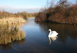
Sandwell Valley

Sandwell Valley is an area of green belt in the county of West Midlands, England, on the border of Birmingham and West Bromwich, with Walsall at its northern end.

Sandwell Valley Country Park

Sandwell Valley Country Park is a country park, run by Sandwell Metropolitan Borough Council, in Sandwell Valley, on the River Tame in the middle of the urban conurbation between Birmingham and West Bromwich in West Midlands, England.

Cradley Heath Human settlement in England

Cradley Heath is a town in the Rowley Regis area of the Metropolitan Borough of Sandwell, West Midlands, England. It lies within the Black Country and is situated 2.5 miles (4 km) north of Halesowen, 4 miles (6 km) south of Dudley and 9 miles (14 km) west of central Birmingham. Cradley Heath is often confused with the neighbouring Halesowen district of Cradley, although the two places are separated by the River Stour and have long been in separate local authorities, and until 1966 were in separate counties.

Netherton, West Midlands Human settlement in England

Netherton is an area of the Metropolitan Borough of Dudley, 1.5 miles (2 km) south of Dudley town centre in the West Midlands of England, but historically in Worcestershire. Part of the Black Country, Netherton is bounded by nature reserves to the east and west, and an industrial area and the Dudley Southern By-Pass to the north.

County Borough of Dudley

The County Borough of Dudley was a local government district in the English Midlands from 1865 to 1974. Originally a municipal borough, it became a county borough in 1889, centred on the main town centre of Dudley, along with the suburbs of Netherton and Woodside. Although surrounded by Staffordshire, the borough was associated with Worcestershire for non-administrative purposes, forming an exclave of the county until 1966, when it was transferred to Staffordshire after an expansion of the borough boundaries. Following local government reorganization in 1974, Dudley took in the boroughs of Halesowen and Stourbridge to form the present-day Metropolitan Borough of Dudley, in the newly formed West Midlands county.

Netherton Tunnel Branch Canal

Netherton Tunnel Branch Canal, in the West Midlands county, England, is part of the Birmingham Canal Navigations, (BCN). It was constructed at a 453–foot elevation, the Wednesbury or Birmingham level; it has no locks. The total length of the branch canal is 2.4 miles (3.9 km) and the canal tunnel is 9,081 feet (2,768 m) long.

Cotwall End Valley

Cotwall End Valley is a local nature reserve in West Midlands, England. It is about a mile south of Sedgley, in the Metropolitan Borough of Dudley.

Haden Hill

Haden Hill is a residential area in the West Midlands of England, straddling the border of Halesowen and Cradley Heath townships and the modern boroughs of Dudley and Sandwell.
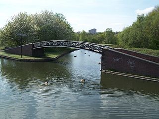
Bumble Hole Branch Canal

The present day Bumble Hole Branch Canal and Boshboil Branch surround Bumble Hole, a water-filled clay pit, in Bumble Hole and Warren's Hall Nature Reserve, Rowley Regis, West Midlands, England. They formed a looped part of the original Dudley No. 2 Canal until the opening of the Netherton Tunnel in 1858 when the loop was bypassed by a new cut, in line with the new tunnel. Part of the bypassed canal loop, which surrounds Bumble Hole, is now in-filled giving access to the pool of Bumble Hole. An area next to the Bumble Hole and Dudley canals is the Bumble Hole Local Nature Reserve.
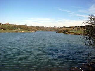
Fens Pools

Fens Pools is a 37.6 hectare biological site of Special Scientific Interest in the West Midlands. The site was notified in 1989. under the Wildlife and Countryside Act 1981 and is currently managed by the Country Trust.

Sheepwash Urban Park Local Nature Reserve in the West Midlands, England

Sheepwash Urban Park is a Local Nature Reserve (LNR), situated in Sandwell Metropolitan Borough, in the West Midlands conurbation of the United Kingdom. It forms part of the Black Country Urban Forest.
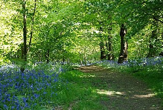
Saltwells Local Nature Reserve

Saltwells Local Nature Reserve is situated in the Netherton area of Dudley Metropolitan Borough in West Midlands, England. The reserve, created in 1981, covers 247 acres and includes Saltwells Wood and part of Netherton Hill within its boundaries. The reserve encloses two Sites of Special Scientific Interest and one scheduled ancient monument.

Warrens Hall Country Park Local natural reserve in Sandwell metropolitan Borough

Warren's Hall Country Park is a local nature reserve situated in Sandwell Metropolitan Borough in the West Midlands of England. It lies next to Bumble Hole Local Nature Reserve. It includes ponds, canals, grassland, small wooded areas and the entrance to Netherton Canal Tunnel.

Barrow Hill Local Nature Reserve

Barrow Hill Local Nature Reserve is a local nature reserve situated in Pensnett in the county of West Midlands, England. Its most distinctive feature, Barrow Hill, is the eroded remnant of a high level igneous intrusion that was formed 315 million years ago during the Carboniferous period. The reserve was created in 2005.

Buckpool and Fens Pool Local Nature Reserve

Buckpool and Fens Pool Local Nature Reserve is situated in the Pensnett area of the West Midlands. The largest area of open water in Dudley Metropolitan Borough, it contains both large and small ponds, one end of the Stourbridge Canal, streams and grassy areas. It was created in 1993.

Bradlaugh Fields

Bradlaugh Fields is a 60 hectare open space in Northampton. The site is a former golf course. In 1987 it was proposed to build housing on the site, but after a campaign by local residents it was acquired by Northampton Borough Council and opened as a wildlife park in 1998. It was named after Charles Bradlaugh, a leading nineteenth century radical and atheist who was MP for Northampton. Three fields with a total area of 17.5 hectares are managed by the Wildlife Trust for Bedfordshire, Cambridgeshire and Northamptonshire as a nature reserve also called Bradlaugh Fields. Hills and Holes is at the southern end and two adjoining meadows, Scrub Field and Quarry Field, are at the northern end. Hills and Holes is an 8.3 hectare Local Nature Reserve (LNR) and Scrub Field is a 5.1 hectare LNR.

Forge Mill Lake

Forge Mill Lake is a local nature reserve in Sandwell Valley, near West Bromwich in West Midlands, England. It is within Sandwell Valley Country Park.

References

  1. 1 2 3 "Local Nature Reserves - Bumble Hole". www.lnr.naturalengland.org.uk. Natural England. Retrieved 23 October 2015.
  2. 1 2 "Countryside walks in Dudley - Bumble Hole". Dudley MBC. Retrieved 22 October 2015.
  3. "Local Nature Reserve - Warren's Hall Country Park". www.lnr.naturalengland.org.uk/. Natural England. Retrieved 29 October 2015.
  4. "Bumble Hole centre opens again". Dudley News. Newsquest (Midlands South) Ltd. 19 November 2010. Retrieved 29 October 2015.
  5. "Black Country Boating Festival 2015". www.bcbf.com. Black Country Boating Festival. Archived from the original on 11 August 2015. Retrieved 23 October 2015.

Coordinates: 52°29′31″N2°04′19″W / 52.492°N 2.072°W / 52.492; -2.072