Tourism
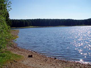
Tourism has played an important role in Buntenbock for a good 100 years. In the early days it was advertised as a healthy place to recover from illness due to its mountain air. Buntenbock lay on important transport routes and was traditionally a village of carters, who mainly worked for the mines. The keeping of domestic animals, particularly horses and goats, stems from that time. In the cheese dairy of Buntenbock's goat farm (Ziegenhof), goat's milk is processed into products such as the aromatic Buntenböcker Ziegenkäse goat's cheese. In the area around Buntenbock are numerous lakes from the mining era, which are used for swimming in summer and skating in winter. In and around Buntenbock there are many walking trails, which include the Harzer Hexenstieg that passes nearby. The village has a small spa park where, from April to September, there is a village market every fortnight on a Wednesday. In winter there is tobogganing and cross-country skiing on Buntenbock's local mountain, the Ziegenberg.

The Harz is a highland area in northern Germany. It has the highest elevations for that region, and its rugged terrain extends across parts of Lower Saxony, Saxony-Anhalt, and Thuringia. The name Harz derives from the Middle High German word Hardt or Hart, Latinized as Hercynia. The Brocken is the highest summit in the Harz with an elevation of 1,141.1 metres (3,744 ft) above sea level. The Wurmberg is the highest peak located entirely within the state of Lower Saxony.

Schwarzenberg is a municipality in the Bregenz Forest in the western Austrian state of Vorarlberg, part of the district of Bregenz. Schwarzenberg has an area of 25.76 km². It lies south of Lake Constance. The village center is heritage-protected for its traditional rustic wooden houses.

Sankt Andreasberg is a former town in the district of Goslar, in Lower Saxony, Germany. Since 1 November 2011, it is part of the town Braunlage. It is situated in the Harz, approximately 7 km west of Braunlage proper, and 20 km east of Osterode am Harz.

Schierke is a village and a former municipality in the Harz district, in the German state of Saxony-Anhalt. Since 1 July 2009, it is part of the town Wernigerode. Situated within the Harz mountain range in the valley of the river Bode, at the rim of the Harz National Park, it is mainly a tourist resort, especially for hiking and all kinds of winter sports.

Lonau is a small village with a population of about 345 situated at an elevation of about 400m in the Harz Mountains of Northern Germany. Besides the clean air and lush forests, it is famous for the capercaillie. It belongs to the city of Herzberg am Harz which is about 4 km to the south. The rivers Große Lonau and Kleine Lonau join here.

The Hohnekamm or Hohne Kamm is a mountain ridge up to 900 m above sea level high in the Harz mountains of central Germany. It is located in the state of Saxony-Anhalt, and is well known for its rock towers or tors, the Hohneklippen.

Torfhaus is a village in the borough of the mining town of Altenau in the Harz mountains of Germany and lies at a height of about 800 m above sea level (NN). It is the highest settlement in Lower Saxony.

Romkerhall is a popular tourist destination on the River Oker in the Harz Mountains of Germany. There is a public car park here as well as a hotel and restaurant opposite the Romkerhall Waterfall. Romkerhall lies within the unincorporated area of Harz in the Lower Saxon county of Goslar in the Harz Mountains. The hotel and waterfall form a small tourist attraction which is marketed as the "Kingdom of Romkerhall - the smallest kingdom in the world!"

Trautenstein is a village in the borough of Oberharz am Brocken in the district of Harz in the German state of Saxony-Anhalt. Trautenstein has 493 inhabitants as of 1 January 2010. Formerly an independent municipality, it was merged into the town Hasselfelde in 2002, which was merged into Oberharz am Brocken in 2010.

The Trudenstein is a rock formation and popular hiker's destination in the Harz Mountains of central Germany. It is located in the federal state of Saxony-Anhalt.

The Bremen Hut in the Harz Mountains is a refuge hut and shelter in that part of the Harz National Park lying within the borough of Ilsenburg (Harz) in Harz district in the German state of Saxony-Anhalt.
The Eckerloch is a forested mountain valley, 845 metres above sea level near the village of Schierke in the Harz Mountains of central Germany.

The Barenberg, also called the Bärenberg or Bärenkopf, is a mountain, 695.5 m above sea level (NN), in the Harz Mountains of Germany near the village of Schierke, Harz county, in the state of Saxony-Anhalt.
Am Kruzifix is an ancient forest landmark in the Harz Mountains of Germany. Today it is recalled by an iron cross or crucifix at the junction of several hiking trails.

The Kapitelsberg in the Harz Mountains of Germany is a hill, 535.7 m above sea level (NN), near the village of Tanne in the county of Harz, Saxony-Anhalt.
The Wilhelmsblick in the Harz Mountains of central Germany is a viewing point near the village of Treseburg in the Bode Gorge in the county of Harz, Saxony-Anhalt. From this single point, four different stretches of the River Bode may be seen as it swings in great loops around the spur on which the viewing point is located.
The Jägersbleeker Teich in the Harz Mountains of central Germany is a storage pond near the town of Clausthal-Zellerfeld in the county of Goslar in Lower Saxony. It is one of the Upper Harz Ponds that were created for the mining industry.

The Dehnenkopf in the Harz Mountains of central Germany is a summit about 775 m above sea level (NN) near Torfhaus in the unincorporated area of Harz in the county of Goslar in Lower Saxony.

The Bergrat Müller Pond, named after a former mining director, Müller, in the Harz mountains of central Germany is a storage pond laid out from 1737 to 1738. It has an area of about 1.3 ha and lies in the forested southern part of the borough of Quedlinburg in the county of Harz in Saxony-Anhalt.

The Kalte Birke is a cross tracks in the Harz Mountains of Germany where there is a refuge hut and former settlement. It is located west of the Innerste Reservoir at about 540 metres above sea level. It lies in the unparished area of Harz in the county of Goslar. Historically it is closely linked to the municipality of Hahausen and village of Neuekrug, four kilometres northwest.


