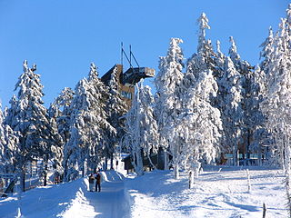
Clausthal-Zellerfeld

Last updated
Clausthal-Zellerfeld
Marktkirche Clausthal.JPG
Church in 2005
Wappen Clausthal-Zellerfeld.png
Location of Clausthal-Zellerfeld within Goslar district
Clausthal-Zellerfeld in GS.svggemeindefreies Gebiet Harz
Germany adm location map.svg
Red pog.svg
Clausthal-Zellerfeld
Lower Saxony location map.svg
Red pog.svg
Clausthal-Zellerfeld
Coordinates: 51°48′18″N10°20′08″E / 51.80500°N 10.33556°E / 51.80500; 10.33556
Country Germany
State Lower Saxony
District Goslar
Subdivisions4 districts
Government
   Mayor (202126) Petra Emmerich-Kopatsch [1] (SPD)
Area
  Total43.71 km2 (16.88 sq mi)
Elevation
560 m (1,840 ft)
Population
 (2021-12-31) [2]
  Total14,804
  Density340/km2 (880/sq mi)
Time zone UTC+01:00 (CET)
  Summer (DST) UTC+02:00 (CEST)
Postal codes
38678
Dialling codes 05323
Vehicle registration GS, BRL, CLZ
Website www.clausthal-zellerfeld.de

Clausthal-Zellerfeld is a town in Lower Saxony, Germany. It is located in the southwestern part of the Harz mountains. Its population is approximately 15,000. The town hosts the Clausthal University of Technology. The health resort is located in the Upper Harz at an altitude between 390 and 821 m above sea level.

Contents

Geography

Clausthal-Zellerfeld is located on the Upper Harz Plateau. The surrounding area is less mountainous compared to most of the Harz. As a result, the adjacent area is less wooded and there is more pasture land. Scattered in and around Clausthal-Zellerfeld are numerous dams and streams belonging to the Upper Harz Water Regale.

The depression between Clausthal and Zellerfeld marks a natural "borderline".

Southwest extends the "Small Clausthal valley".

City districts

History

Clausthal-Zellerfeld originally consisted of two towns which were merged in 1924 to form an administrative unit. Clausthal is well known for the old Clausthal University of Technology and its magnificent buildings, while Zellerfeld is a typical tourist resort for hikers and winter sportsmen. Clausthal-Zellerfeld is the largest town in the area that is situated in the mountains rather than on the edge.

Mining in the area began in the 16th century. Modern wire rope was invented to service the iron mines in the 1830s by the German mining engineer Wilhelm Albert in the years between 1831 and 1834 for use in mining in the Harz Mountains in Clausthal. It was quickly accepted because it proved superior to ropes made of hemp or to metal chains, such as had been used before and soon found its way into diverse applications, including most notably, suspension bridges. The Innerste Valley Railway was inaugurated in 1877 and extended to Altenau in 1914. The large station building and 70 other buildings in the town were destroyed in an air raid on 7 October 1944. [3] 92 people lost their lives.

Mining activity halted in 1930 because the ore deposits were exhausted. Today, there are large remains of mines in the surrounding Harz region, some of which are now museums. The railway line was closed in 1976. The former railway station, which was rebuilt from 1961–1963 after being destroyed in 1944, houses the tourist information and the municipal library today.

The Clausthal University of Technology was established in 1775 for the education of mining engineers. Today, it is a technical university for teaching engineering, natural science (especially chemistry, materials science and physics), computer science and business studies.

Historical population
YearPop.±%
182111,757    
184814,739+25.4%
187114,080−4.5%
188513,917−1.2%
190513,758−1.1%
192512,973−5.7%
193311,855−8.6%
193911,788−0.6%
194615,786+33.9%
195017,643+11.8%
195615,585−11.7%
196115,849+1.7%
196816,468+3.9%
197015,714−4.6%
197516,690+6.2%
198016,270−2.5%
198516,250−0.1%
199017,061+5.0%
199516,703−2.1%
200015,413−7.7%
200515,075−2.2%
201014,579−3.3%
201112,798−12.2%
201212,772−0.2%
201312,923+1.2%
Former railway station Bahnhof Clausthal.JPG
Former railway station

Politics

Town council

2006 local elections:

Culture and sights

Dietzel House dating from 1674, which now also houses the tourist information office Dietzel Haus Zellerfeld.jpg
Dietzel House dating from 1674, which now also houses the tourist information office

Museums

Buildings

Infrastructure

The retail trade is mostly located in the main center around Adolph-Roemer-Straße in the Clausthal district. Small-scale retail can be found in the side center in the Zellerfeld district. At the beginning of 2000, an area at the former Ostbahnhof was designated as a special location for large-scale retail. Further supermarkets can be found at the northern exit of Zellerfeld. Overall, the retail trade in the former mountain town is not very well developed and is now suffering from the general decline in shops.

The development of the Clausthal University of Technology is of great importance for the mining town of Clausthal-Zellerfeld, as it increases the attractiveness and attraction of the location for innovative investments. The development of the TU Clausthal and the cooperation between local companies and science is a decisive advantage for the business location.

In addition to the usual craft businesses, there is a relatively large window factory as well as several companies spun off from the Clausthal University of Technology or CUTEC, which specialize primarily in particle measurement technology in testing technology.

Tourism is another important branch of the economy in Clausthal-Zellerfeld, but above all in its districts Altenau, Buntenbock, Schulenberg and Wildemann.

Traffic

From 1877 to 1976, Innerstetalbahn trains ran from the station to Altenau and Langelsheim . Today the public transport is served by several bus lines, u. a. to Goslar, Osterode am Harz, Altenau and Sankt Andreasberg.

Public facilities

Education

In addition to the primary and secondary school facilities, Clausthal-Zellerfeld also houses the School of Economics and Technology and the Clausthal University of Technology. The facilities of the TU are concentrated on the Feldgraben area campus as well as distributed in the Clausthal city area and on the Tannenhöhe.

Primary school:

Further Training

Persons

People from Clausthal-Zellerfeld

House where Robert Koch was born ClausthalGeburtshaus.jpg
House where Robert Koch was born
Robert Koch Robert Koch.jpg
Robert Koch

Notable people associated with Clausthal-Zellerfeld

Arnold Sommerfeld 1897 Sommerfeld1897.gif
Arnold Sommerfeld 1897

International relations

Twin towns – Sister cities

Clausthal-Zellerfeld is twinned with:

Related Research Articles

<span class="mw-page-title-main">Harz</span> Low mountain range in northern Germany

The Harz is a highland area in northern Germany. It has the highest elevations for that region, and its rugged terrain extends across parts of Lower Saxony, Saxony-Anhalt, and Thuringia. The name Harz derives from the Middle High German word Hardt or Hart. The name Hercynia derives from a Celtic name and could refer to other mountain forests, but has also been applied to the geology of the Harz. The Brocken is the highest summit in the Harz with an elevation of 1,141.1 metres (3,744 ft) above sea level. The Wurmberg is the highest peak located entirely within the state of Lower Saxony.

<span class="mw-page-title-main">Goslar (district)</span> District in Lower Saxony, Germany

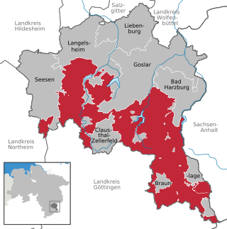
Goslar is a district in Lower Saxony, Germany. It is bounded by the districts of Göttingen, Northeim, Hildesheim and Wolfenbüttel, the city of Salzgitter, and by the states of Saxony-Anhalt and Thuringia (Nordhausen).

<span class="mw-page-title-main">Goslar</span> Place in Lower Saxony, Germany

Goslar is a historic town in Lower Saxony, Germany. It is the administrative centre of the district of Goslar and is located on the northwestern slopes of the Harz mountain range. The Old Town of Goslar and the Mines of Rammelsberg are UNESCO World Heritage Sites for their millennium-long testimony to the history of ore mining and their political importance for the Holy Roman Empire and Hanseatic League. Each year Goslar awards the Kaiserring to an international artist, called the "Nobel Prize" of the art world.

<span class="mw-page-title-main">Langelsheim</span> Place in Lower Saxony, Germany

Langelsheim is a town in the district of Goslar in Lower Saxony, Germany.

Oberharz is a former Samtgemeinde in the district of Goslar, in Lower Saxony, Germany. It was situated in the western part of the Harz, approx. 15 km southwest of Goslar. Its seat was in the town Clausthal-Zellerfeld. It was disbanded in January 2015, when its member municipalities merged into the town Clausthal-Zellerfeld.

Wildemann is a town and a former municipality in the district of Goslar, in Lower Saxony, Germany. It has been part of the town Clausthal-Zellerfeld since January 1, 2015. It is situated in the west of the Harz, northwest of Clausthal-Zellerfeld. It was part of the former Samtgemeinde Oberharz.

<span class="mw-page-title-main">Altenau, Lower Saxony</span> Stadtteil of Clausthal-Zellerfeld in Lower Saxony, Germany

Altenau ( ) is a town and a former municipality in the district of Goslar, in Lower Saxony, Germany. Since 1 January 2015 it is part of the town Clausthal-Zellerfeld.

<span class="mw-page-title-main">Innerste</span> River in Germany

The Innerste is a river in Lower Saxony, Germany. It is a right tributary of the Leine river and 101 km (63 mi) in length.

<span class="mw-page-title-main">Schulenberg im Oberharz</span> Village in Lower Saxony, Germany

Schulenberg im Oberharz is a village and a former municipality in the district of Goslar in Lower Saxony, Germany. It has been part of the town Clausthal-Zellerfeld since January 1, 2015.

<span class="mw-page-title-main">Schalke (Harz)</span>

The Schalke is a mountain, 762 m above sea level (NN), in the Upper Harz in the German state of Lower Saxony. It lies in Goslar district north of Clausthal-Zellerfeld and west of Schulenberg.

The Langelsheim–Altenau (Oberharz) railway was a railway line, that ran through the Upper Harz in Central Germany. It was also called the Upper Harz Railway or Harz Railway. It was built in order to enable the Magdeburg-Halberstadt Railway Company to access the mines in the Harz mountains.

<span class="mw-page-title-main">Weser-Harz-Heide Cycle Route</span>

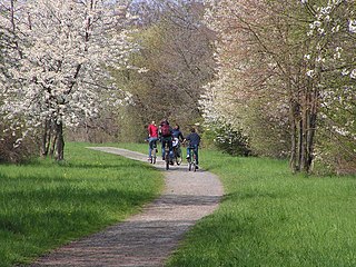
The Weser-Harz-Heide Cycle Route, which is Lower Saxony route no. 5, is a 397 km long-distance cycle path that runs from Hann. Münden, the source of the Weser, over the Harz mountains into the Lüneburg Heath in North Germany.

<span class="mw-page-title-main">Lautenthal</span> Formerly free mining town in Langelsheim, Germany

The formerly free mining town (Bergstadt) of Lautenthal in Germany is a state-recognised, climatic spa with around 1,570 inhabitants and has been part of the borough of Langelsheim since 1972.

<span class="mw-page-title-main">Upper Harz</span>

The Upper Harz is the northwestern and higher part of the Harz mountain range in Germany. The exact boundaries of this geographical region may be defined differently depending on the context. In its traditional sense, the term Upper Harz covers the area of the seven historical mining towns (Bergstädte) - Clausthal, Zellerfeld, Andreasberg, Altenau, Lautenthal, Wildemann and Grund - in the present-day German federal state of Lower Saxony. Orographically, it comprises the Harz catchment areas of the Söse, Innerste and Grane, Oker and Abzucht mountain streams, all part of the larger Weser watershed.

<span class="mw-page-title-main">Harzer Hexenstieg</span>

The Harz Witches' Trail is a footpath, just under 100 km long, in Germany that runs from Osterode through the Harz mountains and over its highest peak, the Brocken, to Thale. It is a project by the Harz Transport Association and Harz Club and is part of the system of trails known as the Harzer Wandernadel.
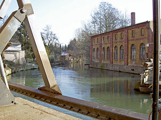
<span class="mw-page-title-main">Oberharz am Brocken</span> Town in Saxony-Anhalt, Germany

Oberharz am Brocken is a town in the Harz District, in Saxony-Anhalt, Germany. It was formed on 1 January 2010 by the merger of the town of Elbingerode with the municipalities of the former Verwaltungsgemeinschaft Brocken-Hochharz.

<span class="mw-page-title-main">Upper Harz Water Regale</span> UNESCO World Heritage Site in Lower Saxony, Germany

The Upper Harz Water Regale is a system of dams, reservoirs, ditches and other structures, much of which was built from the 16th to 19th centuries to divert and store the water that drove the water wheels of the mines in the Upper Harz region of Germany. The term regale, here, refers to the granting of royal privileges or rights in this case to permit the use of water for mining operations in the Harz mountains of Germany.

<span class="mw-page-title-main">Mining in the Upper Harz</span> Historical German industry

Mining in the Upper Harz region of central Germany was a major industry for several centuries, especially for the production of silver, lead, copper, and, latterly, zinc as well. Great wealth was accumulated from the mining of silver from the 16th to the 19th centuries, as well as from important technical inventions. The centre of the mining industry was the group of seven Upper Harz mining towns of Clausthal, Zellerfeld, Sankt Andreasberg, Wildemann, Grund, Lautenthal und Altenau.

<span class="mw-page-title-main">Harz (Landkreis Goslar)</span> Uninhabited place in Lower Saxony, Germany

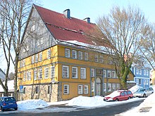
Harz is an unincorporated area in the German district of Goslar.

<span class="mw-page-title-main">Werner Grübmeyer</span> German politician (1926–2018)

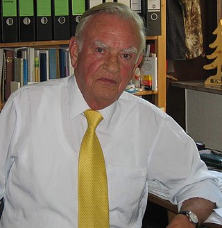
Werner Grübmeyer was a German politician. He was a member of the Christian Democratic Union (CDU).

References

  1. "Direktwahlen in Niedersachsen vom 12. September 2021" (PDF). Landesamt für Statistik Niedersachsen. 13 October 2021.
  2. "LSN-Online Regionaldatenbank, Tabelle A100001G: Fortschreibung des Bevölkerungsstandes, Stand 31. Dezember 2021" (in German). Landesamt für Statistik Niedersachsen.
  3. Evert Heusinkveld. Die Innerstetalbahn Langelsheim - Altenau, p. 11. Nordhorn 2007
  4. "L'Aigle découverte - Nos villes jumelles". Ville de L'Aigle. Archived from the original on 2013-08-01. Retrieved 2013-07-20.