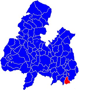
A townland is a small geographical division of land, historically and currently used in Ireland and in the Western Isles in Scotland, typically covering 100–500 acres (40–202 ha). The townland system is of Gaelic origin, antedating the Norman invasion, and most have names of Irish origin. However, some townland names and boundaries come from Norman manors, plantation divisions, or later creations of the Ordnance Survey. The total number of inhabited townlands in Ireland was 60,679 in 1911. The total number recognised by the Irish Place Names database as of 2014 was 61,098, including uninhabited townlands, mainly small islands.
Lagganstown is an area in County Tipperary, Ireland. Lagganstown Upper and Lagganstown Lower are townlands within the civil parish of Relickmurry and Athassel and historical barony of Clanwilliam.
Danesfort is a small rural area in County Kilkenny, Ireland, located approximately 6 km from Kilkenny City on the N10. It is also the name of a civil parish in County Kilkenny. The local area consists of one primary school, a local GAA pitch, a Roman Catholic Church. A creche, a community centre and a care home for the elderly. The townland is divided almost equally either side of the road. Danesfort's flag is the same colour as that of its county, Kilkenny.
Rossmore is a small village and townland in County Tipperary in Ireland. It is in the civil parish of Clonoulty, barony of Kilnamanagh Lower. It is located in the electoral division (ED) of Clonoulty West. It is also half of the Clonoulty and Rossmore parish in the Roman Catholic Archdiocese of Cashel and Emly.
Newtown, Ormond Lower is a townland in the historical Barony of Ormond Lower, County Tipperary, Ireland. It is located in the civil parish of Dorrha, west of Rathcabbin.
Uskane is a townland, a civil parish in the historical barony of Ormond Lower and an Electoral division in County Tipperary in Ireland.
Graigue a townland in the civil parish of Dorrha in the Barony of Ormond Lower, County Tipperary, Ireland. It is located in the extreme north of the county, east of Rathcabbin and is one of 12 townlands in County Tipperary known as Graigue in English.
There are two townlands with the name Newtown, in the Barony of Owney and Arra in County Tipperary, Ireland.
There are two townlands with the name Newtown, in the Barony of Kilnamanagh Upper in County Tipperary, Ireland.
There are two townlands with the name Newtown, in the Barony of Ikerrin in County Tipperary, Ireland.
There are three townlands with the name Newtown, in the Barony of Middle Third in County Tipperary, Ireland.
There are two townlands with the name Newtown, in the Barony of Clanwilliam in County Tipperary, Ireland.

Kilbarron is a civil parish and a townland in the historical barony of Ormond Lower, County Tipperary in Ireland. It is located west of Borrisokane.
Monsea is a civil parish and townland in the Baronies of Ormond Lower and Owney and Arra in County Tipperary, Ireland. Nine of the townlands within the civil parish are located in Ormond Lower with three townlands located in Owney and Arra.
Knigh is a townland and civil parish in the historical Barony of Ormond Lower in County Tipperary, Ireland. It is located between Nenagh and Puckaun.
Aglish is a small settlement in County Tipperary in Ireland. It is in the Civil parish and electoral division of Aglishcloghane in the historical barony of Ormond Lower. The village is approximately 7 kilometres (4 mi) north of Borrisokane and 1 km (0.6 mi) east of the R438 road.

Ballymurreen, also written Ballymoreen, is a civil parish and an electoral division in County Tipperary, Ireland. It is one of 21 civil parishes in the barony of Eliogarty.

Buolick is a townland in the civil parish of the same name in County Tipperary, Ireland. It is approximately 2 square kilometres (0.8 sq mi) in area, and had a population of 27 people as of the 2011 census of Ireland.

Farbill is a barony in east County Westmeath, in Ireland. It was formed by 1672. It is bordered by County Meath to the south and east and three other baronies: Fartullagh, Moyashel and Magheradernon and Delvin. The largest centre of population in the barony is the town of Kinnegad.

Upperthird or Upper Third is a barony in County Waterford, Ireland.


