Yellandu is a town in Bhadradri Kothagudem district of the Indian state of Telangana. It is located in Yellandu mandal of Kothagudem revenue division.
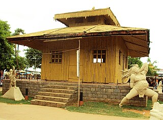
Parnasala is a village in the Dummugudem mandal in the newly formed Bhadradri Kothagudem district of Telangana, India. The village is accessible by road and boats and is situated 32 km from the temple town of Bhadrachalam.

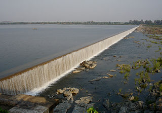
Bhadrachalam is a census town in Bhadradri Kothagudem district in the Indian state of Telangana. It is an important Hindu pilgrimage town with the Bhadrachalam Temple of Rama, situated on the banks of Godavari River. It is located 312 kilometres (194 mi) east of state capital, Hyderabad,115 kilometres (71 mi) from Khammam,178 kilometres (111 mi) from Suryapet,180 kilometres (112 mi) from Warangal,187 kilometres (116 mi) from Vijayawada,220 kilometres (137 mi) and 350 kilometres (217 mi) from Visakhapatnam.

Kothagudem is a city in Telangana. It serves as the headquarters of the Bhadradri Kothagudem district of the Indian state of Telangana. It was a portion of large Zamindari estate known as Husanabad Shankaragiri or Palvancha Zamindari in the Nizam's Dominion. Estate name was given by Captain Glasfurd. The Zamindar of Bhadrachalam was Zamindar of Palvancha also.

Khammam district is a district in the eastern region of the Indian state of Telangana. The city of Khammam is the district headquarters. The district shares boundaries with Suryapet, Mahabubabad, Bhadradri districts and with Eluru and NTR districts.

Manuguru is a census town and mandal in Bhadradri Kothagudem district in the Indian state of Telangana. It falls under the Mahaboobabad Parliamentary constituency and the Pinapaka Assembly constituency. Manuguru is an urban area situated on the banks of the Godavari River. The town has the Singareni coal mines, that provide many jobs, and a power plant.
Chunchupalle is a census town in Bhadradri Kothagudem district of the Indian state of Telangana. It is located in Chunchupalli mandal of Kothagudem revenue division.

Palvancha is a town in Bhadradri district of the Indian state of Telangana. It is located in Palvancha mandal of Kothagudem revenue division.
Cherla is a mandal in Bhadradri Kothagudem district in the state of Telangana. It is located on the banks of River Godavari.
Gundala is a mandal of Bhadradri Kothagudem District of Telangana state in India. It is located at and is near the town of Kothagudem. The headquarters of the sub-division are in the village of Gundala. The sub-division has 17 villages under its administration. Markode, Muthapuram and Lingagudem are the other populated regions in the mandal.
Dummugudem is a village in Bhadradri Kothagudem district of the Indian state of Telangana. It is located in Dummugudem mandal of Bhadrachalam revenue division.
Dammapeta is a mandal in Bhadradri Kothagudem district, Telangana.
Pinapaka is a Mandal in Bhadradri Kothagudem district, Telangana.
Aswaraopeta is a mandal in Bhadradri Kothagudem district, Telangana.
Julurpad or Julurpadu is a mandal in Bhadradri Kothagudem district, Telangana, India.
Chandrugonda is a village in Chandrugonda mandal in Bhadradri Kothagudem district of Telangana, India.
Tekulapalle, Tekulapalli or Tekulapally is a Mandal in Bhadradri Kothagudem district of Telangana state, India.

Mahabubabad district also known as Manukota district is a district in the Indian state of Telangana. The district was carved out from the erstwhile Warangal district following the re-organisation of districts in the state in October 2016. The district shares boundaries with Suryapet, Khammam, Bhadradri, Warangal, Mulugu and Jangaon districts.

Bhadradri Kothagudem is a district in the east of the Indian state of Telangana. Kothagudem is the district headquarters. It is the largest district in Telangana, with an area of 7483 km2. It borders the districts Khammam, Mahabubabad, Mulugu, Eluru and East Godavari, and shares a boundary with the bordering states Chhattisgarh and Andhra Pradesh. The district comprises 24 mandals and 2 revenue divisions, Kothagudem and Bhadrachalam.
Bethampudi is a village in Tekulapalli Mandal, Bhadradri Kothagudem District, Telangana, India. It is located near the boundary with Khammam District, approximately 12 kilometres west of the district seat Kothagudem, and 6 kilometres northeast of the mandal seat Tekulapalli. In 2011, the village has a total population of 25,461.

