
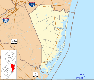
The Toms River is a 41.7-mile-long (67.1 km) freshwater river and estuary in Ocean County, New Jersey in the United States.
The Bass River is a 4.7-mile-long (7.6 km) tributary of the Mullica River in southeastern New Jersey in the United States.

The Oswego River is a 23.7-mile-long (38.1 km) tributary of the Wading River in the southern New Jersey Pine Barrens in the United States.
English Creek is a 6.0-mile-long (9.7 km) tributary of the Great Egg Harbor River in southeast New Jersey in the United States.
Tulpehocken Creek is a 7.7-mile-long (12.4 km) tributary of the Wading River in Burlington County in the southern New Jersey Pine Barrens in the United States.
Oyster Creek is a 10.4-mile-long (16.7 km) tributary of Barnegat Bay in southeastern New Jersey in the United States.
Mount Misery Brook is a tributary of Greenwood Branch in the southern New Jersey Pine Barrens in the United States.
The Cinnaminson Township Public Schools is a comprehensive community public school district that serves students in kindergarten through twelfth grade from Cinnaminson Township, in Burlington County, New Jersey, United States.

WCHR-FM, known as "105.7 The Hawk", "Classic Rock for the Jersey Shore, 105.7 The Hawk" or in reverse "105.7 The Hawk, Classic Rock for the Jersey Shore", is a Manahawkin, New Jersey radio station broadcasting at 105.7 FM with a classic rock format. It is owned by Townsquare Media.

West Berlin is an unincorporated community located within Berlin Township in Camden County, New Jersey, United States. The area is served as United States Postal Service ZIP code 08091.

Vincentown is an unincorporated community located within Southampton Township in Burlington County, New Jersey, United States. The area is served as United States Postal Service ZIP code 08088.
WFPG is an adult contemporary music radio station based in Atlantic City, New Jersey. Its transmitter is located in Atlantic City, while studios are in Northfield, New Jersey.
The Bass River Township School District is a community public school district that serves students in pre-kindergarten through sixth grade from Bass River Township, in Burlington County, New Jersey, United States.
The Island Heights School District is a community public school district that serves students in kindergarten through sixth grade from Island Heights in Ocean County, New Jersey, United States.
Ocean Gate School District is a community public school district that serves students in kindergarten through sixth grade from Ocean Gate in Ocean County, New Jersey, United States.
The Cape May County Technical School District is a regional public school district that offers occupational and academic instruction for public high school and adult students in Cape May County, New Jersey, United States.
Gilford Park is an unincorporated community located within Toms River in Ocean County, New Jersey, United States.
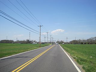
Fostertown is an unincorporated community located within Lumberton Township, in Burlington County, New Jersey, United States. The site was founded in 1735 by William Foster where he set up a plantation on modern-day West Bella Bridge Road. The area is largely farmland with some houses and a high-voltage power line dotting the landscape.
Fellowship is an unincorporated community located within Mount Laurel Township, in Burlington County, New Jersey, United States. The community of Fellowship was originally settled by a Quaker named George Roberts. Fellowship was the most developed of the settlements that comprised Mount Laurel. The community had included two general stores, a wagon shop, a shoe shop, a blacksmith shop, mechanics shops and a boarding school. Today, the community of Fellowship is surrounded by several business establishments and residential subdivisions.
Ancora is an unincorporated community within Winslow Township, in Camden County, New Jersey, United States. The community is home to Ancora Psychiatric Hospital, located on Route 143.


