
Gulu is a City in the Northern Region of Uganda. The regional headquarters are located in the city of Gulu, which is also the administrative capital of Northern Uganda The city consist of two main divisions... Gulu west and Gulu east.
Tororo is a town in the Eastern Region of Uganda. It is the main municipal, administrative, and commercial center of Tororo District.

Murchison Falls National Park (MFNP) is a national park in Uganda and managed by the Ugandan Wildlife Authority. It is in north-western Uganda, spreading inland from the shores of Lake Albert, around the Victoria Nile, up to the Karuma Falls.
Adjumani is a town in the Northern Region of Uganda. It is the main municipal, administrative, and commercial centre of Adjumani District. The district is named after the town.
PostBank Uganda is a commercial bank in Uganda, licensed and supervised by the Bank of Uganda, the country's central bank and national banking regulator. The bank received her tier-1 banking license in December 2021.
Kigumba is a town in Kiryandongo District, northwestern Uganda. It is one of the urban centers in the district. The other urban centres in Kiryandongo District include: (a) Karuma b) Kiryandongo (c) Bweyale and (d) Masindi Port.
The Karuma Hydroelectric Power Station is a 600 MW hydroelectric power project under construction in Uganda. When completed, it will be the largest power-generating installation in the country.
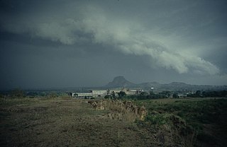
Karuma Falls is a town in Uganda.
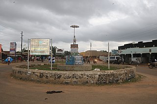
Kiryandongo is a town in the Western Region of Uganda. It is the main municipal, administrative, and commercial center of Kiryandongo District.
Kiryandongo Refugee Settlement is a refugee camp in Bweyale in Kiryandongo district Uganda.
Rwekunye–Apac–Aduku–Lira–Kitgum–Musingo Road is a road in the Northern Region of Uganda, connecting the towns of Masindi Port in Kiryandongo District to Apac in Apac District, Lira in Lira District, Acholibur in Pader District, Kitgum in Kitgum District, and Musingo in Lamwo District at the international border with South Sudan.
Rwekunye is a settlement in Kiryandongo District in the Western Region of Uganda.
Kigumba–Masindi–Hoima–Kabwoya Road is a road in the Western Region of Uganda, connecting the towns of Kigumba in Kiryandongo District, Masindi in Masindi District, Hoima in Hoima District and Kabwoya, in Kikuube District.
Kiryandongo General Hospital, is a hospital in the Western Region of Uganda.
The Restoration Gateway Hospital (RGH), also Restoration Gateway Medical Centre, is a private, Christian-affiliated general medical facility in Uganda. The hospital, which has been under construction since 2012, is being expanded in phases.
Hellen Kahunde, also Helen Kahunde, is a Ugandan educator and politician who serves as the Member of Parliament representing the Kiryandongo District Women' Constituency in the 10th Parliament.
The Kampala–Gulu Highway, also Kampala–Gulu Road, is a road connecting the capital city of Kampala, in the Central Region, with the city of Gulu, the largest urban centre in the Northern Region of Uganda.

Ugandan People's Defence Force Air Force, more commonly known as Ugandan Air Force, is the branch of the Uganda People's Defence Force that deals with the air warfare. It headquarters is located at Entebbe, Uganda. The current air force commander is Charles Lutaaya, while Emmanuel Kwihangana serves as chief of air staff.
