Masindi is a town in the Western Region of Uganda. It is on the road between Kampala and the Murchison Falls National Park. It is the site of the headquarters of the Masindi District.

Murchison Falls National Park (MFNP) is a national park in Uganda and managed by the Ugandan Wildlife Authority. It is in north-western Uganda, spreading inland from the shores of Lake Albert, around the Victoria Nile, up to the Karuma Falls.
Katakwi is a town in the Eastern Region of Uganda. It is the main municipal, administrative, and commercial center of Katakwi District and the site of the district headquarters. It borders Moroto District.

Buliisa District is a district in Western Uganda. As with most Ugandan districts, Buliisa District is named after its "main town" Buliisa, where the district headquarters are located. Bugungu has 6 sub counties Kigwera, Ngwedo, Buliisa, Butiaba, Kihungya, and Biiso and 3 town councils.
Kiwoko is a small town in the Central Region of Uganda. It is one of the municipalities in Nakaseke District.

Kajjansi is a town in Central Uganda. It is one of the urban centers in Wakiso District.
Kigumba is a town in Kiryandongo District, northwestern Uganda. It is one of the urban centers in the district. The other urban centres in Kiryandongo District include: (a) Karuma b) Kiryandongo (c) Bweyale and (d) Masindi Port.
Masindi Port is a town in the Western Region of Uganda. The name also applied to the sub-county, where the own sits and forms the sub-county headquarters.
Karuma Falls is a town in Uganda.
Kalule is a town in Luweero District in Central Uganda.
Gombe, Butambala, often referred to simply as Gombe, is a municipality in Butambala District in the Central Region of Uganda. It is the main municipal, administrative, and commercial center of the district and the site of the district headquarters.

Nwoya District is a district in Northern Uganda. Like most districts in Uganda, it is named after its main municipal, administrative and commercial center, Nwoya, the location of the district headquarters.

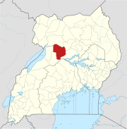
Kiryandongo District is a district in Western Uganda. Like many other Ugandan districts, it is named after its 'chief town', Kiryandongo, where the district headquarters are located.
Kigumba Petroleum Institute, also referred to as Uganda Petroleum Institute or as Uganda Petroleum Institute, Kigumba (UPIK), is a government-owned, national center for training, research and consultancy in the field of petroleum exploration, recovery, refinement and responsible utilization in Uganda.
Rwekunye–Apac–Aduku–Lira–Kitgum–Musingo Road is a road in the Northern Region of Uganda, connecting the towns of Masindi Port in Kiryandongo District to Apac in Apac District, Lira in Lira District, Acholibur in Pader District, Kitgum in Kitgum District, and Musingo in Lamwo District at the international border with South Sudan.
Rwekunye is a settlement in Kiryandongo District in the Western Region of Uganda.
Kigumba–Masindi–Hoima–Kabwoya Road is a road in the Western Region of Uganda, connecting the towns of Kigumba in Kiryandongo District, Masindi in Masindi District, Hoima in Hoima District and Kabwoya, in Kikuube District.
Karuma is a settlement in the Western Region of Uganda.
The Kampala–Gulu Highway, also Kampala–Gulu Road, is a road connecting the capital city of Kampala, in the Buganda Region, with the city of Gulu, the largest urban centre in the Northern Region of Uganda.
Masindi–Biso Road is a road in the Western Region of Uganda, connecting the city of Masindi, in Masindi District and the town of Biso, in Buliisa District in the oil-rich Albertine Graben.