Related Research Articles

Sandy Hill is a neighbourhood in Ottawa, Ontario, located just east of downtown. The neighbourhood is bordered on the west by the Rideau Canal, and on the east by the Rideau River. To the north it stretches to Rideau Street and the Byward Market area while to the south it is bordered by the Queensway highway and Nicholas Street. The area is named for its hilliness, caused by the river, and its sandy soil, which makes it difficult to erect large buildings. It is home to a number of embassies, residences and parks. Le Cordon Bleu operates its Canadian school there, at the opposite end of Sandy Hill from the University of Ottawa.

The Glebe is a neighbourhood in Ottawa, Ontario, Canada. It is located just south of Downtown Ottawa in the Capital Ward. As of 2016, the neighbourhood had a population of 13,055.
Riverview is a neighbourhood in Ottawa, Ontario, Canada. It is southeast of the downtown adjacent to the Rideau River, its location on which is its namesake. The 2021 Census population of Riverview is 13,113.

Vanier is a neighbourhood in the Rideau-Vanier Ward of the east end of Ottawa, Ontario, Canada. Historically francophone and working class, the neighbourhood was a separate city until being amalgamated into Ottawa in 2001. It no longer has a majority francophone population. By 2012 its francophone population had shrunk to less than 40% from 63% in the early 1980s. The neighbourhood is located on the east bank of the Rideau River, across from the neighbourhoods of Lowertown and Sandy Hill, and just south of Rockcliffe Park, New Edinburgh, Lindenlea, and Manor Park. To the east of Vanier are the suburbs of Gloucester. Vanier has a relatively small area with a high population density.
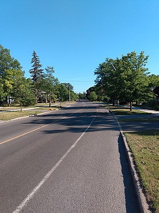
New Edinburgh is a neighbourhood in Rideau-Rockcliffe Ward, in Ottawa, Ontario, Canada. It is located to the northeast of the downtown core. It is bordered on the west by the Rideau River, to the north by the Ottawa River, to the south by Beechwood Avenue, and on the east by Springfield Road and the former Rockcliffe Park village limits.
Old Ottawa South is an older urban neighbourhood in Capital Ward in Ottawa, Ontario, Canada. Old Ottawa South is a relatively small and compact neighbourhood, located between the Rideau Canal and the Rideau River. The eastern boundary is Avenue Road. Bronson Avenue forms the western border of the residential neighbourhood. Carleton University is on the other (western) side of Bronson but the campus can be considered to be geographically within Old Ottawa South as the campus is also nestled between the river and the canal.
Wellington Street is a major street in Ottawa, Canada. It is notable for being the main street of the Parliamentary Precinct of the Parliament of Canada. It is one of the first two streets laid out in Bytown in 1826. The street runs from Vimy Place, just west of Booth Street, to the Rideau Canal where it connects with Rideau Street and delimits the northern border of the downtown core. It is named after the Duke of Wellington, in recognition of his role in the creation of the Rideau Canal, and therefore of Ottawa.
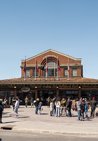
The ByWard Market, is a retail and entertainment district in the downtown core of Ottawa, Ontario, Canada. It is located east of the government and business district. The Market district includes the market buildings and open-air market along George, York, ByWard, and William street.

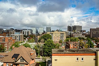
Downtown Ottawa is the central area of Ottawa, Ontario, Canada. It is sometimes referred to as the Central Business District and contains Ottawa's financial district. It is bordered by the Ottawa River to the north, the Rideau Canal to the east, Gloucester Street to the south and Bronson Avenue to the west. This area and the residential neighbourhood to the south are also known locally as 'Centretown'. The total population of the area is 5,501.

Old Ottawa East or just Ottawa East is a neighbourhood in Capital Ward in central Ottawa, Ontario, Canada. It is located south of Nicholas Street and between the Rideau Canal and the Rideau River, with Avenue Road marking the southern border. To the south is the neighbourhood of Old Ottawa South and to the northeast is Sandy Hill. Old Ottawa East includes the Lees Avenue area. The Flora Footbridge, which opened to pedestrians in 2019, connects the community to The Glebe.
Alta Vista is a neighbourhood in Alta Vista Ward in Ottawa, Ontario, Canada. Its boundaries according to the Alta Vista Community Association are that part of Alta Vista Ward south of Smyth Road in the north, north of Walkley Road and east of the Rideau River, and west of the "greenspace underneath Haig Drive". However, the name is ambiguous, as there are several sub-neighbourhoods in this area,, as the neighbourhood could refer to the ward as a whole, down to the core Alta Vista area,, centred on Alta Vista Drive.
Lower Town (also spelled "Lowertown" is a neighbourhood in Rideau-Vanier Ward in central Ottawa, Ontario, Canada, to the east of downtown. It is the oldest part of the city. It is bounded by Rideau Street to the south, the Ottawa River to the west and north and the Rideau River to the east. It includes the commercial Byward Market area in the south-western part, and is predominantly residential in the north and east.

Ottawa—Vanier is a provincial electoral district in Ottawa, Ontario, Canada, that has been represented in the Legislative Assembly of Ontario since 1908. It is located in the east end of Ottawa.

Rideau-Vanier Ward is a ward in the city of Ottawa, designated as Ward 12 and represented on Ottawa City Council. It was originally created in 1994 as a Ward for the Regional Council of the Regional Municipality of Ottawa-Carleton.
Wellington Ward was one of the original five wards of the city of Ottawa, Ontario, Canada created in 1855 from West Ward in Bytown, Upper Canada. It existed until 1994 when it was amalgamated with Dalhousie Ward to become Somerset Ward. The original ward consisted of the city west of the Rideau Canal and south of Wellington Street. It has traditionally consisted of Ottawa's Centretown and Downtown neighbourhoods. Prior to 1952, it consisted of the area between Bank Street and Bronson Avenue. In 1952, it merged with Central Ward, to its east, and lost some of its former territory to Dalhousie Ward on its west.
Ottawa Ward is a former ward in Ottawa, Canada. It was one of the original wards of the city, created in 1855 from parts of Centre Ward and East Ward in Bytown. It was abolished in 1952, when it was overtaken by By Ward.
St. George's Ward was one of the original five wards of the city of Ottawa, Ontario, Canada created in 1855. out of parts of East Ward and Centre Ward, which existed in Bytown. It existed until 1972 when it merged with By Ward to become By-St. George's Ward. It was recreated in 1980, until it was abolished for a final time in 1994, when it merged with part of By-Rideau Ward to form Bruyère-Strathcona Ward.
Centretown is a neighbourhood in Somerset Ward, in central Ottawa, Ontario, Canada. It is defined by the city as "the area bounded on the north by Gloucester Street and Lisgar Street, on the east by the Rideau Canal, on the south by the Queensway freeway and on the west by Bronson Avenue." Traditionally it was all of Ottawa west of the Rideau Canal, while Lower Town was everything to the east. For certain purposes, such as the census and real estate listings, the Golden Triangle and/or Downtown Ottawa is included in Centretown and it is considered part of Centretown by the Centretown Citizens Community Association as well as being used in this way in casual conversation.

The Golden Triangle is a sub-neighbourhood of Centretown in Somerset Ward in central Ottawa, Ontario, Canada. It borders Elgin Street, at its west, and the Rideau Canal, at its east. The Ottawa City Hall is to its north and the Elgin Street Police Station to its south. According to the 2016 Canada Census, the total population for this area was 5,778.
References
- ↑ Taylor, John H. (1986). Ottawa: An Illustrated History. ISBN 9780888629807.