Swamimalai is a panchayat town that is a suburb near Kumbakonam in Thanjavur District in the Indian state of Tamil Nadu. It lies on the banks of river Kaveri and is the site of the fourth of the six abodes of the Hindu deity Murugan (Kartikeya).
Lohardaga is a town and the district headquarters of Lohardaga district in the Indian state of Jharkhand, west of Ranchi, the state capital. Earlier Lohardaga was the commissionary headquarters for Chotanagpur. It was only later that the commissionary of Chotanagpur was shifted to Ranchi. The commissioner's office still exists and it houses the Lohardaga Municipality office.

Ranibennur [Ranebennur] is a Biggest Commercial city in Haveri district and in Central Karnataka, India.It is situated 300 kilometres (190 mi) northwest of Bengaluru, the capital of Karnataka. Other nearby cities include Hubballi (108 km) and Mangaluru (271 km). It is also the largest city in Haveri district, both in terms of Area of ULB and Population.And also main Education centre with Engineering college & several degree colleges & most Number of ICSE & CBSE Schools situated in Ranebennur city. Ranebennur is Famous for its Biranji Rice, Mirchi-Mandaki & Hesaru vade specially maded Egg Rice & Delicious Ranebennur famous Mutton Enne khara food

Khetri Nagar is a town in the Neem Ka Thana district of Rajasthan in India. It is a part of the Shekhawati region. Khetri consists of two towns, "Khetri Town," founded by Raja Raja Bhopal Singh Ji, and "Khetri Nagar," which is about 10 km away from Khetri. Khetri Nagar, well known for its Copper Project, was built by and is under the control of Hindustan Copper Limited, a public sector undertaking under the Government of India. Khetri Nagar is also known as "Copper." There are many attached villages near Khetri Nagar, such as Manota Khurd; the people of this village were employed in mines.
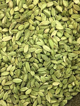
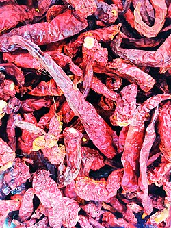
Haveri is a city and headquarters of Haveri district of Karnataka State in India. Haveri is famous for its cardamom garlands, Byadagi red chillies and Hukkeri Math. Around 25 km away, there is a place called Bada, which is the birthplace of the poet Kanakadasa.
Sumerpur is a city in the south part of Pali District of Rajasthan state in India. Named after Maharaja Sumer Singh of Jodhpur, it came into existence in 1912 on the northern bank of Jawai river. The town is headquarters of the Sumerpur revenue subdivision and Sumerpur Tahsil. Sumerpur is an important agricultural mandi for Pali, Sirohi and Jalore districts.
Ajara is a census town and the headquarters of Ajara Taluka in the Kolhapur district of Maharashtra, India. It is a developing city with a Nagar Panchayat.

Baldeogarh is a town and a nagar panchayat in Tikamgarh district in the state of Madhya Pradesh, India. It is also a Tehsil Headquarter.
Bhikhi is a municipal committee in Mansa district in the state of Punjab, India.
Chakpara is a census town in Bally Jagachha CD Block of Howrah Sadar subdivision in Howrah district in the Indian state of West Bengal. Chakpara is under the jurisdiction of Liluah Police Station of Howrah City Police.
Dhampur is a city and a municipal board in Bijnor district in the state of Uttar Pradesh, India. It is located at 29.51°N 78.50°E, and lies in Northern India.
Dhilwan is a town and a nagar panchayat in Kapurthala district in the state of Punjab, India.
Hirekeruru is a panchayat town in Haveri district in the Indian state of Karnataka. The name "the village of the big pond". The name is pronounced as "Hee ray kay roor".The near by city is Ranebennur which is Rich commodity market in seeds & wholesale cloth market. Hirekerur taluk people daily come Ranebennur to shopping
Honnāli is a town and a taluk headquarter in Davanagere district in the Indian state of Karnataka. Its name is derived from honnarali, which means "Blossom of gold".
Kasrawad is a tehsil and nagar panchayat in Khargone district in the Indian state of Madhya Pradesh. Kasrawad Assembly constituency is one of the 230 Vidhan Sabha constituencies of Madhya Pradesh state in central India.
Manawar is a town with tehsil in Dhar district in the Indian state of Madhya Pradesh. The name Manawar came from name of river Mān that flows at southern edge of the town. Pin code of Manawar is 454446.
Naravarikuppam is a town in Thiruvallur district in the Indian state of Tamil Nadu.
Panagar is a town with municipality in Jabalpur district in the Indian state of Madhya Pradesh.
Raybag is a taluka in Belgaum district in the Indian state of Karnataka. Its name is based on the words "Rai" and "bagh", meaning the king's (Rai's) garden (bagh).
Aremallapur is a village in the southern state of Karnataka, India. It is located in the Ranebennur taluk of Haveri district in Karnataka.