Byron, Ohio

Last updated

Location of Byron, Ohio OHMap-doton-Byron.png
Location of Byron, Ohio

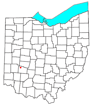
Byron is a small unincorporated community in southeastern Bath Township, Greene County, Ohio, United States. It sits at the intersection of Linebaugh and Dayton-Yellow Springs Roads, between Fairborn and Xenia. [1] Byron is located at 39°47′10″N83°58′51″W / 39.78611°N 83.98083°W / 39.78611; -83.98083 (39.7861705, -83.9807661), at an elevation of 915 feet (279 m). [2]

The community is part of the Dayton Metropolitan Statistical Area.

History

Byron was originally called Tylersville, after President John Tyler, and under the latter name was platted in 1841 on the road running between Yellow Springs and Dayton. [3] The present name honors Lord Byron, an English poet. [4] A post office called Byron was established in 1849, and remained in operation until 1902. [5]

Related Research Articles

<span class="mw-page-title-main">Greene County, Ohio</span> County in Ohio, United States

Greene County is located in the southwestern portion of Ohio. As of the 2020 census, the population was 167,966. Its county seat is Xenia and its largest city is Beavercreek. The county was established on March 24, 1803 and named for General Nathanael Greene, an officer in the Revolutionary War. Greene County is part of the Dayton, OH Metropolitan Statistical Area.

<span class="mw-page-title-main">Yellow Springs, Ohio</span> Village in Ohio, United States

Yellow Springs is a village in northern Greene County, Ohio, United States. The population was 3,697 at the 2020 census. It is part of the Dayton metropolitan area and is home to Antioch College.

<span class="mw-page-title-main">Little Miami Scenic Trail</span>

The Little Miami Scenic Trail is the fourth longest paved trail in the United States, running 78.1 miles (125.7 km) through five southwestern counties in the state of Ohio. The multi-use rail trail sees heavy recreational use by hikers and bicyclists, as well as the occasional horseback rider. Over 700,000 people made use of the trail in 2014.

<span class="mw-page-title-main">Casa de Oro, California</span> Unincorporated community in California, United States

Casa de Oro is a neighborhood in east San Diego County, California, United States. The community, twelve miles east of San Diego, is in the unincorporated town of Spring Valley and an unincorporated part of La Mesa. The United States Census Bureau has also divided the neighborhood between two census-designated places (CDPs), Spring Valley CDP and Casa de Oro-Mount Helix CDP. Casa de Oro's main thoroughfare is Campo Road.

<span class="mw-page-title-main">Lees Creek, Ohio</span> Unincorporated community in Ohio, U.S.

Lees Creek, also known as Centerville, is an unincorporated community in central Wayne Township, Clinton County, Ohio, United States. It lies at the intersection of State Route 729 with Cox Road, 6 miles south of Sabina and 12 miles (19 km) southeast of Wilmington, the county seat of Clinton County. It lies between the headwaters of the Middle Fork of Lees Creek, to the southeast, and the Anderson Fork of Caesar Creek. it had a post office, with the ZIP code 45138. The Post Office closed in 2012 and the town, including East Clinton High School, now carries a Sabina mailing address.

<span class="mw-page-title-main">Pricetown, Highland County, Ohio</span>

Pricetown is an unincorporated community in eastern Salem Township, Highland County, Ohio, United States.

<span class="mw-page-title-main">Cutler, Ohio</span> Unincorporated community in Ohio, U.S.

Cutler is an unincorporated community in southwestern Fairfield Township, Washington County, Ohio, United States. It has a post office with the ZIP code 45724. It lies at the intersection of State Route 555 and County Road 59 near Gilbert Run, a subsidiary of the Little Hocking River, which meets the Ohio River at Little Hocking to the southeast.

<span class="mw-page-title-main">White Cottage, Ohio</span>

White Cottage is an unincorporated community in central Newton Township, Muskingum County, Ohio, United States. It has a post office with the ZIP code 43791. It lies along U.S. Route 22 between Zanesville and Lancaster.

<span class="mw-page-title-main">Springhills, Ohio</span>

Springhills is an unincorporated community in northwestern Harrison Township, Champaign County, Ohio, United States. It lies at the intersection of State Route 245 with Crowl and Springhill-DeGraff Roads. Graves Creek, a subsidiary of the Great Miami River through Stony Creek, runs along the western edge of Springhills. It is located 6 miles (9.5 km) west of West Liberty and 11.5 miles (18.5 km) northwest of Urbana, the county seat of Champaign County.

<span class="mw-page-title-main">Fairhaven, Ohio</span> Unincorporated community in Ohio, U.S.

Fairhaven is an unincorporated community in eastern Israel Township, Preble County, Ohio, United States. It lies along State Route 177 at its intersection with Israel-Somers Road. Four Mile Creek, which feeds into Acton Lake in southern Preble County, runs on the western edge of Fairhaven. It is located 10½ miles southwest of Eaton, the county seat of Preble County. The community is part of the Dayton Metropolitan Statistical Area. Fairhaven Church and Fairhaven Community Church are both located in Fairhaven along State Route 177. Fairhaven Community Church hosts a free annual Dinner Drama for the community. Fairhaven is home to the historic Bunker Hill house, a stop along the Underground Railroad.

<span class="mw-page-title-main">Pyrmont, Ohio</span>

Pyrmont is an unincorporated community in northwestern Perry Township, Montgomery County, Ohio, United States. It centers at the intersection of Brookville–Pyrmont Pike and Sulphur Springs Road, extending to the intersection of Brookville–Pyrmont Pike and Providence Pike. Located in the far west of the county, it lies several miles from the city of Dayton; the nearest city is Brookville, three miles to the northeast. Pyrmont is a part of the Brookville Local School District. Pyrmont, which was on a stagecoach route, was a busy town before Interstate 70 was built near Brookville.

<span class="mw-page-title-main">Logansville, Ohio</span> Unincorporated community in Ohio, United States

Logansville is an unincorporated community in central Pleasant Township, Logan County, Ohio, United States. It lies along State Route 47 at its intersection with County Road 24. The Great Miami River flows southward along the western edge of Logansville. The community lies 2+12 miles (4 km) north of the village of De Graff and 9 miles west of the city of Bellefontaine, the county seat of Logan County. It is located at 40°20′44″N83°55′50″W, and its altitude is 1,010 feet (308 m).

<span class="mw-page-title-main">Brokensword, Ohio</span> Unincorporated community in Ohio, U.S.

Brokensword is an unincorporated community on the border between the Holmes and Lykens townships of Crawford County, Ohio, United States. Located at the intersection of the concurrent State Routes 19 and 100 with Brokensword Road, it is six miles north and two miles west of the city of Bucyrus, the county seat. Broken Sword Creek flows a short distance to the south of the community.

<span class="mw-page-title-main">Roxabell, Ohio</span>

Roxabell is an unincorporated community in central Concord Township, Ross County, Ohio, United States. It lies at the intersection of Davis Hill and Jamison Roads, little more than 1 mile south of the village of Frankfort. Two parts of the North Fork of Paint Creek, a subsidiary of the Ohio River through the Scioto River, pass near Roxabel. It is located slightly more than 3 miles north of State Route 28, midway between the cities of Chillicothe — the county seat of Ross County — and Greenfield.

<span class="mw-page-title-main">Xenia Station</span> Railway station in Ohio, the United States of America

Xenia Station, located at 150 Miami Avenue in Xenia, Ohio, in the United States, is a replica of Xenia's 1880s brick railroad station.

<span class="mw-page-title-main">Goes Station, Ohio</span> Unincorporated community in Ohio, U.S.

Goes Station is a small unincorporated community in northern Xenia Township, Greene County, Ohio, United States. It sits at the intersection of Snively Road and U.S. Route 68 between Xenia and Yellow Springs.

Carysville is an unincorporated community in Adams Township, Champaign County, in the U.S. state of Ohio.

Callahan Creek is a stream in Boone County in the U.S. state of Missouri. It is a tributary of Perche Creek.

Crows Fork Creek is a stream in Callaway County in the U.S. state of Missouri. Crows Fork is a tributary to Auxvasse Creek. Crows Fork begins with the confluence of Maddox Branch with Richland Creek at 38°53′16″N91°53′39″W northeast of Fulton. The stream flows south to southeast and enters Auxvasse Creek west of Reform at 38°47′10″N91°51′46″W.

Denlow is an unincorporated community in north central Douglas County in the Ozarks of Missouri. Denlow is located on Missouri Route 76, just west of the Fox Creek bridge.

References

  1. DeLorme. Ohio Atlas & Gazetteer. 7th ed. Yarmouth: DeLorme, 2004, p. 66. ISBN   0-89933-281-1.
  2. U.S. Geological Survey Geographic Names Information System: Byron, Ohio
  3. Broadstone, Michael A. (1918). History of Greene County, Ohio: Its People, Industries and Institutions, Volume 1. B.F. Bowen. p. 287.
  4. Dills, R. S. (1881). History of Greene County: Together with Historic Notes on the Northwest, and the State of Ohio ... Odell & Mayer. p. 239.
  5. "Greene County". Jim Forte Postal History. Archived from the original on March 12, 2016. Retrieved January 13, 2016.

39°47′10″N83°58′51″W / 39.78611°N 83.98083°W / 39.78611; -83.98083