
The Drakensberg is the eastern portion of the Great Escarpment, which encloses the central Southern African plateau. The Great Escarpment reaches its greatest elevation – 2,000 to 3,482 metres within the border region of South Africa and Lesotho.

Valley of Flowers National Park is an Indian national park which was established in 1982. It is located in Chamoli in the state of Uttarakhand and is known for its meadows of endemic alpine flowers and the variety of flora. This richly diverse area is also home to rare and endangered animals, including the Asiatic black bear, snow leopard, musk deer, brown bear, red fox and blue sheep. Birds found in the park include Himalayan monal pheasant and other high altitude birds.

Bình Phước is a province of Vietnam. It is located in the Southeast region of the country, to the north of Hồ Chí Minh City. It shares a border with Cambodia.

Kon Tum province lies in the Central Highlands region of Vietnam and shares borders with Laos and Cambodia. It has an area of 9,934 square km and a population of approximately 530,000. The economy is primarily agricultural.

Phú Quốc is the largest island in Vietnam. Phú Quốc and nearby islands, along with the distant Thổ Chu Islands, are part of Kiên Giang Province as Phú Quốc City, the island has a total area of 574 km2 (222 sq mi) and a permanent population of approximately 179,480 people. Located in the Gulf of Thailand, the island city of Phú Quốc includes the island proper and 21 smaller islets. Dương Đông ward is located on the west coast, and is also the administrative and largest town on the island. The other ward is An Thới on the southern tip of the island.

Central Highlands, Western Highlands or Midland Highlands is one of the regions of Vietnam. It contains the provinces of Đắk Lắk, Đắk Nông, Gia Lai, Kon Tum, and Lâm Đồng.
The Mnong language belongs to the Austro-Asiatic language family. It is spoken by the different groups of Mnong in Vietnam and a Pnong group in Cambodia.
Kon Ka Kinh National Park is a national park of Vietnam, established by the decision (167/2002/QĐ-TTg) on November 25, 2002 of the then Prime Minister, Phan Văn Khải.

Pù Mát National Park is a national park in Nghệ An Province, in Vietnam's North Central Coast region. It is part of the Western Nghệ An Biosphere Reserve.

Yok Don National Park is a national park located in Krông Na commune, Buôn Đôn District, Đắk Lắk Province, Tây Nguyên of Vietnam, 40 km west of Buôn Ma Thuột city. The park was established in 1991 to protect 582 km² of a biological area of khộp lowland forest. The total area is 1,155.45 km². It borders Mondulkiri Protected Forest (Cambodia) to the west and is part of maybe the largest protected area complex in southeast Asia

Cát Tiên is a district (huyện) of Lâm Đồng province in the Central Highlands region of Vietnam.
The Vietnam mouse-deer, also known as the silver-backed chevrotain, is an even-toed ungulate in the family Tragulidae known only from Vietnam. It was first described in 1910 by British zoologist Oldfield Thomas, who procured four specimens from Nha Trang in Annam. Little is known about its distribution and ecology. After 1910, the Vietnam mouse-deer was reported next in 1990 near Dak Rong and Buon Luoi in the Gia Lai Province. With increasing hunting pressure, habitat loss due to deforestation and no more reports of the species in the wild, the mouse-deer was feared to have gone extinct. The IUCN listed the species as Data Deficient in 2008. In 2019, a study confirmed the presence of the Vietnam mouse-deer in dry low-lying forests of southern Vietnam with camera trap evidence. The mouse-deer is characterised by a rough coat with a strange double-tone coloration unseen in other chevrotains; the front part of the body is reddish brown and contrasts strongly with the greyish posterior. It has big reddish brown ears, white and dark reddish brown marks on the throat.
Botum Sakor National Park is the largest national park of Cambodia. Situated on the coast of the Gulf of Thailand, Botum Sakor is a peninsula projecting southwest from the Cardamom Mountains. The national park comprises an area of 1,825.85 km2 (704.96 sq mi) and spans three districts of Koh Kong Province: Kiri Sakor, Botum Sakor and Koh Kong. The park is under the administration of the Cambodian Ministry of Environment.

Phước Bình National Park is a national park in the commune of Phước Bình, Bác Ái District, Ninh Thuận Province. It is located 62 km north-west from Phan Rang town, the capital of Ninh Thuận Province, on the border with Lâm Đồng and Khánh Hòa provinces. Phước Bình National Park was classified as a nature reserve by Decision 125/2002/QD dated 26 September 2002. On 8 June 2006 it was established as a national park under Decision number 822/QĐ-TTg dated 8 June 2006 by then Vice Prime Minister of Vietnam Nguyễn Tấn Dũng.

U Minh Thượng National Park or National Park of Upper U Minh is a national park in the province of Kiên Giang, Vietnam.
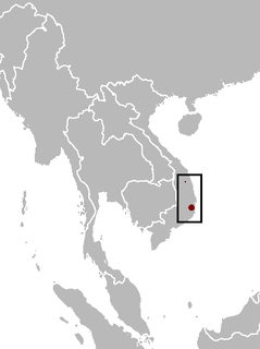
Bù Gia Mập is a rural district (huyện) of Bình Phước province in the Southeast region of Vietnam. It was established on 11 August 2009 on the land of Phước Long district remaining after the establishment of Phước Long town. At that time, it had a population of 147,967.
Rade is an Austronesian language of southern Vietnam. There may be some speakers in Cambodia. It is a member of the Chamic subgroup, and is closely related to the Cham language of central Vietnam.

Attapeu is a province of Laos in the southeast of the country. It has five districts: Samakkixay, Xaysetha, Sanamxay, Sanxay, and Phouvong, covering an area of 10,320 square kilometres (3,980 sq mi) with a population of 127,285. Its capital city lies at Attapeu.

Many areas of Vietnam are under protection. While the national reserves cover small areas of scientific significance with restricted access, the national parks also cover wetlands of Ramsar designated areas and BirdLife International inscribed bird areas. The largest of the national parks initially covered were the Cúc Phương National Park, the Cát Tiên National Park, and the Côn Đảo National Park which to start with were forest areas cum reserves or prohibited areas. The objective for creating national parks was to allow access to the reserved areas as a part of ecotourism and cultural needs with full attention to the basic approach of conservation of natural environmental resources.
The Battle of Quang Duc took place from 30 October to 10 December 1973 when North Vietnamese forces attempted to occupy part of Quang Duc Province to expand their logistical network from Cambodia into South Vietnam. While the North Vietnamese attacks were initially successful they were eventually forced out by the South Vietnamese.


