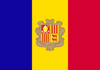
Andorra, officially the Principality of Andorra, is a sovereign landlocked country on the Iberian Peninsula, in the eastern Pyrenees, bordered by France to the north and Spain to the south. Believed to have been created by Charlemagne, Andorra was ruled by the count of Urgell until 988, when it was transferred to the Roman Catholic Diocese of Urgell. The present principality was formed by a charter in 1278. It is currently headed by two co-princes: the bishop of Urgell in Catalonia, Spain and the president of France. Its capital and largest city is Andorra la Vella.

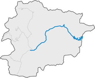
Andorra is a small, landlocked country in southwestern Europe, located in the eastern Pyrenees mountain range and bordered by Spain and France. With an area of 468 km², it is the sixth smallest country in Europe and also the largest of the European microstates.
Andorra is a landlocked country in Europe, which lies between France and Spain, whose transport infrastructure is primarily road provision.

Altorricón or El Torricó is a municipality located in the comarca of La Litera/La Llitera in the province of Huesca, Aragon, Spain. With an extension of 32.03 km2, the municipal district of Altorricón lies on the southern part of La Llitera, limiting with El Segrià (Almacelles). The district is surrounded north and south by Tamarite de Litera. The municipality contains the town of Altorricón and the uninhabited towns of Cuquet, Montanera and Lo Tossal as well as the old church of San Bartolomé de Altorricón.

La Massana is one of the seven parishes of the Principality of Andorra. It is located in the northwest of the country. La Massana is also the name of the main town of the parish. The name Massana derives from the Latin name mattianam for a variety of apple. Other settlements in the parish are Pal, Arinsal, Erts, Sispony, Anyós, L'Aldosa de la Massana, Puiol del Pui, Escàs, Els Plans, Mas de Ribafeta, Xixerella and Pui.

The Carretera Central (CC), meaning "Central Road", is a west-east highway spanning the length of the island of Cuba.

Turismo Carretera is a popular stock car racing series in Argentina, and the oldest auto racing series still active in the world. The series is organized by Asociación Corredores de Turismo Carretera.

The Carretera Austral is the name given to Chile's Route 7. The highway runs south for about 1,240 kilometers (770 mi) from Puerto Montt to Villa O'Higgins, passing through rural Patagonia.

The Route nationale 20 (N20) is a trunk road (nationale) between Paris and the frontier with Spain heading south through the heart of France and passing through the Cathedral City of Orléans and Toulouse. The road forks at Col de Puymorens with one branch being the Route nationale 22 which leads to Andorra. In winter, avalanches sometimes close the road.

Puerto Rico Highway 14 (PR-14) is a main highway connecting Ponce to Cayey, Puerto Rico. The road runs the same course as the historic Carretera Central. The Ponce-to-Coamo section of PR-14 was built under the direction of Spanish engineer Raimundo Camprubí Escudero.

European traffic signs present relevant differences between countries despite an apparent uniformity and standardisation. Most European countries refer to the 1968 Vienna Convention on Road Signs and Signals. The convention has been adopted by the following countries : Albania, Armenia, Austria, Belarus, Belgium, Bosnia and Herzegovina, Bulgaria, Croatia, Cyprus, the Czech Republic, Denmark, Estonia, Finland, France, Georgia, Germany, Greece, Hungary, Italy, Latvia, Liechtenstein, Lithuania, Luxembourg, Moldova, Montenegro, Netherlands, North Macedonia, Norway, Poland, Portugal, Romania, Russia, San Marino, Serbia, Slovakia, Slovenia, Spain, Sweden, Switzerland, Turkey, Ukraine and the United Kingdom. The convention has not been adopted by Ireland, Iceland or Malta.
The Carretera Central is a historic north–south central highway in Puerto Rico, linking the cities of San Juan and Ponce by way of Río Piedras, Caguas, Cayey, Aibonito, Coamo, and Juana Díaz. It crosses the Cordillera Central. Plans for the road started in the first half of the 19th century, and the road was fully completed in 1898. At the time the United States took possession of Puerto Rico in 1898, the Americans called it "the finest road in the Western Hemisphere."
Federal Highway 305D is a toll highway in Quintana Roo. It serves as a spur of Federal Highway 180D (Mérida-Cancún) to Playa del Carmen, creating a direct connection between Yucatán and Playa del Carmen and avoiding detours through Cancún or Tulum.

National Primary Route 35, or just Route 35 is a National Road Route of Costa Rica, located in the Alajuela province, and it is a road that serves the central north area of Costa Rica.
National Tertiary Route 606, or just Route 606 is a National Road Route of Costa Rica, located in the Guanacaste, Puntarenas provinces. It is known as Carretera a Monteverde, between Route 1 in Puntarenas province and Monteverde. It is the main access road to the dairy farms and tourist-attraction rain forests of Monteverde.

National Primary Route 2, formally known as Carretera Interamericana Sur, is the southern segment of the Pan-American Highway that traverses Costa Rica.
National Primary Route 34, official name Carretera Pacífica Fernández Oreamuno, and popularly known as Carretera Costanera Sur, or just Route 34, is a National Road Route and scenic route of Costa Rica, located in the Alajuela, Puntarenas provinces that connects Route 27 and Route 2 mostly along the central and south Pacific coast of the country, and is the recommended route over the Pan-American Highway when traveling between the south of the country to the Greater Metropolitan Area.
CG-2 is a road of the Andorra Road Network that connects Escaldes-Engordany to the border with France.

National Road Network of Costa Rica, are a series of numbered road routes that are managed through Costa Rica by the Ministry of Public Works and Transport (MOPT) and its subagency the National Road Council (Conavi).

