Transport in Andorra

Last updated

Andorra is a landlocked country in Europe, which lies between France and Spain, whose transport infrastructure is primarily road provision.

Contents

Railways

A train at Latour-de-Carol, one of the two stations serving Andorra Latour-de-Carol station - 2004-02-02.jpg
A train at Latour-de-Carol, one of the two stations serving Andorra

Andorra has no railways, and never had, although the line connecting Latour-de-Carol and Toulouse, which in turn connects to France's TGVs at Toulouse, runs within 2 kilometres (1.2 mi) of the Andorran border. One station in France is connected by bus to Andorra la Vella L'Hospitalet-près-l'Andorre (served by the SNCF). A bus service used to run to Latour-de-Carol, served by both SNCF's line to Toulouse and Spain's (Renfe's) line to Barcelona. [1] [2]

A new public transport system, "Metro Aeri", was proposed by the government in 2004, but has not been built. It would have been an elevated cable metro system that would glide above the city's river. [3]

Roads

CG-2, a major road in Andorra Andorra CG-2 horizontal.jpg
CG-2, a major road in Andorra

Andorra has a network of roads, with a total length of 269 km (167 mi), of which 198 km (123 mi) are paved, leaving 71 km (44 mi) of unpaved road. The main road to the north (France) goes through the Envalira pass, which is 2,409 metres (7,904 ft) high but nevertheless open all year round as it has a tunnel as well. The two main roads out of Andorra la Vella are the CG-1 to the Spanish border, and the CG-2 to the French border via the Envalira Tunnel near Pas de la Casa. [4] In winter, the main roads in Andorra are usually quickly cleared of snow and remain accessible, but the main road out of Andorra on the French side (RN-20 on the French side and CG-2 on the Andorran side) is less frequently cleared and is sometimes closed by avalanches. [5] Other main roads out of Andorra la Vella are the CG-3 and CG-4 to Arcalis and Pal, respectively.

Bus services cover all metropolitan areas and many rural communities, with services on most major routes running half-hourly or more frequently during peak travel times. There are frequent long-distance bus services from Andorra to Barcelona and Barcelona Airport, and also to Toulouse and Toulouse Airport, in each case taking approximately 3 hours. Bus routes also serve Girona Airport and Portugal via Lleida. Bus services are mostly run by private companies, but some local ones are operated by the government. The private bus companies are Autocars Nadal, Camino Bus, Cooperativa Interurbana Andorrana, Eurolines, Hispano Andorrana, and Novatel. [6]

Airways

There are no airports for fixed-wing aircraft within Andorra's borders but there are, however, heliports in La Massana (Camí Heliport), Arinsal and Escaldes-Engordany with commercial helicopter services. [7] [8]

Nearby airports located in Spain and France provide access to international flights for the Principality. There is an airport located in the neighbouring Catalan comarca of Alt Urgell, 12 km south of the Andorran-Spanish border, named Andorra–La Seu d'Urgell Airport. [9] Starting July 2015 it has operated commercial flights to Madrid and Palma de Mallorca, and as of September 2022 flight are operated to Madrid by Iberia Regional.

The nearest other airports are at Perpignan, France (156 km from Andorra) and Lleida, Spain (160 km from Andorra). The largest nearby airports are at Toulouse, France (165 km from Andorra) and Barcelona, Spain (215 km from Andorra). There are hourly bus services from both the Barcelona and Toulouse airports to Andorra.

See also

Related Research Articles

<span class="mw-page-title-main">Andorra</span> Country in Europe

Andorra, officially the Principality of Andorra, is a sovereign landlocked country on the Iberian Peninsula, in the eastern Pyrenees in Western Europe, bordered by France to the north and Spain to the south. Believed to have been created by Charlemagne, Andorra was ruled by the count of Urgell until 988, when it was transferred to the Roman Catholic Diocese of Urgell. The present principality was formed by a charter in 1278. It is currently headed by two co-princes: the bishop of Urgell in Catalonia, Spain and the president of France. Its capital and largest city is Andorra la Vella.

<span class="mw-page-title-main">Geography of Andorra</span>

Andorra is a small, landlocked country in southwestern Europe, located in the eastern Pyrenees mountain range and bordered by Spain and France. With an area of 468 km², it is the sixth smallest country in Europe and also the largest of the European microstates.

<span class="mw-page-title-main">Andorra la Vella</span> Capital of Andorra

Andorra la Vella is the capital and largest city of Andorra. It is located high in the east Pyrenees, between France and Spain. It is also the name of the parish that surrounds the capital.

<span class="mw-page-title-main">La Massana</span> Parish in Andorra

La Massana is one of the seven parishes of the Principality of Andorra. It is located in the northwest of the country. La Massana is also the name of the main town of the parish. The name Massana derives from the Latin name mattianam for a variety of apple. Other settlements in the parish are Pal, Arinsal, Erts, Sispony, Anyós, L'Aldosa de la Massana, Puiol del Pui, Escàs, Els Plans, Mas de Ribafeta, Xixerella and Pui.

<span class="mw-page-title-main">El Pas de la Casa</span> Place in Andorra

El Pas de la Casa is a ski resort, town, and mountain pass in the Encamp parish of Andorra, lying on the border with France.

<span class="mw-page-title-main">Arinsal</span> Place in La Massana, Andorra

Arinsal is a village in Andorra, set at an altitude of between 1550 and 2560 metres, close to the border with Spain at Tor, Pallars. In the summer Arinsal is home to walkers and bikers, as well as those who just want to relax in the mountain scenery. In the winter, it offers skiing and snowboarding for beginners, as well as a good selection of runs for intermediates.
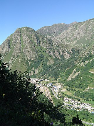
<span class="mw-page-title-main">L'Hospitalet-près-l'Andorre</span> Commune in Occitanie, France

L'Hospitalet-près-l'Andorre is a commune in the Ariège department of southwestern France.

This page contains the lists of airports in Europe by country, grouped by region. The lists include both military air bases and civilian airports.

Juberri or Juverri is a village in Andorra, located in the south of the country near the Spanish border, above the main CG-1 road between Andorra la Vella and la Seu d'Urgell in Catalonia, Spain. It is part of the parish of Sant Julià de Lòria.

<span class="mw-page-title-main">Outline of Andorra</span> Country, landlocked between Spain and France

The following outline is provided as an overview of and topical guide to Andorra:

Public transport in Barcelona is operated by several companies, most of which are part of the Autoritat del Transport Metropolità, a transport authority managing services in the Barcelonès and the rest of the metropolitan area of Barcelona. This article is a summary with transport facilities and services strictly within the municipality of Barcelona, and contains links to more specific articles.

<span class="mw-page-title-main">Visa policy of Andorra</span> Policy on permits required to enter Andorra

The Andorran government imposes no visa requirements on its visitors, and only requires a passport or European Union national identity card for entrance. However, since the country is only accessible via the Schengen countries of Spain or France, entrance is not possible without entering the Schengen area first, and the Schengen visa rules can therefore be regarded as applying de facto. Because Andorra is not part of the Schengen area, a multiple entry visa is required to re-enter the Schengen area when leaving Andorra. Foreign visitors, including EU citizens, looking to stay in Andorra more than 90 days require a residence permit.

Listed below are articles about or related to Andorra, arranged alphabetically:

<span class="mw-page-title-main">Andorre-L'Hospitalet station</span>

Andorre-L'Hospitalet is a railway station in L'Hospitalet-près-l'Andorre, Occitanie, France. The station is on the Portet-Saint-Simon–Puigcerdà railway and was opened on 22 July 1929. The station is served by TER (local) and Intercités de nuit services operated by the SNCF. The station is 1429m above sea level.

<span class="mw-page-title-main">Latour-de-Carol-Enveitg station</span> Railway station in Enveitg, France

Latour-de-Carol-Enveitg or Latour-de-Carol is a railway station in Enveitg and Latour-de-Carol, Occitanie, France. It is the current terminus of three lines.

<span class="mw-page-title-main">Portet-Saint-Simon–Puigcerdà railway</span> Railway line in France

The Portet-Saint-Simon - Puigcerdà railway is a secondary railway line in southwestern France. It connects Portet-sur-Garonne, 11 km south of Toulouse on the Toulouse–Bayonne railway, to Latour-de-Carol and Puigcerdà, towns located on each side of the French/Spanish border in Cerdanya. The railway was opened in several stages between 1861 and 1929.

Andorra la Vella Heliport is a heliport located in Andorra la Vella, the capital city of the Principality of Andorra.

<span class="mw-page-title-main">Andorra–Spain border</span> International border

The border between Andorra and Spain is in the Pyrenees between northern Spain and southern Andorra. It is 64 kilometres (40 mi) long. It is an external border of the EU, as well as an external border of the Schengen area, as Andorra is neither part of the EU nor a party to the Schengen agreement.

<span class="mw-page-title-main">Andorra–France border</span> International border

The Andorra–France border extends for 57 km (35 mi) in southern France and northern and north-eastern Andorra.
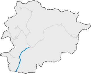
<span class="mw-page-title-main">CG-1</span> Road in Andorra

CG-1 is a road of the Andorra Road Network that connects the capital, Andorra la Vella with La Seu d'Urgell to Alt Urgell. The workers of FHASA contributed to its construction. It is also called Carretera d'Espanya.

References

PD-icon.svg This article incorporates public domain material from The World Factbook (2024 ed.). CIA.  (Archived 2000 edition.)

  1. SNCF Map
  2. Google map
  3. "La construcció del metro aeri d'Andorra no començarà abans que s'acabi aquesta legislatura - Europa Press - VilaWeb". 2010-11-04. Retrieved 2010-11-04.
  4. Agència de Mobilitat, Govern d'Andorra Archived 2013-03-17 at the National and University Library of Iceland
  5. L'Hospitalet. La RN 20 coupée à cause d'une avalanche, La Depeche, 17 December 2008. Ladepeche.fr (in French)
  6. Public transport of passengers Archived 2012-05-26 at archive.today , Servei de Planificació i Gestió del Transport, Govern d'Andorra, 2009.
  7. "Inici - Heliand - Helicopters a Andorra". Heliand. Retrieved 2015-05-14.
  8. "Untitled Document". www.helitrans.ad. Archived from the original on July 15, 2009. Retrieved August 24, 2024.
  9. "Public and regional airport of Andorra-la Seu d'Urgell". Archived from the original on 2016-03-28. Retrieved 2016-03-18.
Listen to this article (1 minute)
Sound-icon.svg
This audio file was created from a revision of this article dated 27 April 2008 (2008-04-27), and does not reflect subsequent edits.

Commons-logo.svg Media related to Transport in Andorra at Wikimedia Commons