


Andorra is located in the Axial Zone of the central Pyrenees mountain range in southwestern Europe, which means that it has intensely folded and thrust rocks formed when the Iberian Peninsula was rotated onto the European continent.
Andorra is located in the Axial Zone of the central Pyrenees mountain range in southwestern Europe, which means that it has intensely folded and thrust rocks formed when the Iberian Peninsula was rotated onto the European continent.
Rocks from the Cambrian or Ordovician occur in the form of conglomerate, limestone, phyllite, quartzite, and slate. Diapirs of slate from the Silurian Period are found in the Llavirsi syncline near Bixessarri in the southwest. Gneiss and schist are found in the cores of anticlines in the northeast of the country. This gneiss contains muscovite. The antiforms are connected with near horizontal shear zones, containing nappes of metamorphosed sediments. Younger overlying Paleozoic metamorphosed sediments found over most of Andorra have also been steeply folded.
In the southeast of the country is an alkaline granite from a batholith called Mt-Louis-Andorra Batholith. It extends into Spain and covers an area of 600 km2 (230 sq mi). Different rock composition zones occur, with monzogranite found at the centre, quartz diorite at the edge and granodiorite in intermediate parts. The batholith has caused metamorphism on its western edge. The base of the batholith is exposed in the east of Andorra.
In the Central and Eastern Pyrenees, which includes Andorra, no fossils older than the Ordovician Caradoc 450–460 million years ago have been found. [1]
Andorra was extensively glaciated during the Quaternary; glaciers flowed down all of the major valleys of Andorra, merging into one large glacier at Escaldes-Engordany, which in the coldest stage reached as far south as Pont de la Fontaneda near Santa Coloma. [2] Andorra has numerous glacial erosional features, including U-shaped valleys, cirques, arêtes, and roche moutonnées. Examples of cirques include the Cirque de Pessons in the east, Llac de Tristaina in the northwest, and the two cirques at approximately 2,400 m (7,900 ft) elevation on Pic de Casamanya (2,740 m (8,990 ft)). [2] Santa Coloma has a glacial terminal moraine.

The exposed geology of the Yosemite area includes primarily granitic rocks with some older metamorphic rock. The first rocks were laid down in Precambrian times, when the area around Yosemite National Park was on the edge of a very young North American continent. The sediment that formed the area first settled in the waters of a shallow sea, and compressive forces from a subduction zone in the mid-Paleozoic fused the seabed rocks and sediments, appending them to the continent. Heat generated from the subduction created island arcs of volcanoes that were also thrust into the area of the park. In time, the igneous and sedimentary rocks of the area were later heavily metamorphosed.

The geology of the Iberian Peninsula consists of the study of the rock formations on the Iberian Peninsula, connected to the rest of the European landmass by the Pyrenees. The peninsula contains rocks from every geological period from the Ediacaran to the Quaternary, and many types of rock are represented. World-class mineral deposits are also found there.

The Moldanubian Zone is in the regional geology of Europe a tectonic zone formed during the Variscan or Hercynian Orogeny. The Moldanubian Zone crops out in the Bohemian Massif and the southern part of the Black Forest and Vosges and contains the highest grade metamorphic rocks of Variscan age in Europe.
The Massif Central is one of the two large basement massifs in France, the other being the Armorican Massif. The Massif Central's geological evolution started in the late Neoproterozoic and continues to this day. It has been shaped mainly by the Caledonian orogeny and the Variscan orogeny. The Alpine orogeny has also left its imprints, probably causing the important Cenozoic volcanism. The Massif Central has a very long geological history, underlined by zircon ages dating back into the Archaean 3 billion years ago. Structurally it consists mainly of stacked metamorphic basement nappes.

The Pyrenees are a 430-kilometre-long, roughly east–west striking, intracontinental mountain chain that divide France, Spain, and Andorra. The belt has an extended, polycyclic geological evolution dating back to the Precambrian. The chain's present configuration is due to the collision between the microcontinent Iberia and the southwestern promontory of the European Plate. The two continents were approaching each other since the onset of the Upper Cretaceous (Albian/Cenomanian) about 100 million years ago and were consequently colliding during the Paleogene (Eocene/Oligocene) 55 to 25 million years ago. After its uplift, the chain experienced intense erosion and isostatic readjustments. A cross-section through the chain shows an asymmetric flower-like structure with steeper dips on the French side. The Pyrenees are not solely the result of compressional forces, but also show an important sinistral shearing.

The geology of Massachusetts includes numerous units of volcanic, intrusive igneous, metamorphic and sedimentary rocks formed within the last 1.2 billion years. The oldest formations are gneiss rocks in the Berkshires, which were metamorphosed from older rocks during the Proterozoic Grenville orogeny as the proto-North American continent Laurentia collided against proto-South America. Throughout the Paleozoic, overlapping the rapid diversification of multi-cellular life, a series of six island arcs collided with the Laurentian continental margin. Also termed continental terranes, these sections of continental rock typically formed offshore or onshore of the proto-African continent Gondwana and in many cases had experienced volcanic events and faulting before joining the Laurentian continent. These sequential collisions metamorphosed new rocks from sediments, created uplands and faults and resulted in widespread volcanic activity. Simultaneously, the collisions raised the Appalachian Mountains to the height of the current day Himalayas.
The Otú Norte or Otú-Pericos Fault is an inactive sinistral oblique strike-slip fault in the department of Antioquia in northern Colombia. The fault has a total length of 144.4 kilometres (89.7 mi) and runs along an average north-northwest to south-southeast strike of 346.4 ± 8, cross-cutting the northern part of the Central Ranges of the Colombian Andes. Together with the parallel Bagre Norte Fault the fault separates the Central Ranges from its northeasternmost continuation, the Serranía de San Lucas.
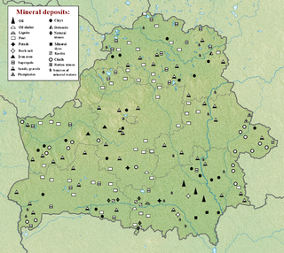
The geology of Belarus began to form more than 2.5 billion years ago in the Precambrian, although many overlying sedimentary units deposited during the Paleozoic and the current Quaternary. Belarus is located in the eastern European plain. From east to west it covers about 650 kilometers while from north to south it covers about 560 kilometers, and the total area is about 207,600 square kilometers. It borders Poland in the north, Lithuania in the northwest, Latvia and Russia in the north, and Ukraine in the south. Belarus has a planar topography with a height of about 160 m above sea level. The highest elevation at 346 meters above sea level is Mt. Dzerzhinskaya, and the lowest point at the height of 80 m is in the Neman River valley.
The geology of Bhutan is less well studied than many countries in Asia, together with the broader Eastern Himalayas region. Older Paleozoic and Precambrian rocks often appear mixed together with younger sediments due to the Himalayan orogeny.
The geology of Alaska includes Precambrian igneous and metamorphic rocks formed in offshore terranes and added to the western margin of North America from the Paleozoic through modern times. The region was submerged for much of the Paleozoic and Mesozoic and formed extensive oil and gas reserves due to tectonic activity in the Arctic Ocean. Alaska was largely ice free during the Pleistocene, allowing humans to migrate into the Americas.
The geology of Wisconsin includes Precambrian crystalline basement rock over three billion years old. A widespread marine environment during the Paleozoic flooded the region, depositing sedimentary rocks which cover most of the center and south of the state.

The geology of Kazakhstan includes extensive basement rocks from the Precambrian and widespread Paleozoic rocks, as well as sediments formed in rift basins during the Mesozoic.

The geology of Afghanistan includes nearly one billion year old rocks from the Precambrian. The region experienced widespread marine transgressions and deposition during the Paleozoic and Mesozoic, that continued into the Cenozoic with the uplift of the Hindu Kush mountains.
The geology of Thailand includes deep crystalline metamorphic basement rocks, overlain by extensive sandstone, limestone, turbidites and some volcanic rocks. The region experienced complicated tectonics during the Paleozoic, long-running shallow water conditions and then renewed uplift and erosion in the past several million years ago.

The geology of North Korea has been studied by the Central Geological Survey of Mineral Resources, rare international research, and by inference from South Korea's geology.
The geology of Greece is highly structurally complex due to its position at the junction between the European and African tectonic plates.

The geology of Italy includes mountain ranges such as the Alps and the Apennines formed from the uplift of igneous and primarily marine sedimentary rocks all formed since the Paleozoic. Some active volcanoes are located in Insular Italy.

The geology of the West Coast of New Zealand's South Island is divided in two by the Alpine Fault, which runs through the Region in a North-East direction. To the West of the fault Paleozoic basement rocks are interluded by plutones and both are unconformably covered in a sedimentary sequence. To the East of the Alpine Fault are the Mesozoic Alpine Schist and Greywacke of the Southern Alps. There are numerous active faults throughout the region.
The Ross orogeny was a mountain building event in Antarctica in the early Paleozoic. The ancestral Trans-Antarctic Mountains were uplifted earlier by the Beardmore orogeny but had eroded as a broad epicratonic sea flooded much of Antarctica in the Cambrian. Shallow water sedimentary rocks, platform carbonates and deepwater turbidites from this period are found in the mountain range. The Ross orogeny was one of the most extensive orogenic events in Antarctica, causing widespread plutonism and metamorphism. Bimodal magmatism and extension mark the beginnings of the orogeny, while during the later phase sedimentary rocks at the continental margin were deformed, metamorphosed and intruded with granite batholiths. Interpretations of rock forms in Antarctica during the 1980s suggested a westward-dipping subduction zone may have formed along the paleo-Pacific Ocean shoreline of East Antarctica. This is inferred from a large number of I-type and S-type granitoids which are similar to large circum-Pacific batholiths.

The geology of California is highly complex, with numerous mountain ranges, substantial faulting and tectonic activity, rich natural resources and a history of both ancient and comparatively recent intense geological activity. The area formed as a series of small island arcs, deep-ocean sediments and mafic oceanic crust accreted to the western edge of North America, producing a series of deep basins and high mountain ranges.
| | This Andorra-related article is a stub. You can help Wikipedia by expanding it. |

