Dolomites

Last updated
Dolomites
Italian: Dolomiti
Ladin: Dolomites
German: Dolomiten
Faloria Cortina d'Ampezzo 10.jpg
Tofana massif with Cortina d'Ampezzo in the foreground
Highest point
Peak Marmolada
Elevation 3,343 m (10,968 ft)
Coordinates 46°26′N11°51′E / 46.433°N 11.850°E / 46.433; 11.850
Dimensions
Area15,942 km2 (6,155 sq mi)
Geography
Alps location map.png
Red triangle with thick white border.svg
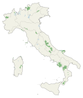
Dolomites
Location of the Dolomites in the Alps
Country Flag of Italy.svg Italy
Regions
Parent range Alps
Geology
Orogeny Alpine orogeny
Rock age Mostly Triassic
Rock types
The Dolomites
UNESCO World Heritage Site
Tre cime di Lavaredo.jpg
Dolomites
Interactive map of The Dolomites
Criteria Natural: (vii)(viii)
Reference 1237
Inscription2009 (33rd Session)
Area141,902.8 ha
Buffer zone89,266.7 ha

The Dolomites [a] or Pale Mountains (Italian : Monti Pallidi) are a mountain range in northeastern Italy. They form part of the Southern Limestone Alps and extend from the River Adige in the west to the Piave Valley (Pieve di Cadore) in the east. The northern and southern borders are defined by the Puster Valley and the Sugana Valley (Italian: Valsugana). The Dolomites are in the regions of Veneto, Trentino-Alto Adige/Südtirol and Friuli-Venezia Giulia, [2] covering an area shared between the provinces of Belluno, Vicenza, Verona, Trentino, South Tyrol, Udine and Pordenone.

Contents

Other mountain groups of similar geological structure are spread along the River Piave to the east—Dolomiti d'Oltrepiave; and far away over the Adige River to the west— Dolomiti di Brenta (Western Dolomites). A smaller group is called Piccole Dolomiti (Little Dolomites), between the provinces of Trentino, Verona and Vicenza.

The Dolomiti Bellunesi National Park and many other regional parks are in the Dolomites. On 26 June 2009, the Dolomites were declared a UNESCO World Heritage Site. [3] [4] The Adamello-Brenta UNESCO Global Geopark is also in the Dolomites. [5] The Geological Museum of the Dolomites (in Italian Museo Geologico delle Dolomiti) is located in Predazzo, Fiemme Valley.

Etymology

The Dolomites take their name from the carbonate rock dolomite. This was named after the 18th-century French mineralogist Déodat Gratet de Dolomieu (1750–1801), who was the first to describe the mineral. [6] The prior local vernacular name of Monti Pallidi came from the mountains' reddish to purple hues viewed at sunset from said carbonates' reflection of the shone alpenglow. [7]

History

For millennia, hunters and gatherers had advanced into the highest rocky regions and had probably also climbed some peaks. There is evidence that the Jesuit priest Franz von Wulfen from Klagenfurt climbed the Lungkofel and the Dürrenstein in the 1790s. In 1857 Irishman John Ball was the first known person to climb Monte Pelmo. Paul Grohmann later climbed numerous peaks such as the Antelao, Marmolada, Tofana, Monte Cristallo and the Boè. Around 1860 the Agordin mountaineer Simone de Silvestro was the first person to stand on the Civetta. Michael Innerkofler was one of the climbers of the Tre Cime di Lavaredo. Later very important local mountaineers, known for many first ascents, were Angelo Dibona and Giovanni Piaz. [8]

During the First World War, the front line between the Italian and Austro-Hungarian Army ran through the Dolomites, where both sides used mines extensively. Open-air war museums are at Cinque Torri (Five Towers), Monte Piana and Mount Lagazuoi. Many people visit the Dolomites to climb the vie ferrate, protected paths through the rock walls that were created during the war.

A number of long-distance footpaths traverse the Dolomites. They are called alte vie (German: Dolomiten Höhenwege – high paths), and are numbered 1 to 10. The trails take about a week to walk, and are served by numerous rifugi (huts). The first and the most renowned is the Alta Via 1. Radiocarbon dating has been used in the Alta Badia region to demonstrate a connection between landslide activity and climate change. [9]

Geography

The region is commonly divided into the Western and Eastern Dolomites, separated by a line following the Val Badia–Campolongo Pass–Cordevole Valley (Agordino) axis.

Current classification

The Dolomites may be divided into the following ranges:

Tourism and sports

Skiers in Cortina in 1903 Sciatori a Cortina1.jpg
Skiers in Cortina in 1903

The Dolomites are renowned for skiing in the winter months and mountain climbing, hiking, cycling and BASE jumping, as well as paragliding and hang gliding in summer and late spring/early autumn. [10] [11] Free climbing has been a tradition in the Dolomites since 1887, when 17-year-old Georg Winkler soloed the first ascent of the pinnacle of the Vajolet Towers. [12] The main centres include: Rocca Pietore alongside the Marmolada Glacier, which lies on the border of Trentino and Veneto, the small towns of Alleghe, Falcade, Auronzo, Cortina d'Ampezzo and the villages of Arabba, Urtijëi and San Martino di Castrozza, as well as the whole of the Fassa, Gardena and Badia valleys. [13]

The Maratona dles Dolomites , an annual single-day road bicycle race covering seven mountain passes of the Dolomites, occurs in the first week of July.

Other characteristic places are:

Major peaks

Punta Penia (3 343 m), the highest point of Marmolada mountain. Marmolada + Sellaronda tour 45a.jpg
Punta Penia (3 343 m), the highest point of Marmolada mountain.
NameMetresFeet
Marmolada 3,34310,968
Antelao 3,26410,706
Tofana di Mezzo 3,24110,633
Sorapiss 3,22910,594
Cristallo 3,22110,568
Monte Civetta 3,22010,564
Cima di Vezzana 3,19210,470
Cimon della Pala 3,18410,453
Langkofel / Sassolungo3,18110,427
Monte Pelmo 3,16810,397
Dreischusterspitze 3,16210,375
Boespitze / Piz Boè (Sella group)3,15210,342
Hohe Gaisl (Croda Rossa d'Ampezzo)3,14810,329
Gran Vernel 3,14510,319
Piz Popena 3,14310,312
Cima dei Bureloni 3,13010,269
Grohmannspitze (Langkofel)3,12610,256
Zwölferkofel 3,09410,151
Elferkofel 3,09210,144
Piz dles Cunturines 3,06410,052
Sass Rigais (Geislerspitzen)3,0259,925
Kesselkogel (Rosengarten)3,0049,856
Tre Cime di Lavaredo (Drei Zinnen)2,9999,839
Fünffingerspitze2,9979,833
Pala di San Martino 2,9829,831
Rosengartenspitze / Catinaccio2,9819,781
Cima di Fradusta 2,9399,642
Cimon del Froppa 2,9329,649
Cima Canali 2,9009,514
Grande Fermeda 2,8739,426
Monte Agnèr 2,8729,416
Fermedaturm2,8679,407
Cima d'Asta 2,8489,344
Croda Grande 2,8499,347
Vajoletturm / Torri del Vajolet (highest)2,8219,256
Sass Maor 2,8149,232
Cima di Ball 2,8029,193
Cima della Madonna (Sass Maor)2,7519,026
Cima della Rosetta 2,7438,999
Cima Ambrizzola 2,7158,907
Central Grasleitenspitze2,7058,875
Sassongher 2,6658,743
Schlern 2,5628,406
Sasso di Mur2,5548,380
Monte Siera[ citation needed ]2,4438,015
Cima delle Dodici2,3387,671
Monte Pavione2,3367,664
Cima Palon 2,2397,346
Cima di Posta2,2357,333

Major passes

View of Gardena Pass and Sella group from Pizes de Cir Frea pass Sella group Dolomites.jpg
View of Gardena Pass and Sella group from Pizes de Cir
Namemetresfeet
Ombretta Pass (Campitello to Caprile), footpath2,7388,983
Langkofeljoch (Gröden Valley to Campitello), footpath2,6838,803
Tschagerjoch (Karersee to the Vajolet Glen), footpath2,6448,675
Grasleiten Pass (Vajolet Glen to the Grasleiten Glen), footpath2,5978,521
Pravitale Pass (Rosetta Plateau to the Pravitale Glen), footpath2,5808,465
Comelle Pass (same to Cencenighe), footpath2,5798,462
Rosetta Pass (San Martino di Castrozza to the great limestone Rosetta plateau), footpath2,5738,442
Vajolet Pass (Tiers to the Vajolet Glen), footpath2,5498,363
Canali Pass (Primiero to Agordo), footpath2,4978,193
Tierseralpljoch (Campitello to Tiers), footpath2,4558,055
Ball Pass (San Martino di Castrozza to the Pravitale Glen), footpath2,4508,038
Forcella di Giralba (Sexten to Auronzo), footpath2,4367,992
Col dei Bos (Falzarego Glen to the Travernanzes Glen), footpath2,3137,589
Forcella Grande (San Vito to Auronzo), footpath2,2627,422
Pordoi Pass (Arabba to Val di Fassa), road2,2507,382
Sella Pass (Gröden Valley to Val di Fassa), road2,2447,362
Giau Pass (Cortina to Val Fiorentina), road2,2367,336
Tre Sassi Pass (Cortina to St Cassian), footpath2,1997,215
Valparola Pass (Cortina to St Cassian), road2,1687,113
Mahlknechtjoch (Upper Duron Glen to the Seiser Alp), footpath2,1687,113
Gardena Pass (Gröden Valley to Colfuschg), road2,1216,959
Falzarego Pass (Caprile to Cortina), road2,1176,946
Fedaja Pass (Val di Fassa to Caprile), bridle path2,0466,713
Valles Pass (Paneveggio to Falcade), road2,0326,667
Würzjoch (Eisacktal to Val Badia), road2,0036,572
Rolle Pass (Predazzo to San Martino di Castrozza and Primiero), road1,9846,509
Forcella Forada (Caprile to San Vito), bridle path1,9756,480
San Pellegrino Pass (Moena to Cencenighe), road1,9106,267
Campolongo Pass (Corvara to Arabba), road1,8756,152
Forcella d'Alleghe (Alleghe to the Zoldo Glen), footpath1,8205,971
Tre Croci Pass (Cortina to Auronzo), road1,8085,932
Furkel Pass (Mareo to Olang), road1,7595,771
Karerpass or Costalunga Pass (Welschnofen to Vigo di Fassa), road1,7535,751
Kreuzbergpass or Monte Croce Pass (Innichen and Sexten to the Piave Valley and Belluno), road1,6385,374
Ampezzo Pass (Toblach to Cortina and Belluno), path1,5445,066
Cereda Pass (Primiero to Agordo), road1,3724,501
Toblach Pass (Bruneck to Lienz), railway1,2093,967

Major parks

Horses on pasture at Parco Naturale Tre Cime, South Tyrol. Cadini di Misurina in the background Parco Naturale Tre Cime horses 3.jpg
Horses on pasture at Parco Naturale Tre Cime, South Tyrol. Cadini di Misurina in the background

See also

References

  1. Italian: Dolomiti [doloˈmiːti] , [1] also known as the Dolomite Mountains, Dolomite Alps or Dolomitic Alps
  1. Ladin: Dolomites; German: Dolomiten [doloˈmiːtn̩] ("Dolomiten" in Langenscheidt German-English Dictionary); Venetian: Dołomiti [doɰoˈmiti] : Friulian: Dolomitis
  2. "Dolomiti, le montagne rosa". italia.it (in Italian). Archived from the original on 2021-11-29. Retrieved 2020-07-02.
  3. "The Dolomites UNESCO World Heritage Site". Dolomites UNESCO World Heritage (in English, German, and Italian). Archived from the original on 4 February 2024. Retrieved 4 May 2024.
  4. "The Dolomites". UNESCO (in English, French, Arabic, Spanish, Japanese, and Dutch). Archived from the original on 25 April 2024. Retrieved 4 May 2024.
  5. "Adamello-Brenta UNESCO Global Geopark" . Retrieved 17 January 2023.
  6. Saussure le fils, M. de (1792): "Analyse de la dolomite". Journal de Physique, vol. 40, pp. 161–173.
  7. Dibona, Dino (2001). Leggende e storie insolite delle Dolomiti : tra realtà e fantasia, un viaggio indimenticabile nel magico scenario delle montagne più belle del mondo (in Italian). Newton & Compton. ISBN   9788854124165.
  8. Die Besteigung der Berge - Die Dolomitgipfel werden erobert (German: The ascent of the mountains - the dolomite peaks are conquered)
  9. Borgatti, Lisa; Soldati, Mauro (2010-08-01). "Landslides as a geomorphological proxy for climate change: A record from the Dolomites (northern Italy)". Geomorphology. Landslide geomorphology in a changing environment. 120 (1–2): 56–64. Bibcode:2010Geomo.120...56B. doi:10.1016/j.geomorph.2009.09.015. hdl: 11380/640411 .
  10. Draper, Robert (2015-08-16). "In Italy, Hiking and Haute Cuisine in the Dolomites - The New York Times". The New York Times . Archived from the original on 26 March 2024. Retrieved 4 May 2024.
  11. Williams, Ingrid K. (2018-08-30). "36 Hours in the Dolomites". The New York Times . Retrieved 2020-04-18.
  12. Huber, Alex. "The Perfect Perfume". Rock and Ice Magazine. Archived from the original on 2008-02-15.
  13. Koch, Amy Tara (25 November 2019). "Hut Skiing in the Dolomites: Storybook Scenery and Grappa Included - The New York Times". The New York Times . Archived from the original on 2 April 2024. Retrieved 4 May 2024.

Bibliography