Parco Nazionale Appennino Tosco-Emiliano | |
---|---|
![]() Monte Prado in the park in winter | |
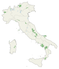
Location | Emilia-Romagna, Toscana |
Nearest city | La Spezia |
Coordinates | 44°19′06″N10°14′26″E / 44.31833°N 10.24056°E |
Area | 227.92 km2 (88.00 sq mi) |
Established | 2001 |
Governing body | Ministero dell'Ambiente |
www |
Appennino Tosco-Emiliano National Park is a state-held natural preserve in Northern and central Italy, located in the heart of an area noted for natural features and for the local quality products and handicrafts. It was founded in 2001, and is included in the provinces of Massa and Carrara, Lucca, Reggio Emilia and Parma.
The Park territory includes the mountain area between Cisa and Forbici Passes. The forest ridges separate Tuscany from Emilia. The National Park is not far from the Cinque Terre and Foreste Casentinesi, Monte Falterona, Campigna National Parks.
The area is dominated by the summits of Alpe di Succiso, Monte Prado and Monte Cusna (over 2,121 m), lakes, and high-mountain grasslands. In Emilia, Pietra di Bismantova dominates the landscape with its vertical walls. Appennino Tosco Emiliano National Park has a wide range of environments (from grasslands to bilberry moorlands, to the most inaccessible summits. It includes lakes, waterfalls, streams that are enclosed by rocky walls. Wild animals like the italian wolf, the red deer, the european mouflon, the roe deer, the golden eagle, and many rare botanic species live in the Park.
The Apennines or Apennine Mountains are a mountain range consisting of parallel smaller chains extending c. 1,200 km (750 mi) along the length of peninsular Italy. In the northwest they join with the Ligurian Alps at Altare. In the southwest they end at Reggio di Calabria, the coastal city at the tip of the peninsula. Since 2000 the Environment Ministry of Italy, following the recommendations of the Apennines Park of Europe Project, has been defining the Apennines System to include the mountains of north Sicily, for a total distance of 1,500 kilometres (930 mi). The system forms an arc enclosing the east side of the Ligurian and Tyrrhenian seas.
Castelnovo Monti is a town and comune in the province of Reggio Emilia, central Italy.
Monte Prelà is a mountain in Liguria, northern Italy, part of the Ligurian Apennines.
The Giardino Botanico "Maria Ansaldi" Pania di Corfino is a botanical garden located an altitude of 1370 m in the Appennino Tosco-Emiliano National Park, near the visitor center of Orecchiella Natural Park in Isera, Corfino, Villa Collemandina, Province of Lucca, Tuscany, Italy. It is open daily in the warmer months; an admission fee is charged.
Monte Carmo is a mountain in the Ligurian Apennine, northern Italy.
The Pietra di Bismantova is a geological formation in the Reggiano Apennines, in the comune of Castelnovo ne' Monti, province of Reggio Emilia, Northern Italy, c. 45 kilometres (28 mi) from Reggio Emilia. It has the shape of a narrow, quasi-cylindrical plateau whose steep walls rise 300 metres (980 ft) as an isolated spur from the nearby hills. The top has an elevation of 1,047 metres (3,435 ft) above sea level. It is included in the National Park of the Appennino Tosco-Emiliano.
The Alpe di Succiso is a mountain in the northern Apennines, located in the trait between the Cerreto and Lagastrello Passes, with an altitude of 2,017 m. It has a pyramidal appearance, carved by several gorges.
Monte Prado is a mountain in the northern Apennines, located in the trait between the Pradarena and Radici Passes, with an altitude of 2,054 metres (6,739 ft).
Monte Cusna is the 2nd highest peak in the northern Apennines after Monte Cimone. But, it is much steeper and more remote.
Monte Penna is a mountain (1,735 m) on the border between Liguria and Emilia-Romagna, northern Italy, part of the Ligurian Apennines. It is included in the Natural Regional Park of the Aveto, and overlooks the Val di Taro; the sources of both the Taro and Ceno Rivers are located in Monte Penna's slope.
Monte Groppo Rosso is a mountain in Liguria, northern Italy, part of the Ligurian Apennines. It is located in the provinces of Genoa and Piacenza. It lies at an altitude of 1597 metres.
Monte Reale is a mountain of the Ligurian Apennines. It is located in the Province of Genoa along the watershed between the basin of the Scrivia Torrent and that of the Vobbia, its tributary to the right. It is situated in the more western part of the Regional Natural Park of Antola between the municipal territories of Ronco Scrivia and Isola del Cantone.
Monte Ramaceto is a mountain in Liguria, northern Italy, part of the Ligurian Apennines.
Monte Roncalla is a mountain in Liguria, northern Italy, part of the Ligurian Apennines.
The Apennine deciduous montane forests are a temperate broadleaf and mixed forests ecoregion in the Apennine Mountains of Italy. The development of these forests is ensured by the high rainfall in the Apennines, combined with a temperate-cool climate. Because of climate change, the presence of silver fir, although still widespread, has been dramatically reduced in favour of beech.
The Monti Marsicani are the sixth-highest group of Apennines located in the Abruzzo region, mostly in the Province of L’Aquila and partly in the Province of Frosinone and Province of Isernia. The highest peak is Monte Greco (2285m). They are limited in north by the Fucino plateau and Peligna Valley, on the east by the River Gizio and Altopiano delle Cinque Miglia, on the south by the Valley Sangro and Volturno, on the east by valley Liri and Melfa.
The Rabbi is a river in the Tuscany and Emilia-Romagna regions of Italy. The source of the river is in the Foreste Casentinesi, Monte Falterona, Campigna National Park in the Appennino Tosco-Emiliano mountains in the province of Florence. The river crosses the border into the province of Forlì-Cesena and flows northeast near Premilcuore and Predappio before joining the Montone near Forlì.
Monte Tobbio is a 1092 metres high mountain of the Apennines, located in the Italian region of Piedmont.
Monte Alpesisa is a 989 metres high mountain in the Ligurian Apennines, in Italy.
Lake Pradaccio is a partially natural lake of glacial origin located in the province of Parma, with a surface area of about 40,000 square meters and a maximum depth of 2 meters.